Welshfield, Ohio
Welshfield (also Troy, Troy Center, Troy Centre, or Wellsfield) is an unincorporated community in central Troy Township, Geauga County, Ohio, United States.
Welshfield, Ohio | |
|---|---|
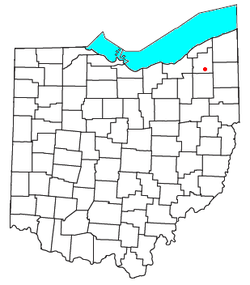 Location of Welshfield, Ohio | |
| Coordinates: 41°23′13″N 81°8′32″W | |
| Country | United States |
| State | Ohio |
| County | Geauga |
| Township | Troy |
| Elevation | 1,234 ft (376 m) |
| Time zone | UTC-5 (Eastern (EST)) |
| • Summer (DST) | UTC-4 (EDT) |
| GNIS feature ID | 1061727[1] |
History
Welshfield was named for Jacob Welsh, a pioneer settler.[2] Jacob Welsh helped build a local church and school in exchange for the naming rights.[3] The community once had a post office that was established on 23 February 1838. When it was discontinued on 30 December 1958, the Burton office began to handle mail for Welshfield addresses.[4]
Geography
It lies at the intersection of U.S. Route 422 and State Route 700, 1 mile (1.6 km) east of the Cuyahoga River and 3 miles (4.8 km) east of the LaDue Reservoir.[5] Its elevation is 1,234 feet (376 m).[1]
gollark: If you *remove* those they can't do anything but also a bunch of apps probably break.
gollark: and/or still have them.
gollark: If you root it and install Google services, yes.
gollark: On the other hand:- As far as I know Google funds/manages most AOSP development- Google is moving more OS features into Google Play services, their proprietary thing- "Google SafetyNet" stops many things running on rooted devices- Google Play Services runs with nigh-root perms on most Android devices- Google imposes a bunch of requirements on anyone who wants to ship Google apps with their devices
gollark: (root it on some devices, anyway, and install custom ROMs)
References
- "Welshfield, Ohio". Geographic Names Information System. United States Geological Survey. Retrieved 2008-03-24.
- History of Geauga and Lake Counties, Ohio: With Illustrations and Biographical Sketches of Its Pioneers and Most Prominent Men. Williams Brothers. 1878. p. 186.
- Overman, William Daniel (1958). Ohio Town Names. Akron, OH: Atlantic Press. p. 140.
- Geographic Names Information System Feature Detail Report, Geographic Names Information System, 1992-08-17. Accessed 2008-03-24.
- DeLorme. Ohio Atlas & Gazetteer. 7th ed. Yarmouth: DeLorme, 2004, p. 42. ISBN 0-89933-281-1.
Municipalities and communities of Geauga County, Ohio, United States | ||
|---|---|---|
| City | 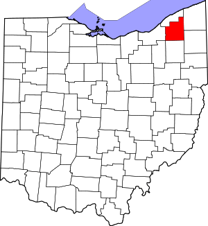 Map of Ohio highlighting Geauga County | |
| Villages | ||
| Townships | ||
| CDPs | ||
| Unincorporated communities | ||
| Footnotes | ‡This populated place also has portions in an adjacent county or counties | |
This article is issued from Wikipedia. The text is licensed under Creative Commons - Attribution - Sharealike. Additional terms may apply for the media files.