Warta
The Warta (/ˈvɑːrtə/ VAR-tə, Polish: [ˈvarta] (![]()
![]()
| Warta | |
|---|---|
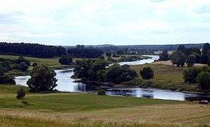 Warta River near Wronki | |
.png) | |
| Location | |
| Country | Poland |
| Physical characteristics | |
| Source | |
| • location | Kromołów, part of Zawiercie, Kraków-Częstochowa Upland |
| • elevation | 380 m (1,250 ft) |
| Mouth | |
• location | Oder River at Kostrzyn |
• coordinates | 52.5986°N 14.6103°E |
| Length | 808.2 km (502.2 mi) |
| Basin size | 54,529 km2 (21,054 sq mi) |
| Discharge | |
| • average | 195 m3/s (6,900 cu ft/s) |
| Basin features | |
| Progression | Oder→ Baltic Sea |
Course
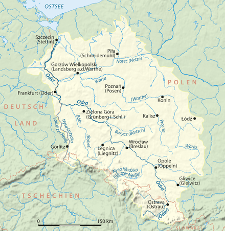
It rises in the Kraków-Częstochowa Upland at Kromołów in Zawiercie, Silesian Voivodeship, flows through Łódź Land, Greater Poland and Lubusz Land, where it empties into the Oder near Kostrzyn at the border with Germany.
The Greater Polish Warta Basin was the original Poland; it is said that the Polans (Polish: Polanie), a West Slavic tribe, settled the Warta Basin in the 8th century. The river is also mentioned in the second stanza of the Polish national anthem, "Poland Is Not Yet Lost."
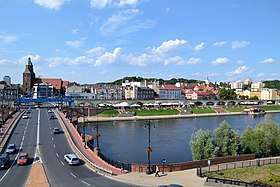
Cities
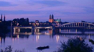 Warta River in Poznań |
Left tributaries
See also
| Wikimedia Commons has media related to Warta. |
- Rivers of Poland
- Geography of Poland
- Warta Landscape Park
- Ujście Warty National Park
References
- Statistical Yearbook of the Republic of Poland 2017, Statistics Poland, p. 85-86
- Warta River Encyclopædia Britannica Online
External links
- Warta Poland - canoeing information (Polish)
Tributaries of the Oder / Odra | ||
|---|---|---|
| Main tributaries of the left bank |
|  |
| Main tributaries of the right bank |
| |
| Distributary | ||
| Cities | ||
| Authority control |
|
|---|