Warrior Peak
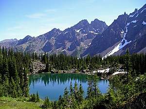
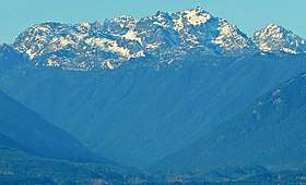
Warrior Peak is a 7,320+ ft (2,230+ m) double summit mountain located in Olympic National Park in Jefferson County of Washington state. Warrior is the 11th highest peak in the Olympic Mountains Range.[1] The southeast summit is the slightly higher of the two summits, the northwest peak is estimated at 7285 feet elevation.[2] Warrior Peak is easy to identify from Seattle, since it appears as the first prominent peak immediately north of Mount Constance, which is the dominant peak on the skyline. Warrior's nearest higher peak is in fact Mount Constance, 0.8 mi (1.3 km) to the south-southeast.[1] The first ascent of the mountain was made in 1945 by Fred Beckey, who solo climbed both summits, and named the mountain.[2]
| Warrior Peak | |
|---|---|
 Warrior Peak (centered) beyond Home Lake | |
| Highest point | |
| Elevation | 7,320+ ft (2,230+ m) [1] |
| Prominence | 760 ft (230 m) [1] |
| Coordinates | 47°47′03″N 123°08′01″W [1] |
| Geography | |
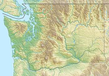
 Warrior Peak Location of Warrior Peak in Washington  Warrior Peak Warrior Peak (the United States) | |
| Location | Jefferson County, Washington, USA |
| Parent range | Olympic Mountains |
| Topo map | USGS Mount Deception |
| Geology | |
| Age of rock | Eocene |
| Type of rock | pillow basalt |
| Climbing | |
| First ascent | 1945 Fred Beckey (solo) |
| Easiest route | Scrambling class 3[2] |
Climate

Based on the Köppen climate classification, Warrior Peak is located in the marine west coast climate zone of western North America.[3] Most weather fronts originate in the Pacific Ocean, and travel northeast toward the Olympic Mountains. As fronts approach, they are forced upward by the peaks of the Olympic Range, causing them to drop their moisture in the form of rain or snowfall (Orographic lift). As a result, the Olympics experience high precipitation, especially during the winter months. During winter months, weather is usually cloudy, but, due to high pressure systems over the Pacific Ocean that intensify during summer months, there is often little or no cloud cover during the summer. Because of maritime influence, snow tends to be wet and heavy, resulting in avalanche danger. In terms of favorable weather, June to September are the best months for climbing the mountain.[2] Precipitation runoff from the west side of the mountain drains into Home Creek, a tributary of the Dungeness River, whereas the east side drains into Tunnel Creek which is a tributary of the Big Quilcene River.
Geology
The Olympic Mountains are composed of obducted clastic wedge material and oceanic crust, primarily Eocene sandstone, turbidite, and basaltic oceanic crust.[4] The mountains were sculpted during the Pleistocene era by erosion and glaciers advancing and retreating multiple times.
See also
- Olympic Mountains
- Geology of the Pacific Northwest
- Geography of Washington (state)
References
- "Warrior Peak". Peakbagger.com. Retrieved 2019-05-05.
- "Warrior Peak". Climbersguideolympics.com. Retrieved 2019-05-05.
- Peel, M. C.; Finlayson, B. L. & McMahon, T. A. (2007). "Updated world map of the Köppen−Geiger climate classification". Hydrol. Earth Syst. Sci. 11. ISSN 1027-5606.
- Alt, D.D.; Hyndman, D.W. (1984). Roadside Geology of Washington. pp. 249–259. ISBN 0-87842-160-2.
External links
- Warrior Peak weather: Mountain Forecast
- Warrior Peak climbing information The Mountaineers
- 1975 Air Force C141 Crash: Historylink.org