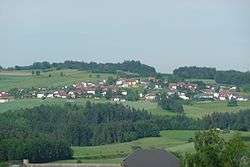
Waldburg, Austria
Waldburg is a municipality in the district of Freistadt in the Austrian state of Upper Austria.
Waldburg | |
|---|---|
 | |
 Coat of arms | |
 Waldburg Location within Austria | |
| Coordinates: 48°30′30″N 14°26′20″E | |
| Country | Austria |
| State | Upper Austria |
| District | Freistadt |
| Government | |
| • Mayor | Michael Hirtl (ÖVP) |
| Area | |
| • Total | 26.58 km2 (10.26 sq mi) |
| Elevation | 685 m (2,247 ft) |
| Population (2018-01-01)[2] | |
| • Total | 1,375 |
| • Density | 52/km2 (130/sq mi) |
| Time zone | UTC+1 (CET) |
| • Summer (DST) | UTC+2 (CEST) |
| Postal code | 4240 |
| Area code | 07942 |
| Vehicle registration | FR |
| Website | www.oberoesterreich. at/waldburg |
Geography
Waldburg is lies in the Mühlviertel. The Jaunitz creek and the Kronbach creek flow through the Waldburg region. The "Sepp'n Höhe" is, at 780 m above sea level, Waldburg's highest point.
Subdivisions
|
|
|
Neighboring municipalities
Places adjacent to Waldburg, Austria | |
|---|---|

Sights
The parish church of Waldburg has three magnificent late-gothic winged altars. The High Altar is sacred to Mary Magdalene. The right Side Altar is sacred to Saint Wolfgang and the left Side Altar is sacred to Saint Catherine.
Museum Mini Agrimundus: Traditional miniatures from rural living.
Twin towns
Waldburg ist twinned with Waldburg a town in the district of Ravensburg in Baden-Württemberg in Germany.
gollark: ABR can roll things in the meantime.
gollark: Does it contain accurate extrapolations of human culture?
gollark: It is.
gollark: Does it contain weather?
gollark: Does it contain magnetohydrodynamics?
References
- "Dauersiedlungsraum der Gemeinden Politischen Bezirke und Bundesländer - Gebietsstand 1.1.2018". Statistics Austria. Retrieved 10 March 2019.
- "Einwohnerzahl 1.1.2018 nach Gemeinden mit Status, Gebietsstand 1.1.2018". Statistics Austria. Retrieved 9 March 2019.
| Wikimedia Commons has media related to Waldburg (Oberösterreich). |
This article is issued from Wikipedia. The text is licensed under Creative Commons - Attribution - Sharealike. Additional terms may apply for the media files.