Wadi Halfa
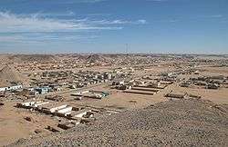
Wādī Ḥalfā (Arabic: وادي حلفا[1]) is a city in the Northern state of Sudan on the shores of "Lake Nubia" (the Sudanese section of Lake Nasser) near the border with Egypt. It is the terminus of a rail line from Khartoum and the point where goods are transferred from rail to ferries going down the lake. As of 2007, the city had a population of 15,725.[2] The town is located amidst numerous ancient Nubian antiquities and was the focus of much archaeological work by teams seeking to save artifacts from the flooding caused by the completion of the Aswan Dam.
Wadi Halfa | |
|---|---|
 | |
 Wadi Halfa Location in Sudan | |
| Coordinates: 21°47′N 31°22′E | |
| Country | |
| State | Northern |
| Population (2007) | |
| • Total | 15,725 |
History

Archaeological evidence indicates that settlement has been in the area since ancient times,[3] and during the Middle Kingdom period, the Egyptian colony of Buhen across the river existed until the Roman period.[4] The modern town of Wadi Halfa was founded in the 19th century, when it became a port on the Nile for steamers from Aswan, such as the Nubia.[5][6] During the Turko-Egyptian conquest of 1820[7], Wadi Halfa was used as a stopping point for troops headed south. Communications developed in the latter half of the 19th century, with a telegraph line to Egypt connected in 1866 and ill-fated attempts to build a railway to Kerma in 1873[5] and 1877.[8] The eventual establishment of the Sudanese rail head at Wadi Halfa—connected via steamer to the Egyptian network via a port just south of Asyut—caused the site to eclipse the former caravan site at Korosko.

In 1885, Wadi Halfa entered a period of turmoil after falling under the Mahdist War regime. Conflicts frequently broke out on the border, and in 1889, Abd al-Rahman al-Mahdi's army entered the town on the way to the Battle of Tushki.[5] Wadi Halfa was briefly the headquarters of the British-led Egyptian and British forces under Kitchener seeking to defeat the forces of Muhammad Ahmad, the self-proclaimed Mahdi from 1895 to 1898. The rail line up the Nile was originally begun in 1897 to support this military buildup;[9] it extends, via Atbara, to El Obeid and beyond into southern and western Sudan.[10]

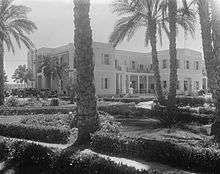
A river monitoring station functioned in Wadi Halfa between 1911 and 1931, to monitor changes associated with the Aswan reservoir, but from 1931 to 1962 it was moved to Kajnarty, 47 kilometres to the north of the town.[11] A railroad hotel was built in the town during the 20th century, and during World War II, Wadi Halfa was a communications post for Allied forces in Africa. By 1956, the town had grown to a population of 11,000.[5] On 8 November 1959, the signing of the Sudanese-UAR Nile Water Agreement brought the area into much debate, given that the agreement to flood the area upon the creation of the Aswan Dam would directly affect some 52,000 people in the area who would have to be resettled over a four-year period from 1960.[2] Worst affected were the Nubians who demonstrated in Wadi Halfa on 23–24 October 1960 against being resettled, and on 26 October demonstrations took place in the Sudanese capital, Khartoum, which had to be dispersed by police using tear gas.[2] The government was quick to suppress the agitation, placing Wadi Halfa under martial law and terminating communications with the rest of the country. Protests in Khartoum, mainly by students, led to the temporary closure of the Khartoum campus of Cairo University and about 50 arrests.[2] The old town was completely destroyed after the construction of the Aswan High Dam due to flooding in 1964. Most of the town was relocated, and by 1965 the population of New Halfa was just 3,200.[2] During the 1970s, the area was under intense scrutiny by archaeologists working to protect ancient Nubian monuments.[4]
Wadi Halfa was featured in part 4, entitled "Shifting Sands", of the 8 part Michael Palin television documentary Pole to Pole released by the BBC in 1992.
In 2005 a museum and interactive Nubian village were planned for Wadi Halfa[12] but by 2014 nothing had been done.[13]
Climate
Wadi Halfa has a hot desert climate (Köppen climate classification BWh) typical of the Nubian Desert. Wadi Halfa receives each year the highest mean amount of bright sunshine, with an extreme value of 4,300 h[14] which is equal to 97–98 % of possible sunshine.[15] In addition to this, the town receives a mean annual amount of rainfall of 0.5 mm[14] and many years usually pass without any rainfall falling on the ground.
Wadi Halfa experiences long, hot summers and short, warm winters. The annual mean temperature is about 27 °C. From May to September, inclusively, the averages highs exceed 40 °C. The annual mean rate of potential evaporation is also among the highest found throughout the world, with as much as 5,930 mm.[16]
| Climate data for Wadi Halfa (1961–1990) | |||||||||||||
|---|---|---|---|---|---|---|---|---|---|---|---|---|---|
| Month | Jan | Feb | Mar | Apr | May | Jun | Jul | Aug | Sep | Oct | Nov | Dec | Year |
| Record high °C (°F) | 35.5 (95.9) |
41.6 (106.9) |
45.5 (113.9) |
45.7 (114.3) |
47.8 (118.0) |
48.7 (119.7) |
46.7 (116.1) |
47.6 (117.7) |
46.5 (115.7) |
44.5 (112.1) |
39.0 (102.2) |
35.6 (96.1) |
48.7 (119.7) |
| Average high °C (°F) | 23.3 (73.9) |
25.7 (78.3) |
30.5 (86.9) |
36.1 (97.0) |
39.6 (103.3) |
41.1 (106.0) |
40.7 (105.3) |
40.1 (104.2) |
39.2 (102.6) |
36.1 (97.0) |
29.2 (84.6) |
24.8 (76.6) |
33.9 (93.0) |
| Daily mean °C (°F) | 16.4 (61.5) |
18.1 (64.6) |
22.5 (72.5) |
27.7 (81.9) |
31.5 (88.7) |
33.1 (91.6) |
32.8 (91.0) |
32.5 (90.5) |
31.8 (89.2) |
28.8 (83.8) |
22.5 (72.5) |
18.1 (64.6) |
26.3 (79.3) |
| Average low °C (°F) | 9.5 (49.1) |
10.5 (50.9) |
14.6 (58.3) |
19.4 (66.9) |
23.3 (73.9) |
25.0 (77.0) |
24.9 (76.8) |
24.9 (76.8) |
24.4 (75.9) |
21.5 (70.7) |
15.7 (60.3) |
11.3 (52.3) |
18.8 (65.8) |
| Record low °C (°F) | 4.2 (39.6) |
2.5 (36.5) |
6.0 (42.8) |
11.0 (51.8) |
13.4 (56.1) |
17.8 (64.0) |
18.5 (65.3) |
17.8 (64.0) |
17.4 (63.3) |
12.3 (54.1) |
5.2 (41.4) |
2.0 (35.6) |
2.0 (35.6) |
| Average precipitation mm (inches) | 0.1 (0.00) |
0.0 (0.0) |
0.0 (0.0) |
0.0 (0.0) |
0.0 (0.0) |
0.0 (0.0) |
0.0 (0.0) |
0.5 (0.02) |
0.0 (0.0) |
0.0 (0.0) |
0.0 (0.0) |
0.0 (0.0) |
0.6 (0.02) |
| Average relative humidity (%) | 41 | 33 | 26 | 21 | 20 | 20 | 23 | 26 | 25 | 28 | 37 | 43 | 29 |
| Mean monthly sunshine hours | 303.8 | 277.2 | 303.8 | 303.0 | 325.5 | 324.0 | 331.7 | 322.4 | 288.0 | 310.0 | 303.0 | 294.5 | 3,686.9 |
| Percent possible sunshine | 92 | 91 | 86 | 86 | 86 | 87 | 87 | 88 | 86 | 90 | 94 | 91 | 89 |
| Source: NOAA[17] | |||||||||||||
Economy

Agriculture played an important role in local economy.[5] The Chinese have invested in a fish processing plant in the town.
References
- Formerly also romanized as Halfa and Wady Halfa.
- Middle East Record Volume 1, 1960. The Moshe Dayan Center. p. 416.
- Omer, Ibrahim (December 2008). "Prehistory of the Sudan". Ancient Sudan - Kush. Retrieved 2016-11-19.
- "Wādī Ḥalfā". Encyclopædia Britannica. Retrieved 18 November 2013.
- Kramer, Robert S.; Lobban, Jr., Richard A.; Fluehr-Lobban, Carolyn (22 March 2013). Historical Dictionary of the Sudan. Scarecrow Press. p. 454. ISBN 978-0-8108-7940-9.
- Daly, Martin W.; Hogan, Jane R. (2005). Images of Empire: Photographic Sources for the British in the Sudan. BRILL. p. 95. ISBN 978-90-04-14627-3.
- "1820-1885 - The Turkiyah Pacification". www.globalsecurity.org. Retrieved 2019-10-21.
- Budge, Ernest A.W. The Egyptian Sudan: Its History and Monuments, Vol. II, pp. 461 ff. 1907 reprinted by Cosimo Classics (New York), 2010. Accessed 13 Feb 2014.
- Raugh, Harold E. (1 January 2004). The Victorians at War, 1815-1914: An Encyclopedia of British Military History. ABC-CLIO. p. 280. ISBN 978-1-57607-925-6.
- Henderson, K. D. D. (1946). Survey of Anglo-Egyptian Sudan 1898-1944. London,UK: Longmans, Green & Co. pp. 25–26.
- Dumont, Henri J. (6 May 2009). The Nile: Origin, Environments, Limnology and Human Use. Springer. p. 360. ISBN 978-1-4020-9726-3.
- de Simone, Costanza (2009-12-22). "Wadi Halfa Museum: A Rescue Mechanism for the Nubian Intangible Heritage". Égypte/Monde arabe (5–6): 401–414. ISSN 1110-5097.
- Elcheikh, Zeina (2014-01-13). "Beyond the Borders: Nubian Culture and Cultural Tourism". Preservation Journey. Retrieved 2016-11-19.
- Griffiths, John F. (1976-01-01). Climate and the Environment. Westview Press. ISBN 9780891586111.
Halfa.
- Griffiths, John F.; Driscoll, Dennis M. (1982-01-01). Survey of Climatology. C.E. Merrill Publishing Company. ISBN 9780675099943.
100 % possible.
- Brooks, Charles Ernest Pelham; Buxton, Patrick Alfred; (France), Société de géographie (1932-01-01). Le climat du Sahara et de l'Arabie (in French). Société d'Editions Géographiques, Maritimes et Coloniales.
- "Wadi Halfa Climate Normals 1961–1990". National Oceanic and Atmospheric Administration. Retrieved April 23, 2015.
Further reading
- De Simone, Costanza. "Wadi Halfa Development and Museum","Incontro Mediterraneo" 13, 2008.
- De Simone, Costanza. Nubia and Nubians: The ‘Museumization’ of a Culture. Saarbrücken: Lambert Academic Publishing, 2015.
- Greene, David Lee; Armelagos, George J. (1972). The Wadi Halfa mesolithic population. Dept. of Anthropology, University of Massachusetts.
- Socio-economic survey of Wadi Halfa and Lake Nuba. ESRC. 1978.
| Wikimedia Commons has media related to Wadi Halfa. |