Von der Wall Point
Von der Wall Point (72°32′S 98°40′W) is a low ice-covered point on the south side of Thurston Island. It extends into Peacock Sound toward the northeast extremity of Sherman Island. Delineated from aerial photos taken by U.S. Navy Operation Highjump in December 1946. Named by Advisory Committee on Antarctic Names (US-ACAN) for J.H. Von der Wall, tractor driver and mechanic with the Byrd Antarctic Expedition in 1933–35.
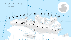
Map of Thurston Island.
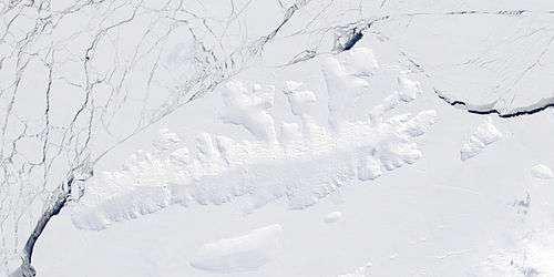
Satellite image of Thurston Island.
Maps
- Thurston Island – Jones Mountains. 1:500000 Antarctica Sketch Map. US Geological Survey, 1967.
- Antarctic Digital Database (ADD). Scale 1:250000 topographic map of Antarctica. Scientific Committee on Antarctic Research (SCAR). Since 1993, regularly upgraded and updated.
![]()
![]()
| General |
| .svg.png) |
|---|---|---|
| Geographic regions | ||
| Waterways | ||
| Famous explorers | ||
gollark: There are maybe other things you could theoretically do.
gollark: If you can find an XSS vulnerability in the "parsing" (which is really just conversion to HTML...) using perhaps an inconsistency between it and the bizarre way HTML5 specifies HTML is to be parsed, bees, or [DATA EXPUNGED], you could steal their account or something.
gollark: No, I mean hack it so it looks like an admin did it.
gollark: Hack esowiki and make it so.
gollark: ```diff+ true greenness```
This article is issued from Wikipedia. The text is licensed under Creative Commons - Attribution - Sharealike. Additional terms may apply for the media files.