Vohilava, Mananjary
Vohilava is a town and commune in Madagascar. It belongs to the district of Mananjary, which is a part of Vatovavy-Fitovinany Region. it is the endpoint of the Route nationale 24 from Mananjary.
Vohilava | |
|---|---|
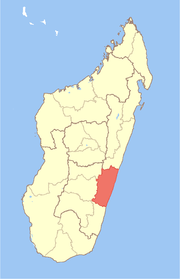
 Vohilava Location in Madagascar | |
| Coordinates: 21°4′S 48°0′E | |
| Country | |
| Region | Vatovavy-Fitovinany |
| District | Mananjary |
| Elevation | 103 m (338 ft) |
| Population (2001)[2] | |
| • Total | 32,000 |
| Time zone | UTC3 (EAT) |
The population of the commune was estimated to be approximately 32,000 in 2001 commune census.[2]
Primary and junior level secondary education are available in town. The majority 97% of the population of the commune are farmers. The most important crops are coffee and rice; also bananas are an important agricultural product. Services provide employment for 3% of the population.[2]
References and notes
- Estimated based on DEM data from Shuttle Radar Topography Mission
- "ILO census data". Cornell University. 2002. Retrieved 2008-05-03.
gollark: Peter, please set up a... board or something... for piwars?
gollark: See, this is fine, it's an actual MS domain and it asks for limited perms.
gollark: Also, we do not in fact share everything we do on onenote.
gollark: It probably works via oauth or something, it's fine.
gollark: https://kanboard.org/
This article is issued from Wikipedia. The text is licensed under Creative Commons - Attribution - Sharealike. Additional terms may apply for the media files.