Anorombato
Anorombato is a town and commune in Madagascar. It belongs to the district of Manakara, which is a part of Vatovavy-Fitovinany Region. The population of the commune was estimated to be approximately 12,000 in 2001 commune census.[2]
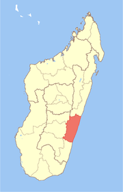
Anorombato | |
|---|---|
 Anorombato Location in Madagascar | |
| Coordinates: 22°1′S 47°47′E | |
| Country | |
| Region | Vatovavy-Fitovinany |
| District | Manakara |
| Elevation | 64 m (210 ft) |
| Population (2001)[2] | |
| • Total | 12,000 |
| Time zone | UTC3 (EAT) |
Only primary schooling is available. The majority 98% of the population of the commune are farmers. The most important crops are coffee and rice; also bananas are an important agricultural product. Services provide employment for 2% of the population.[2]
References and notes
- Estimated based on DEM data from Shuttle Radar Topography Mission
- "ILO census data". Cornell University. 2002. Retrieved 2008-05-03.
gollark: The entire language is stacks of accursed mold, apart from some recent nice things like destructuring.
gollark: I mostly use JS because I can quickly write slightly horrible code in it, and browsers.
gollark: There should not be an external tool necessary to detect stupid errors.
gollark: And the obvious `+` thing does the *wrong* thing instead of just erroring. This is bad.
gollark: It has no operator overloading.
This article is issued from Wikipedia. The text is licensed under Creative Commons - Attribution - Sharealike. Additional terms may apply for the media files.