Visokoi Island
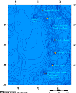
Visokoi Island is an uninhabited island in the Traversay Islands group of the South Sandwich Islands. It was discovered in 1819 by a Russian expedition under Fabian Gottlieb von Bellingshausen, who named the island Visokoi ("high") because of its conspicuous height.[1][2] The island was surveyed in 1930 by Discovery Investigations (DI) personnel, who charted and named many of its features.[3][4] Several of the names given by DI were changed in 1953 by the United Kingdom Antarctic Place-Names Committee (UK-APC) to avoid redundancy with nearby features.[3][5]
 South Sandwich Islands | |
Location of Visokoi Island | |
| Geography | |
|---|---|
| Coordinates | 56°42′S 027°12′W |
| Archipelago | South Sandwich Islands |
| Length | 7.2 km (4.47 mi) |
| Width | 4.8 km (2.98 mi) |
| Highest elevation | 1,005 m (3,297 ft) |
| Highest point | Mount Hodson |
| Administration | |
United Kingdom | |
| Demographics | |
| Population | Uninhabited |
Geography
The island is 7.2 km (4.5 miles) long and 4.8 km (3.0 miles) wide, capped by Mount Hodson, a volcanic peak (1,005 metres or 3,297 feet).[2] The peak is named after Sir Arnold Weinholt Hodson, a governor of the Falkland Islands.[6] The island has a strong smell of sulphurous fumes.[5] The island is surrounded by an underwater shelf that extends out approximately 2.3–6 km (1.4–3.7 mi), at a depth of approximately 200 m (660 ft).[7]
Finger Point marks the island's northern tip. It was named descriptively by DI in 1930.[8]
Wordie Point is the south-west point of the island. DI personnel named it for Scottish geologist and polar explorer James Wordie.[9] 1.5 nmi (2.8 km) north of it is Sulphur Point, whose reddish ground is streaked with sulphur. Originally called West Bluff by DI personnel, it was renamed by UK-APC to avoid confusion with West Bluff on nearby Zavodovski Island.[5]
Irving Point, first discovered by von Bellingshausen's expedition, forms the eastern extremity of the island. DI personnel named it "Penguin Point," but UK-APC changed it to avoid redundancy with other similarly-named locations. Irving Point was chosen for Royal Navy Lieutenant Commander J. Irving, who sketched the South Sandwich Islands from the Discovery II.[3]
1.3 nmi (2.4 km) northwest of Irving Point lies Saddle Bluff, named by DI personnel.[10] Nearby Shamrock Hill, a prominent volcanic cone, was named by the survey party from HMS Protector because they occupied this feature as a survey station on Saint Patrick's Day, 1964.[11]
Mikhaylov Point is a small promontory marking the island's southern extremity. It was named "Low Point" by DI personnel, but the name was changed by UK-APC to avoid duplication with Low Point on nearby Vindication Island. The name "Mikhaylov Point" was recommended for Pavel N. Mikhaylov, artist aboard the Vostok during the Russian expedition under von Bellingshausen.[4]
See also
- List of Antarctic and sub-Antarctic islands
References
- Mills, William James (2003). Exploring polar frontiers: a historical encyclopedia. A - L. ABC-CLIO. p. 680. ISBN 978-1-57607-422-0. Retrieved 6 January 2012.
- "Visokoi Island". Geographic Names Information System. United States Geological Survey. Retrieved 21 May 2019.
- "Irving Point". Geographic Names Information System. United States Geological Survey. Retrieved 21 May 2019.
- "Mikhaylov Point". Geographic Names Information System. United States Geological Survey. Retrieved 21 May 2019.
- "Sulphur Point". Geographic Names Information System. United States Geological Survey. Retrieved 21 May 2019.
- "Mount Hodson". Geographic Names Information System. United States Geological Survey. Retrieved 21 May 2019.
- Advances in Marine Biology. Academic Press. 14 August 2015. p. 21. ISBN 9780128023556.
- "Finger Point". Geographic Names Information System. United States Geological Survey. Retrieved 21 May 2019.
- "Wordie Point". Geographic Names Information System. United States Geological Survey. Retrieved 21 May 2019.
- "Saddle Bluff". Geographic Names Information System. United States Geological Survey. Retrieved 21 May 2019.
- "Shamrock Hill". Geographic Names Information System. United States Geological Survey. Retrieved 21 May 2019.
Further reading
- LeMasurier, W. E.; Thomson, J. W., eds. (1990). Volcanoes of the Antarctic Plate and Southern Oceans. American Geophysical Union. ISBN 0-87590-172-7.
- Hodson Volcano
![]()