Vindication Island
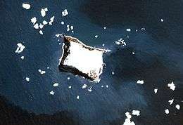
Vindication Island (Spanish: Isla Vindicación) is a small uninhabited island in the South Sandwich Islands. It lies about 2 miles (3.2 km) from Candlemas Island, separated by the Nelson Channel. The island is mostly ice free.
 NASA Terra image of Vindication Island | |
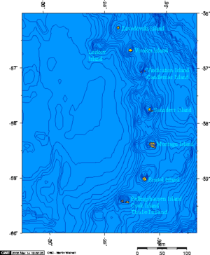
Location of Vindication Island | |
| Geography | |
|---|---|
| Coordinates | 57°06′S 26°47′W |
| Area | 3 km2 (1.2 sq mi) |
| Length | 2.1 km (1.3 mi) |
| Width | 1.6 km (0.99 mi) |
| Highest elevation | 430 m (1,410 ft) |
| Highest point | Quadrant Peak |
| Administration | |
United Kingdom | |
| Demographics | |
| Population | Uninhabited |
Geography
This small island is part of the Candlemas Islands subgroup of the South Sandwich Islands. The island's highest point is Quadrant Peak at 430 m (1,411 ft), while the south-easternmost cape is Chinstrap Point. Its southwesternmost point is Knob Point, charted in 1930 by Discovery Investigations personnel on the Discovery II, and probably so named because a conspicuous height of land overlooks the point.[1]
Vindication Island is the eroded remains of a former volcanic complex.[2]
Unlike neighboring Candlemas Island, where there is volcanic activity, the volcano on Vindication has shown no sign of activity for over 10,000 years.[3]
Buddha Rock lies 0.3 nautical miles (0.6 km) west of Vindication Island.

See also
- List of Antarctic and subantarctic islands
References
- "Knob Point". Geographic Names Information System. United States Geological Survey. Retrieved 25 January 2020.
- The South Sandwich Islands: Petrology of the Volcanic Rocks, P. E. Baker, Scientific Report of the British Antarctic Survey, Nr 93, Cambridge 1978, p. 7
- LeMasurier, W. E.; Thomson, J. W., eds. (1990). Volcanoes of the Antarctic Plate and Southern Oceans. American Geophysical Union. p. 512 pp. ISBN 0-87590-172-7.