Vinton, Ohio
Vinton is a village in Gallia County, Ohio, United States. The population was 222 at the 2010 census. It is part of the Point Pleasant, WV–OH Micropolitan Statistical Area.
Vinton, Ohio | |
|---|---|
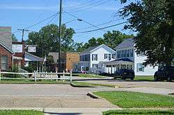
 Main Street | |
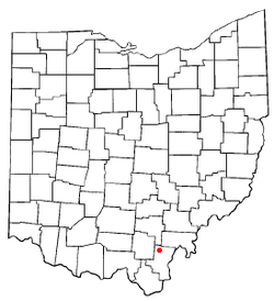
 Location of Vinton, Ohio | |
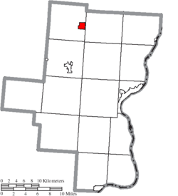
 Location of Vinton in Gallia County | |
| Coordinates: 38°58′39″N 82°20′25″W | |
| Country | United States |
| State | Ohio |
| County | Gallia |
| Township | Huntington |
| Area | |
| • Total | 1.21 sq mi (3.14 km2) |
| • Land | 1.18 sq mi (3.05 km2) |
| • Water | 0.03 sq mi (0.09 km2) |
| Population | |
| • Total | 222 |
| • Estimate (2019)[3] | 210 |
| • Density | 178.42/sq mi (68.86/km2) |
| Time zone | UTC-5 (Eastern (EST)) |
| • Summer (DST) | UTC-4 (EDT) |
| ZIP code | 45686 |
| Area code(s) | 740 |
| FIPS code | 39-80178 |
History
Vinton was platted in 1832.[4] A post office called Vinton has been in operation since 1834.[5]
Geography
Vinton is located at 38°58′39″N 82°20′25″W (38.977490, -82.340170).[6]
According to the United States Census Bureau, the village has a total area of 1.21 square miles (3.13 km2), of which 1.18 square miles (3.06 km2) is land and 0.03 square miles (0.08 km2) is water.[7]
Vinton is located on Raccoon Creek, a tributary of the Ohio River.[8]
Demographics
| Historical population | |||
|---|---|---|---|
| Census | Pop. | %± | |
| 1870 | 137 | — | |
| 1880 | 196 | 43.1% | |
| 1890 | 318 | 62.2% | |
| 1900 | 304 | −4.4% | |
| 1910 | 324 | 6.6% | |
| 1920 | 407 | 25.6% | |
| 1930 | 344 | −15.5% | |
| 1940 | 387 | 12.5% | |
| 1950 | 378 | −2.3% | |
| 1960 | 374 | −1.1% | |
| 1970 | 352 | −5.9% | |
| 1980 | 375 | 6.5% | |
| 1990 | 293 | −21.9% | |
| 2000 | 324 | 10.6% | |
| 2010 | 222 | −31.5% | |
| Est. 2019 | 210 | [3] | −5.4% |
| U.S. Decennial Census[9] | |||
2010 census
As of the census[2] of 2010, there were 222 people, 95 households, and 65 families living in the village. The population density was 188.1 inhabitants per square mile (72.6/km2). There were 125 housing units at an average density of 105.9 per square mile (40.9/km2). The racial makeup of the village was 99.1% White and 0.9% African American. Hispanic or Latino of any race were 0.5% of the population.
There were 95 households, of which 24.2% had children under the age of 18 living with them, 58.9% were married couples living together, 8.4% had a female householder with no husband present, 1.1% had a male householder with no wife present, and 31.6% were non-families. 30.5% of all households were made up of individuals, and 9.5% had someone living alone who was 65 years of age or older. The average household size was 2.34 and the average family size was 2.89.
The median age in the village was 46.7 years. 20.3% of residents were under the age of 18; 5.9% were between the ages of 18 and 24; 21.8% were from 25 to 44; 35.6% were from 45 to 64; and 16.7% were 65 years of age or older. The gender makeup of the village was 47.3% male and 52.7% female.
2000 census
As of the census[10] of 2000, there were 324 people, 123 households, and 91 families living in the village. The population density was 290.5 people per square mile (111.7/km2). There were 143 housing units at an average density of 128.2 per square mile (49.3/km2). The racial makeup of the village was 97.84% White, 0.62% African American, 0.31% Asian, 1.23% from other races. Hispanic or Latino of any race were 0.31% of the population.
There were 123 households, out of which 35.0% had children under the age of 18 living with them, 61.8% were married couples living together, 10.6% had a female householder with no husband present, and 26.0% were non-families. 22.8% of all households were made up of individuals, and 13.8% had someone living alone who was 65 years of age or older. The average household size was 2.63 and the average family size was 3.11.
In the village, the population was spread out, with 26.9% under the age of 18, 8.6% from 18 to 24, 25.9% from 25 to 44, 25.0% from 45 to 64, and 13.6% who were 65 years of age or older. The median age was 39 years. For every 100 females there were 100.0 males. For every 100 females age 18 and over, there were 97.5 males.
The median income for a household in the village was $25,417, and the median income for a family was $33,250. Males had a median income of $37,250 versus $20,833 for females. The per capita income for the village was $13,836. About 17.9% of families and 16.4% of the population were below the poverty line, including 19.0% of those under age 18 and 20.5% of those age 65 or over.
Education
Public education in the village of Vinton is provided by the Gallia County Local School District.
References
- "2019 U.S. Gazetteer Files". United States Census Bureau. Retrieved July 28, 2020.
- "U.S. Census website". United States Census Bureau. Retrieved 2013-01-06.
- "Population and Housing Unit Estimates". United States Census Bureau. May 24, 2020. Retrieved May 27, 2020.
- History of Gallia County: Containing a Condensed History of the County; Biographical Sketches; General Statistics; Miscellaneous Matters &c. St. Peter's Episcopal Church. 1882. p. 28.
- "Post offices". Jim Forte Postal History. Retrieved 16 July 2016.
- "US Gazetteer files: 2010, 2000, and 1990". United States Census Bureau. 2011-02-12. Retrieved 2011-04-23.
- "US Gazetteer files 2010". United States Census Bureau. Archived from the original on 2012-01-25. Retrieved 2013-01-06.
- "State of Ohio GIS Databases". Archived from the original on 2011-08-21. Retrieved 2011-03-06.
- "Census of Population and Housing". Census.gov. Retrieved June 4, 2015.
- "U.S. Census website". United States Census Bureau. Retrieved 2008-01-31.
