Vils (Danube)
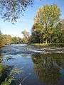
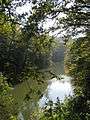
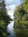
The Vils is a river in Bavaria, Germany, it is a right tributary of the Danube.
| Vils | |
|---|---|
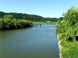 Vils close to entering Danube | |
| Location | |
| Country | Germany |
| State | Bavaria |
| Cities | Schalkham, Gerzen, Aham, Frontenhausen, Marklkofen, Reisbach, Eichendorf, Aldersbach, Vilshofen |
| Physical characteristics | |
| Source | Große Vils |
| • location | Seeon, Lengdorf, Upper Bavaria |
| • coordinates | 48°17′12″N 12°02′25″E |
| • elevation | 502 m (1,647 ft) |
| 2nd source | Kleine Vils |
| • location | Vilsheim, Lower Bavaria, Germany |
| • coordinates | 48°26′45″N 12°06′28″E |
| • elevation | 466 m (1,529 ft) |
| Source confluence | Gerzen |
| • coordinates | 48°29′49″N 12°25′21″E |
| • elevation | 425.5 m (1,396 ft) |
| Mouth | Danube |
• coordinates | 48°37′58″N 13°11′31″E |
• elevation | 279 m (915 ft) |
| Length | 81.7 km (50.8 mi)[1] |
| Basin size | 1,449 km2 (559 sq mi)[1] |
| Discharge | |
| • average | 76.8 m3/s (2,710 cu ft/s) |
| • maximum | 520 m3/s (18,000 cu ft/s) |
| Basin features | |
| Progression | Danube→ Black Sea |
The Vils is formed by the confluence of its two source rivers, the Kleine Vils and the Große Vils, in Gerzen. It is 81.7 km (50.8 mi) long (127.5 km (79.2 mi) including Große Vils).[1] It flows east through a rural area with small towns, including Aham, Frontenhausen, Marklkofen, Reisbach, Eichendorf and Aldersbach. It flows into the Danube in Vilshofen.
See also
References
- Complete table of the Bavarian Waterbody Register by the Bavarian State Office for the Environment (xls, 10.3 MB)
This article is issued from Wikipedia. The text is licensed under Creative Commons - Attribution - Sharealike. Additional terms may apply for the media files.