Vicco, Kentucky
Vicco is a home rule-class city in Perry and Knott counties, Kentucky, United States. The population was 334 at the 2010 census.[3] On January 16, 2013, Vicco became the smallest city in the United States to pass an ordinance outlawing discrimination based on sexual orientation.[4][5]
Vicco, Kentucky | |
|---|---|
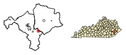
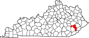
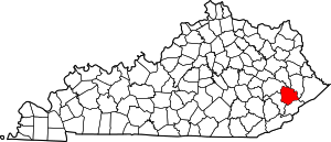
 Location in Perry County and Knott County, Kentucky | |
| Coordinates: 37°12′58″N 83°3′40″W | |
| Country | United States |
| State | Kentucky |
| Counties | Perry, Knott |
| Incorporated | June 1, 1964 |
| Government | |
| • Type | City Commission |
| • Mayor | Johnny Cummings |
| Area | |
| • Total | 0.85 sq mi (2.20 km2) |
| • Land | 0.84 sq mi (2.17 km2) |
| • Water | 0.01 sq mi (0.03 km2) |
| Elevation | 942 ft (287 m) |
| Population (2010) | |
| • Total | 334 |
| • Estimate (2019)[2] | 301 |
| • Density | 359.19/sq mi (138.62/km2) |
| Time zone | UTC-5 (Eastern (EST)) |
| • Summer (DST) | UTC-4 (EDT) |
| ZIP code | 41773 |
| Area code(s) | 606 |
| FIPS code | 21-79590 |
| GNIS feature ID | 0506035 |
History
Vicco was originally a coal mining town; its name comes from the initials of the Virginia Iron Coal and Coke Company. The city was known for its bars and entertainment; The New York Times described it as "the local coal miner's Vegas". The decline of the coal industry in the region brought economic trouble to Vicco, as local businesses closed and the city faced severe budget deficits. However, the city has recently attempted a revival, having restarted its defunct police force among other measures.[4]
Geography
Vicco is located in eastern Perry County at 37°12′58″N 83°3′40″W (37.216186, -83.061089).[6] A small portion of the city extends northeast into neighboring Knott County. The city is in the valley of the Carr Fork, a west-flowing tributary of the North Fork of the Kentucky River.
Kentucky Route 15 passes through the center of Vicco, leading west 11 miles (18 km) to Hazard, the Perry county seat, and east 20 miles (32 km) to Whitesburg.
According to the United States Census Bureau, Vicco has a total area of 0.85 square miles (2.2 km2), of which 0.01 square miles (0.03 km2), or 1.26%, are water.[3]
Demographics
| Historical population | |||
|---|---|---|---|
| Census | Pop. | %± | |
| 1970 | 377 | — | |
| 1980 | 456 | 21.0% | |
| 1990 | 244 | −46.5% | |
| 2000 | 318 | 30.3% | |
| 2010 | 334 | 5.0% | |
| Est. 2019 | 301 | [2] | −9.9% |
| U.S. Decennial Census[7] | |||
As of the census[8] of 2000, there were 318 people, 132 households, and 93 families residing in the city. The population density was 411.2 people per square mile (159.5/km2). There were 152 housing units at an average density of 196.6 per square mile (76.2/km2). The racial makeup of the city was 99.69% White and 0.31% from two or more races.
There were 132 households of which 28.8% had children under the age of 18 living in them, 49.2% were married couples living together, 16.7% had a female householder with no husband present, and 29.5% were non-families. 27.3% of all households were made up of individuals and 7.6% had someone living alone who was 65 years of age or older. The average household size was 2.41 and the average family size was 2.91.
In the city, the population was spread out with 23.9% under the age of 18, 8.5% from 18 to 24, 27.7% from 25 to 44, 27.4% from 45 to 64, and 12.6% who were 65 years of age or older. The median age was 36 years. For every 100 females, there were 86.0 males. For every 100 females age 18 and over, there were 87.6 males.
The median income for a household in the city was $13,235, and the median income for a family was $14,688. Males had a median income of $31,875 versus $22,500 for females. The per capita income for the city was $10,325. About 42.4% of families and 39.5% of the population were below the poverty line, including 42.4% of those under age 18 and 26.9% of those age 65 or over.
References
- "2019 U.S. Gazetteer Files". United States Census Bureau. Retrieved July 24, 2020.
- "Population and Housing Unit Estimates". United States Census Bureau. May 24, 2020. Retrieved May 27, 2020.
- "Geographic Identifiers: 2010 Demographic Profile Data (G001): Vicco city, Kentucky". American Factfinder. U.S. Census Bureau. Retrieved March 7, 2019.
- Barry, Dan (January 28, 2013). "Sewers, Curfews and a Ban on Gay Bias". The New York Times. Retrieved January 28, 2013.
- ACLU of Kentucky Celebrates Victory in Vicco | American Civil Liberties Union
- "US Gazetteer files: 2010, 2000, and 1990". United States Census Bureau. 2011-02-12. Retrieved 2011-04-23.
- "Census of Population and Housing". Census.gov. Retrieved June 4, 2015.
- "U.S. Census website". United States Census Bureau. Retrieved 2008-01-31.

