Verkhoturye
Verkhoturye (Russian: Верхоту́рье) is a historical town and the administrative center of Verkhotursky District of Sverdlovsk Oblast, Russia, located in the middle Ural Mountains on the left bank of the Tura River 306 kilometers (190 mi) north of Yekaterinburg. Population: 8,820 (2010 Census);[4] 7,815 (2002 Census;[5] 8,973 (1989 Census);[6] 10,900 (1967).
Verkhoturye Верхоту́рье | |
|---|---|
Town | |
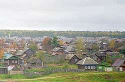
 View of the town | |
.png) Flag .png) Coat of arms | |
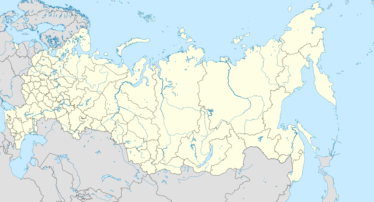
Location of Verkhoturye 
| |
 Verkhoturye Location of Verkhoturye  Verkhoturye Verkhoturye (Sverdlovsk Oblast) | |
| Coordinates: 58°52′00″N 60°48′00″E | |
| Country | Russia |
| Federal subject | Sverdlovsk Oblast |
| Founded | 1598 |
| Town status since | 1598 |
| Elevation | 115 m (377 ft) |
| Population | |
| • Estimate (2018)[1] | 8,612 |
| • Capital of | f Verkhotursky District |
| Time zone | UTC+5 (MSK+2 |
| Postal code(s)[3] | 624380–624382 |
| Dialing code(s) | +7 34389 |
| OKTMO ID | 65709000001 |
| Website | adm-verhotury |
History
Verkhoturye was founded in 1598 by Vasily Golovin and Ivan Voyeykov on the site of the Vogul settlement of Neromkar. There were major fires in 1674 and 1738. The railroad arrived in 1906. It lost town status in 1926 and regained it in 1947. Two oil pipelines pass through the area and there are plans to build an oil refinery.
In contrast to the surrounding mining towns, Verkhoturye has been relatively untouched by industrialization and much of its historic appearance has been preserved. Being one of the oldest Russian settlements east of the Urals, and with forty churches in the area, Verkhoturye is considered one of the centers of Russian Christianity. Famous churches include the Trinity Church (1703—1712), Nikolay Monastery (established in 1604) with the Cathedral of Exaltation of the Holy Cross (1905—1913), and Transfiguration Church (1821). In addition, the town houses the oldest female monastery beyond Urals (established in 1621).
The Gateway to Siberia

The relatively low middle Ural Mountains at the latitude of Verkhoturye form a natural gateway into Siberia from the west. With the Russian conquest of Siberia and the foundation of the trans-Ural Russian towns of Tyumen in 1586 and Tobolsk in 1587 the problem arose of finding the best route to them from European Russia. Around 1580, Yermak Timofeyevich had ascended the Chusovaya River south of Verkhoturye and crossed to the Barancha, a tributary of the Tagil River. This route was abandoned because the upper Tagil was too shallow. Around 1590 a more northerly route was opened from Cherdyn north of Solikamsk up to the Vishera River and down the Lozva River. In 1597 Artemy Babinov pioneered what became the standard route. This Babinsky Road ran overland from Solikamsk on the western slope of the Urals to Verkhoturye. An ostrog (fort) was built at Verkhoturye in 1598 and a customs house in 1600 or 1601. Until about 1763, Babinov's route was the main road into Siberia. All winter sledges would haul goods from Solikamsk to Verkhoturye where they were stockpiled until the spring thaw. Siberian furs collected as yasak (tribute) passed through Verkhoturye en route to the Sable Treasury in Moscow. Privately owned furs leaving Siberia paid a 10% tax unless the merchant could prove that the tax had been paid in Siberia. Goods entering Siberia paid a 4% tax (in addition to the 10% paid when the goods were sold). Goods coming and going were inspected and inventoried to prevent contraband. Guard posts were set up in the region to prevent people from slipping around the custom house.

Around 1600, Turinsk was built downriver and a winter ice-road was built to connect the two settlements. At some point the Irbit Fair downriver became a major trading place. In 1695, all routes from the Kama basin except Verkhoturye were legally closed. Verkhoturye declined from about 1763 when the Siberian Route was built through Yekaterinburg to the south. In the 1770s the toll for crossing into Siberia was abolished or reduced.
Other Ural crossings
To the north the three crossing points were the Arctic Ocean, the Usa River, and the Northern Sosva River. These all connected the lower Ob River to the Pechora River and the export port of Arkhangelsk. The routes around Verkhoturye connected Tobolsk to the Kama River tributary of the Volga and on to the Sable Treasury at Moscow. Below Verkhoturye there was an old caravan route which led to the Ufa steppe and the Volga River. This became more important as the Volga population increased, but remained minor because it did not lead to either Moscow or Arkhangelsk.
References
- "26. Численность постоянного населения Российской Федерации по муниципальным образованиям на 1 января 2018 года". Federal State Statistics Service. Retrieved January 23, 2019.
- "Об исчислении времени". Официальный интернет-портал правовой информации (in Russian). June 3, 2011. Retrieved January 19, 2019.
- Почта России. Информационно-вычислительный центр ОАСУ РПО. (Russian Post). Поиск объектов почтовой связи (Postal Objects Search) (in Russian)
- Russian Federal State Statistics Service (2011). "Всероссийская перепись населения 2010 года. Том 1" [2010 All-Russian Population Census, vol. 1]. Всероссийская перепись населения 2010 года [2010 All-Russia Population Census] (in Russian). Federal State Statistics Service.
- Russian Federal State Statistics Service (May 21, 2004). "Численность населения России, субъектов Российской Федерации в составе федеральных округов, районов, городских поселений, сельских населённых пунктов – районных центров и сельских населённых пунктов с населением 3 тысячи и более человек" [Population of Russia, Its Federal Districts, Federal Subjects, Districts, Urban Localities, Rural Localities—Administrative Centers, and Rural Localities with Population of Over 3,000] (XLS). Всероссийская перепись населения 2002 года [All-Russia Population Census of 2002] (in Russian).
- "Всесоюзная перепись населения 1989 г. Численность наличного населения союзных и автономных республик, автономных областей и округов, краёв, областей, районов, городских поселений и сёл-райцентров" [All Union Population Census of 1989: Present Population of Union and Autonomous Republics, Autonomous Oblasts and Okrugs, Krais, Oblasts, Districts, Urban Settlements, and Villages Serving as District Administrative Centers]. Всесоюзная перепись населения 1989 года [All-Union Population Census of 1989] (in Russian). Институт демографии Национального исследовательского университета: Высшая школа экономики [Institute of Demography at the National Research University: Higher School of Economics]. 1989 – via Demoscope Weekly.
External links
| Wikimedia Commons has media related to Verkhoturie. |
- History and culture of the town and the region (in Russian)