Verkhnyaya Toyma, Arkhangelsk Oblast
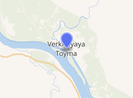
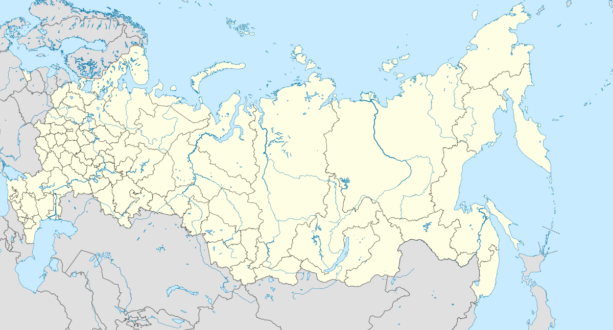
Verkhnyaya Toyma (Russian: Ве́рхняя То́йма) is a rural locality (a selo) and the administrative center of Verkhnetoyemsky District, Arkhangelsk Oblast, Russia, located on the right bank of the Northern Dvina River. It also serves as the administrative center of Verkhnetoyemsky Selsoviet, one of the fourteen selsoviets into which the district is administratively divided. Municipally, it is the administrative center of Verkhnetoyemskoye Rural Settlement. Population:3,462 (2010 Census);[5] 3,940 (2002 Census);[6] 4,430 (1989 Census).[7] It is served by Verkhnyaya Toyma Airport.
Verkhnyaya Toyma Верхняя Тойма | |
|---|---|
Location of Verkhnyaya Toyma 
| |
 Verkhnyaya Toyma Location of Verkhnyaya Toyma  Verkhnyaya Toyma Verkhnyaya Toyma (Arkhangelsk Oblast) | |
| Coordinates: 62°15′N 45°01′E | |
| Country | Russia |
| Federal subject | Arkhangelsk Oblast |
| Administrative district | Verkhnetoyemsky District[1] |
| Selsoviet | Verkhnetoyemsky Selsoviet[1] |
| • Capital of | Verkhnetoyemsky District,[1] Verkhnetoyemsky Selsoviet[1] |
| • Municipal district | Verkhnetoyemsky Municipal District[2] |
| • Rural settlement | Verkhnetoyemskoye Rural Settlement[2] |
| • Capital of | Verkhnetoyemsky Municipal District,[2] Verkhnetoyemskoye Rural Settlement[2] |
| Time zone | UTC+3 (MSK |
| Postal code(s)[4] | 165500 |
| OKTMO ID | 11608408101 |
History
Etymology
The name of Verkhnyaya Toyma stems from the name of the Verkhnyaya Toyma River, which, in turn, means The Upper Toyma, as compared with The Lower Toyma, the Nizhnyaya Toyma River, also a right tributary of the Northern Dvina.
The toponym Toyma is common to all northern Russian territories, from Toyma in Karelia to Toyma River in the Republic of Tatarstan. It relates to an extinct Uralic ethnonym of the same name known to the Novgorodians since (at least) the beginning of the 12th century. Janet Martin considered Toima (sic) the southern extreme of Novgorodian control over the Dvina basin in this period.[8] The first mention of Toyma, paying tribute to Novgorodians, is dated 1137[9] but there is no evidence that the word Toyma relates to the present-day area or its neighbor, Verkhnetoyemsky Selsoviet. The 1219 chronicle mentions ethnonym toymokary (Russian: ... И поиде тои зимö Семьюнъ Öминъ въ 4 стöх на Тоимокары ...). The 1237 Tale of the Death of the Russian Land mentions "Toyma pagans" living between "the Karelians" and Veliky Ustyug (Russian: ...от корöлы до Оустьюга, гдö тамо бяхоу тоимици погании...),[10] a location roughly aligned with the Northern Dvina basin.
Russian linguists argue whether the ethnonym Toyma relates to a specific tribe, a tribal group, a language or a whole continuum of Uralic languages.[11] Evgeny Chelimsky applied ethnonym Toyma to the wide area in the southern part of Northern Dvina basin and wrote that it is equivalent to the Northern Finns in Aleksandr Matveyev's classification.[12] Matveyev objected, writing that the Northern Finnish continuum was considerably wider than Toyma's, and that the hypothetical Toyma people occupied only a minor portion of it.[13] He preferred to equate the Toyma with a particular tribe that lived in Nizhnaya Toyma area, and noted that it also could belong to Permic languages.[14] At any rate, the Toymas disappeared before the 17th century, when their existence could be recorded in Muscovite sources, either through russification or through earlier assimilation by other Uralic peoples.
Timeline
From 1552, Verkhnyaya Toyma was a local administration center.[15] In the 17th century, there were two annual trade fairs in Toyma: The Annunciation Day Fair (April, 7) and the Saint Peter's Day Fair (July 5).[16]
Until 1924, the area was a part of Solvychegodsky Uyezd, which belonged to a variety of Governorates, and in 1918 moved to the newly established Northern Dvina Governorate. In 1924, the uyezds were abolished in favor of the new divisions, the districts (raions). Verkhnetoyemsky District was formed on April 10, 1924.
Geography and location
Verkhnyaya Toyma is located on the right bank of the Northern Dvina River, at the confluence of the Verkhnyaya Toyma River. It is located northwest of Kotlas.
Economy
Prior to 1917, the main occupations of the population were hunting, wood distillation, and livestock production. Crop production was basically unknown, and regular shortages of bread have been recorded due to the seasonal inaccessibility of the area. Verkhnyaya Toyma was a major trade center due to the location on the Northern Dvina. The large-scale timber industry only took a start in 1929, when Nizhnyaya Toyma Forest Production Company (Russian: Верхнетоемский леспромхоз) was established.[15] The agriculture is currently bankrupt and does not deliver any products.[15]
Transportation
Northern Dvina is navigable, although there is only local passenger navigation.
The right bank of the Northern Dvina River (including Verkhnyaya Toyma) is not connected by the all-season roads to the main road network. There are local roads, nostly unpaved. There is a ferry crossing over the Northern Dvina.
There is an airport, which used to generate considerable passenger traffic in the 1980s, but it is now defunct.
Culture and recreation

The district contains 3 objects classified as cultural and historical heritage (all of local importance). These include
- The bridge over Verkhnyaya Toyma River (1930s);[17]
- The Kuznetsov House (1858);[18]
- The bridge over a ravine (1960s).[19]
The only museum in Verkhnyaya Toyma is the District is Verkhnyaya Toyma District Museum [20]
References
Notes
| Wikimedia Commons has media related to Verkhnyaya Toyma. |
- Государственный комитет Российской Федерации по статистике. Комитет Российской Федерации по стандартизации, метрологии и сертификации. №ОК 019-95 1 января 1997 г. «Общероссийский классификатор объектов административно-территориального деления. Код 11 208 808 007», в ред. изменения №278/2015 от 1 января 2016 г.. (State Statistics Committee of the Russian Federation. Committee of the Russian Federation on Standardization, Metrology, and Certification. #OK 019-95 January 1, 1997 Russian Classification of Objects of Administrative Division (OKATO). Code 11 208 808 007, as amended by the Amendment #278/2015 of January 1, 2016. ).
- Архангельское областное Собрание депутатов. Областной закон №258-внеоч.-ОЗ от 23 сентября 2004 г. «О статусе и границах территорий муниципальных образований в Архангельской области», в ред. Областного закона №224-13-ОЗ от 16 декабря 2014 г. «Об упразднении отдельных населённых пунктов Соловецкого района Архангельской области и о внесении изменения в статью 46 Областного закона "О статусе и границах территорий муниципальных образований в Архангельской области"». Вступил в силу со дня официального опубликования. Опубликован: "Волна", №38, 8 октября 2004 г. (Arkhangelsk Oblast Council of Deputies. Oblast Law #258-vneoch.-OZ of September 23, 2004 On the Status and Borders of the Territories of the Municipal Formations in Arkhangelsk Oblast, as amended by the Oblast Law #224-13-OZ of December 16, 2014 On Abolishing Several Inhabited Localities in Solovetsky District of Arkhangelsk Oblast and on Amending Article 46 of the Oblast Law "On the Status and Borders of the Territories of the Municipal Formations in Arkhangelsk Oblast". Effective as of the day of the official publication.).
- "Об исчислении времени". Официальный интернет-портал правовой информации (in Russian). 3 June 2011. Retrieved 19 January 2019.
- Почта России. Информационно-вычислительный центр ОАСУ РПО. (Russian Post). Поиск объектов почтовой связи (Postal Objects Search) (in Russian)
- Russian Federal State Statistics Service (2011). "Всероссийская перепись населения 2010 года. Том 1" [2010 All-Russian Population Census, vol. 1]. Всероссийская перепись населения 2010 года [2010 All-Russia Population Census] (in Russian). Federal State Statistics Service.
- Russian Federal State Statistics Service (21 May 2004). "Численность населения России, субъектов Российской Федерации в составе федеральных округов, районов, городских поселений, сельских населённых пунктов – районных центров и сельских населённых пунктов с населением 3 тысячи и более человек" [Population of Russia, Its Federal Districts, Federal Subjects, Districts, Urban Localities, Rural Localities—Administrative Centers, and Rural Localities with Population of Over 3,000] (XLS). Всероссийская перепись населения 2002 года [All-Russia Population Census of 2002] (in Russian).
- "Всесоюзная перепись населения 1989 г. Численность наличного населения союзных и автономных республик, автономных областей и округов, краёв, областей, районов, городских поселений и сёл-райцентров" [All Union Population Census of 1989: Present Population of Union and Autonomous Republics, Autonomous Oblasts and Okrugs, Krais, Oblasts, Districts, Urban Settlements, and Villages Serving as District Administrative Centers]. Всесоюзная перепись населения 1989 года [All-Union Population Census of 1989] (in Russian). Институт демографии Национального исследовательского университета: Высшая школа экономики [Institute of Demography at the National Research University: Higher School of Economics]. 1989 – via Demoscope Weekly.
- Janet Martin (2004). Treasure of the Land of Darkness: The Fur Trade and Its Significance for Medieval Russia. Cambridge University Press. ISBN 0-521-54811-X, ISBN 978-0-521-54811-3, p. 57
- Janet Martin (2004). Treasure of the Land of Darkness: The Fur Trade and Its Significance for Medieval Russia. Cambridge University Press. ISBN 0-521-54811-X, ISBN 978-0-521-54811-3, p. 55, provides a list of tax-paying possessions of Novgorod in 1137, including Toyma.
- Original Russian version of the Tale of the Death of the Russian Land, second paragraph.
- Aleksandr Matveyev (in Russian) (2007). K probleme klassifikatsii yazukov substratnoy toponimii russkogo severa (К вопросу классификации языков субстратной топонимии Русского Севера. Voprosy Onomastiki, No 4, 2007. pp. 14–27, provides a roundup of opposing views on the subject
- Evgeny Helimski (2006). Severno-zapadnaya gruppa finno-ugorskih yazykov Archived July 22, 2011, at the Wayback Machine (Северно-западная группа финно-угорских языков). Voprosy Onomastiki, No 3, 2006. pp. 38-39
- Aleksandr Matveyev (in Russian) (2007). K probleme klassifikatsii yazukov substratnoy toponimii russkogo severa (К вопросу классификации языков субстратной топонимии Русского Севера. Voprosy Onomastiki, No 4, 2007. p. 23.
- Aleksandr Matveyev (in Russian) (2007). K probleme klassifikatsii yazukov substratnoy toponimii russkogo severa (К вопросу классификации языков субстратной топонимии Русского Севера. Voprosy Onomastiki, No 4, 2007. p. 24
- Историческая справка (in Russian). Администрация муниципального образования "Верхнетоемский муниципальный район". Retrieved 2 June 2011.
- История Верхней Тоймы и Верхнетоемского района Архангельской области (in Russian). Тойма.рф. 2010. Retrieved 3 June 2011.
- Мост через р. В. Тойму (висячий) (in Russian). Russian Ministry of Culture. Archived from the original on 18 August 2016. Retrieved 3 June 2011.
- Дом Кузнецова А.М. (in Russian). Russian Ministry of Culture. Archived from the original on 18 August 2016. Retrieved 3 June 2011.
- Мест через овраг (in Russian). Russian Ministry of Culture. Archived from the original on 18 August 2016. Retrieved 3 June 2011.
- Верхне-Тоемский историко-краеведческий музей (in Russian). Российская сеть культурного наследия. Retrieved 3 June 2011.
Sources
- Архангельское областное Собрание депутатов. Областной закон №65-5-ОЗ от 23 сентября 2009 г. «Об административно-территориальном устройстве Архангельской области», в ред. Областного закона №232-13-ОЗ от 16 декабря 2014 г. «О внесении изменений в отдельные Областные Законы в сфере осуществления местного самоуправления и взаимодействия с некоммерческими организациями». Вступил в силу через десять дней со дня официального опубликования. Опубликован: "Волна", №43, 6 октября 2009 г. (Arkhangelsk Oblast Council of Deputies. Oblast Law #65-5-OZ of September 23, 2009 On the Administrative-Territorial Structure of Arkhangelsk Oblast, as amended by the Oblast Law #232-13-OZ of December 16, 2014 On Amending Various Oblast Laws Dealing with the Process of Municipal Self-Government and Relations with Non-Profit Organizations. Effective as of the day which is ten days after the official publication.).
External links
- Верхняя Тойма Архангельской области (in Russian). Тойма.рф. 2010. Retrieved 3 June 2011.