Venango, Kansas
Venango is an unincorporated community in Ellsworth County, Kansas, United States. It is located on the east bank of the Kanopolis Lake.
Venango, Kansas | |
|---|---|
 KDOT map of Ellsworth County (legend) | |
| Coordinates: 38°38′20″N 97°59′11″W[1] | |
| Country | United States |
| State | Kansas |
| County | Ellsworth |
| Elevation | 1,516 ft (462 m) |
| Time zone | UTC-6 (CST) |
| • Summer (DST) | UTC-5 (CDT) |
| Area code | 785 |
| FIPS code | 20-73465 [1] |
| GNIS ID | 476930 [1] |


History
A post office was opened in Venango in 1875, and remained in operation until it was discontinued in 1902.[2]
Education
The community is served by Smoky Valley USD 400 public school district.
gollark: Unlike most, its databases are one file and it's a small C library you can embed in programs.
gollark: SQLite is an *implementation* of much of this standard, plus weird extra features.
gollark: SQL is merely a standard language for accessing databases.
gollark: I wrote a bad RSS reader for it at one point.
gollark: Yes, but I think their thing predates Electron, so it's weird and custom and has a ton of SQLite databases in it.
See also
- Kanopolis Lake
- Kanopolis State Park
- Mushroom Rock State Park
- Yankee Run, Kansas, located on west bank of Kanopolis Lake
References
- Geographic Names Information System (GNIS) details for Venango, Kansas; United States Geological Survey (USGS); October 13, 1978.
- "Kansas Post Offices, 1828-1961 (archived)". Kansas Historical Society. Archived from the original on October 9, 2013. Retrieved 9 June 2014.
Further reading
External links
Municipalities and communities of Ellsworth County, Kansas, United States | ||
|---|---|---|
| Cities | 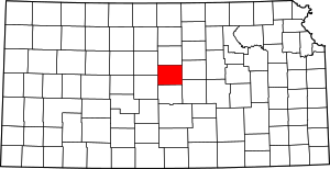 Map of Kansas highlighting Ellsworth County | |
| Unincorporated communities | ||
| Ghost towns | ||
| Townships | ||
| POIs | ||
This article is issued from Wikipedia. The text is licensed under Creative Commons - Attribution - Sharealike. Additional terms may apply for the media files.