Urenui
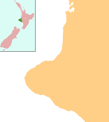
Urenui is a settlement in northern Taranaki, in the North Island of New Zealand. It is located on State Highway 3 close to the shore of the North Taranaki Bight, 13 kilometres east of Waitara and 6 km south-west of Mimi. The Urenui River flows past the settlement into the North Taranaki Bight.[1][2]
Urenui | |
|---|---|
 Urenui | |
| Coordinates: 38°59′52″S 174°23′25″E | |
| Country | New Zealand |
| Region | Taranaki |
| District | New Plymouth District |
| Population (2013) | |
| • Total | 426 |
The New Zealand Ministry for Culture and Heritage gives a translation of "great courage" for Urenui, noting that courage is "a figurative expression".[3] A fuller explanation is that the name was given by Manaia in honour of his well-endowed son. Ure means "penis", and nui means "large".[4]
Mail sent to addresses at Urenui must show both a PO box number and a street address.[5]
Demographics
Urenui had a population of 426 at the 2013 New Zealand census, a decrease of 3 people since the 2006 census. There were 210 males and 216 females.[6] 91.2% were European/Pākehā, 19.9% were Māori, 0.7% were Pacific peoples and 0.0% were Asian.[7]
Marae
Approximately 3 km eastward of the town is the Urenui Marae, the only remaining marae of Ngāti Mutunga. It includes Te Aroha meeting house.[8][9]
Education
Urenui School is a coeducational contributing primary (years 1–6) school with a roll of 96 students as of March 2020.[10][11] The school was founded in 1876 and celebrated its 125th jubilee in 2001.[12]
Notable people
- Māui Pōmare, politician
- Te Rangi Hīroa (Sir Peter Buck), doctor, politician
See also
- Ngati Mutunga
- Taranaki Region
References
- Peter Dowling (editor) (2004), Reed New Zealand Atlas, Reed Books, pp. map 35, ISBN 978-0-7900-0952-0CS1 maint: extra text: authors list (link)
- Roger Smith, GeographX (2005), The Geographic Atlas of New Zealand, Robbie Burton, pp. map 74, ISBN 978-1-877333-20-0
- "1000 Māori place names". New Zealand Ministry for Culture and Heritage. 6 August 2019.
- Discover New Zealand:A Wises Guide (9th ed.). 1994. p. 217.
- Ewing, Isobel (11 April 2013). "Anger as Urenui mail goes undelivered".
- 2013 Census QuickStats about a place : Urenui
- 2013 Census QuickStats about a place (Cultural diversity) : Urenui
- "Te Kāhui Māngai directory". tkm.govt.nz. Te Puni Kōkiri.
- "Māori Maps". maorimaps.com. Te Potiki National Trust.
- "New Zealand Schools Directory". New Zealand Ministry of Education. Retrieved 26 April 2020.
- Education Counts: Urenui School
- "Jubilees & reunions: Urenui School" (– Scholar search), Education Gazette New Zealand, 79 (12), 30 June 2000
Further reading
- Messenger, A. H.; Andrews, Edward Rolfe (1956), Urenui School 80th jubilee, 1876–1956: souvenir booklet, history of school and district, 1st and 2nd April, 1956, Urenui, [N.Z.] ; New Plymouth, [N.Z.]: Urenui School ; Taranaki Herald
- Buist, Alastair Gordon (1964), Archaeology in North Taranaki, New Zealand a study of field monuments in the Pukearuhe – Mimi-Urenui area, Wellington, [N.Z.]: New Zealand Archaeological Association
- Gumbley, Warren (1997), Archaeological mapping of pa in four Taranaki historic reserves, Wellington, New Zealand: Department of Conservation
- de Jardine, Margaret (1992), The little ports of Taranaki: being Awakino, Mokau, Tongaporutu, Urenui, Waitara, Opunake, Patea, together with some historical background to each, New Plymouth, [N.Z.]: Margaret de Jardine
- "Ngati Mutunga (electronic resource)". Retrieved 29 January 2008.
- The history of Urenui: arrival of the first Maoris, New Plymouth, NZ: Taranaki Daily News, 6 September 1930
- Buist, Alastair Gordon (1964), Archaeology in North Taranaki, New Zealand a study of field monuments in the Pukearuhe – Mimi-Urenui area, Wellington, NZ: New Zealand Archaeological Association