Upatoi, Georgia
Upatoi is a community in northeastern Muscogee County, Georgia, United States.[1][2] Upatoi was annexed by the city of Columbus, Georgia in 1971 as part of the consolidation of the city and county governments.[3] The community is on Georgia Route 22 and U.S. Route 80 approximately 15 miles east of Columbus.[1] Upatoi Creek is on the southern boundary of Muscogee County approximately three miles south of the community.[1]
History
A post office was established at Upatoi in 1829 and has since closed.[4]
The Norfolk Southern Railway marks the southern boundary of Upatoi and the northern boundary of Fort Benning.[1]
gollark: Maybe it is, but lying.
gollark: Does it return at some point? Print errors? Consume 399 bees?
gollark: It could be implementing Macron.
gollark: Muahaha, I will now see what your bot does.
gollark: Yes.
References
- Utapoi, GA, 7.5 Minute Topographic Quadrangle, USGS, 1955
- U.S. Geological Survey Geographic Names Information System: Upatoi, Georgia
- https://www.columbusga.gov/history/consolidation.htm
- "Post Offices". Jim Forte Postal History. Retrieved 24 June 2019.
Municipalities and communities of Muscogee County, Georgia, United States | ||
|---|---|---|
| Cities | 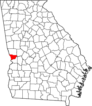 Map of Georgia highlighting Muscogee County | |
| Neighborhoods |
| |
| Military base | ||
| Footnotes | ‡ This symbol represents that the indicated city is part of two or more counties. | |
Greater Columbus, Georgia | ||
|---|---|---|
| Central cities/Largest cities | 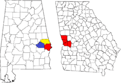 Location of the Columbus, Georgia-Auburn, Alabama CSA and its counties:
Columbus, Georgia Metropolitan Statistical Area
Auburn, Alabama Metropolitan Statistical Area
Tuskegee, Alabama Micropolitan Statistical Area (defunct) | |
| Cities in Georgia | ||
| Cities in Alabama | ||
| Counties in Georgia | ||
| Counties in Alabama | ||
This article is issued from Wikipedia. The text is licensed under Creative Commons - Attribution - Sharealike. Additional terms may apply for the media files.