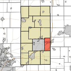
Union Township, Madison County, Indiana
Union Township is one of fourteen townships in Madison County, Indiana, United States. As of the 2010 census, its population was 8,898 and it contained 4,004 housing units.[1]
Union Township | |
|---|---|
 Location in Madison County | |
| Coordinates: 40°05′39″N 85°36′19″W | |
| Country | |
| State | |
| County | Madison |
| Government | |
| • Type | Indiana township |
| Area | |
| • Total | 19.88 sq mi (51.5 km2) |
| • Land | 19.81 sq mi (51.3 km2) |
| • Water | 0.07 sq mi (0.2 km2) 0.35% |
| Elevation | 909 ft (277 m) |
| Population (2010) | |
| • Total | 8,898 |
| • Density | 449.2/sq mi (173.4/km2) |
| ZIP codes | 46012, 46017, 47356 |
| GNIS feature ID | 0453923 |
History
Union Township was organized in 1830. It was likely named in commemoration of the federal union of the United States.[2]
Geography
According to the 2010 census, the township has a total area of 19.88 square miles (51.5 km2), of which 19.81 square miles (51.3 km2) (or 99.65%) is land and 0.07 square miles (0.18 km2) (or 0.35%) is water.[1]
Cities, towns, villages
- Anderson (east edge)
- Chesterfield (vast majority)
Cemeteries
The township contains these three cemeteries: Bronnenberg, Clem and Keesling.
Major highways
Airports and landing strips
- Anderson Municipal Airport
Education
- Anderson Community School Corporation
Union Township residents may obtain a free library card from the Anderson Public Library in Anderson.[3]
Political districts
- Indiana's 6th congressional district
- State House District 35
- State House District 37
- State Senate District 25
gollark: You can't ++userdata get things unless you ++userdata set them.
gollark: Also, it's per-user so you'll have to set up your own bismuth.
gollark: <@!160279332454006795> 🐝 you.
gollark: I'm SURE I had countermeasures against that, hmm.
gollark: ++userdata get noheader rust
References
- "Union Township, Madison County, Indiana". Geographic Names Information System. United States Geological Survey. Retrieved 2009-10-08.
- United States Census Bureau 2008 TIGER/Line Shapefiles
- IndianaMap
- "Population, Housing Units, Area, and Density: 2010 - County -- County Subdivision and Place -- 2010 Census Summary File 1". United States Census. Archived from the original on 2020-02-12. Retrieved 2013-05-10.
- Forkner, John La Rue & Dyson, Byron H. (1897). Historical Sketches and Reminiscences of Madison County, Indiana. Wilson, Humprheys & Co. p. 969.
- "Library card application". Anderson Public Library. Retrieved 10 March 2018.
External links
This article is issued from Wikipedia. The text is licensed under Creative Commons - Attribution - Sharealike. Additional terms may apply for the media files.