Fall Creek Township, Henry County, Indiana
Fall Creek Township is one of thirteen townships in Henry County, Indiana, United States. As of the 2010 census, its population was 4,612 and it contained 1,953 housing units.[1]
Fall Creek Township | |
|---|---|
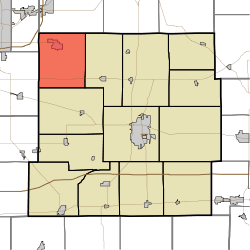 Location in Henry County | |
| Coordinates: 40°02′14″N 85°31′29″W | |
| Country | United States |
| State | Indiana |
| County | Henry |
| Government | |
| • Type | Indiana township |
| Area | |
| • Total | 30.48 sq mi (78.9 km2) |
| • Land | 30.42 sq mi (78.8 km2) |
| • Water | 0.05 sq mi (0.1 km2) 0.16% |
| Elevation | 984 ft (300 m) |
| Population (2010) | |
| • Total | 4,612 |
| • Density | 151.6/sq mi (58.5/km2) |
| GNIS feature ID | 0453291 |
Fall Creek Township was organized in 1829.[2] It was named for the stream which runs through it.[2]
Geography
According to the 2010 census, the township has a total area of 30.48 square miles (78.9 km2), of which 30.42 square miles (78.8 km2) (or 99.80%) is land and 0.05 square miles (0.13 km2) (or 0.16%) is water.[1] The streams of Candy Brook, Deer Creek, Fair Brook, Honey Creek, Mechanicsburg Drain, Mud Creek, Painter Run, Sharp Run, Sugar Creek and Sweet Brook run through this township forming Fall Creek which meets White River in Indianapolis.
Cities and towns
Unincorporated towns
(This list is based on USGS data and may include former settlements.)
Adjacent townships
- Salem Township, Delaware County (north)
- Jefferson Township (east)
- Harrison Township (south)
- Adams Township, Madison County (west)
- Union Township, Madison County (northwest)
Cemeteries
The township contains eight cemeteries: Fattic, Mechanicsburg, Miller, Keesling, Showalter, Pioneer, White Union, and Painter.
Major highways
Education
Fall Creek Township residents may obtain a free library card from the Middletown Fall Creek Library in Middletown.[3]
References
- "Fall Creek Township, Henry County, Indiana". Geographic Names Information System. United States Geological Survey. Retrieved 2009-09-24.
- United States Census Bureau cartographic boundary files
- "Population, Housing Units, Area, and Density: 2010 - County -- County Subdivision and Place -- 2010 Census Summary File 1". United States Census. Archived from the original on 2020-02-12. Retrieved 2013-05-10.
- Hazzard, George (1906). Hazzard's History of Henry County, Indiana, 1822-1906. G. Hazzard, author and publisher. pp. 883–884.
- "Library Policies". Middletown Fall Creek Library. Retrieved 7 March 2018.
External links
Municipalities and communities of Henry County, Indiana, United States | ||
|---|---|---|
| City | Map of Indiana highlighting Henry County | |
| Towns | ||
| Townships | ||
| Unincorporated communities | ||
| Footnotes | ‡This populated place also has portions in an adjacent county or counties | |