Tymochtee Township, Wyandot County, Ohio
Tymochtee Township is one of the thirteen townships of Wyandot County, Ohio, United States. The 2010 census found 1,124 people in the township.
Tymochtee Township, Wyandot County, Ohio | |
|---|---|
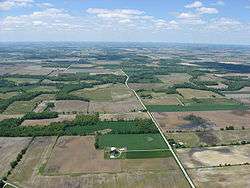 Countryside south of McCutchenville | |
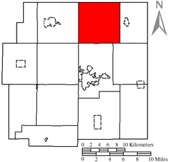 Location of Tymochtee Township in Wyandot County | |
| Coordinates: 40°57′10″N 83°14′6″W | |
| Country | United States |
| State | Ohio |
| County | Wyandot |
| Area | |
| • Total | 36.2 sq mi (93.8 km2) |
| • Land | 36.2 sq mi (93.7 km2) |
| • Water | 0.0 sq mi (0.1 km2) |
| Elevation | 778 ft (237 m) |
| Population (2010) | |
| • Total | 1,124 |
| • Density | 31.0/sq mi (12.0/km2) |
| Time zone | UTC-5 (Eastern (EST)) |
| • Summer (DST) | UTC-4 (EDT) |
| FIPS code | 39-78141[2] |
| GNIS feature ID | 1087214[1] |
Geography
Located in the northern part of the county, it borders the following townships:
- Seneca Township, Seneca County - north
- Eden Township, Seneca County - northeast corner
- Sycamore Township - east
- Eden Township - southeast
- Crane Township - south
- Salem Township - southwest corner
- Crawford Township - west
- Big Spring Township, Seneca County - northwest corner
No municipalities are located in Tymochtee Township, although the unincorporated communities of McCutchenville and Mexico are located in the northern and northeastern parts of the township respectively.
Name and history
It is the only Tymochtee Township statewide.[3]
Government
The township is governed by a three-member board of trustees, who are elected in November of odd-numbered years to a four-year term beginning on the following January 1. Two are elected in the year after the presidential election and one is elected in the year before it. There is also an elected township fiscal officer,[4] who serves a four-year term beginning on April 1 of the year after the election, which is held in November of the year before the presidential election. Vacancies in the fiscal officership or on the board of trustees are filled by the remaining trustees.
References
- "US Board on Geographic Names". United States Geological Survey. 2007-10-25. Retrieved 2008-01-31.
- "U.S. Census website". United States Census Bureau. Retrieved 2008-01-31.
- "Detailed map of Ohio" (PDF). United States Census Bureau. 2000. Retrieved 2007-02-16.
- §503.24, §505.01, and §507.01 of the Ohio Revised Code. Accessed 4/30/2009.
External links
Municipalities and communities of Wyandot County, Ohio, United States | ||
|---|---|---|
| City | 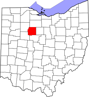 Map of Ohio highlighting Wyandot County | |
| Villages | ||
| Townships | ||
| CDP | ||
| Unincorporated communities | ||
| Footnotes | ‡This populated place also has portions in an adjacent county or counties. | |