McCutchenville, Ohio
McCutchenville is a census-designated place (CDP) in northern Tymochtee Township, Wyandot County, Ohio, United States.[1] Although it is unincorporated, it has a post office, with the ZIP code of 44844.[2] It lies at the intersection of State Routes 53 and 587.
McCutchenville, Ohio | |
|---|---|
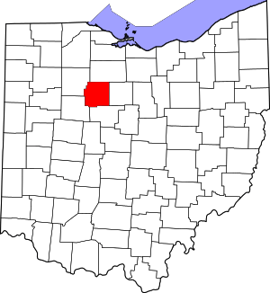
 Location of McCutchenville, Ohio | |
| Coordinates: 40°59′26″N 83°15′34″W | |
| Country | United States |
| State | Ohio |
| County | Wyandot |
| Township | Tymochtee |
| Time zone | UTC-5 (Eastern (EST)) |
| • Summer (DST) | UTC-4 (EDT) |
| ZIP codes | 44844 |
History
McCutchenville was laid out in 1829.[3] The community was named for Joseph McCutchen, the original owner of the town site.[4] A post office has been in operation at McCutchenville since 1833.[5]
gollark: Which Lyric did VARIOUS TIMES.
gollark: It's better than pinging @everyone.
gollark: Ye§.
gollark: <@!216295379895844865> You seem like a person who exists. !vote!gibson!.
gollark: We MUST depose lyricly for this.
References
- U.S. Geological Survey Geographic Names Information System: McCutchenville, Ohio
- Zip Code Lookup
- The History of Wyandot County, Ohio: Containing a History of the County; Its Townships, Towns, Churches, Schools, Etc. Leggett, Conaway & Company. 1884. p. 1031.
- Marvin Jr., Ronald I. (24 August 2015). A Brief History of Wyandot County, Ohio. History Press. p. 56. ISBN 978-1-62585-535-0.
- "Wyandot County". Jim Forte Postal History. Retrieved 7 December 2015.
This article is issued from Wikipedia. The text is licensed under Creative Commons - Attribution - Sharealike. Additional terms may apply for the media files.
