Troy Township, Perry County, Indiana
Troy Township is one of seven townships in Perry County, Indiana, United States. As of the 2010 census, its population was 11,965 and it contained 5,746 housing units[1] (almost two thirds of the overall county population).
Troy Township | |
|---|---|
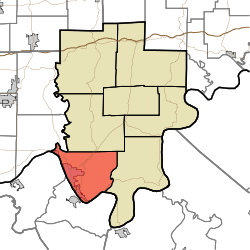 Location in Perry County | |
| Coordinates: 37°57′38″N 86°42′53″W | |
| Country | |
| State | |
| County | Perry |
| Government | |
| • Type | Indiana township |
| Area | |
| • Total | 44.31 sq mi (114.8 km2) |
| • Land | 43.04 sq mi (111.5 km2) |
| • Water | 1.27 sq mi (3.3 km2) 2.87% |
| Elevation | 518 ft (158 m) |
| Population (2010) | |
| • Total | 11,965 |
| • Density | 278/sq mi (107/km2) |
| ZIP codes | 47520, 47586, 47588 |
| GNIS feature ID | 453903 |
Geography
According to the 2010 census, the township has a total area of 44.31 square miles (114.8 km2), of which 43.04 square miles (111.5 km2) (or 97.13%) is land and 1.27 square miles (3.3 km2) (or 2.87%) is water.[1]
Unincorporated towns
(This list is based on USGS data and may include former settlements.)
Cemeteries
The township contains these seven cemeteries: Bolin, Cliff, Greenwood, Log Church, Powell, Saint Michaels and Saint Pius.
Major highways
Lakes
- Echo Lake
- Fenn Haven Lake
School districts
- Cannelton City Schools
- Tell City-Troy Township School Corporation
Political districts
- State House District 74
- State Senate District 47
gollark: It begins.
gollark: For me this is 06:39. So very early.
gollark: I fell down with laughter at that!
gollark: and it's lower time.
gollark: https://dragcave.net/view/iOW16
References
- "Troy Township, Perry County, Indiana". Geographic Names Information System. United States Geological Survey. Retrieved 2009-11-21.
- United States Census Bureau 2009 TIGER/Line Shapefiles
- IndianaMap
- "Population, Housing Units, Area, and Density: 2010 - County -- County Subdivision and Place -- 2010 Census Summary File 1". United States Census. Archived from the original on 2020-02-12. Retrieved 2013-05-10.
External links
- Indiana Township Association
- United Township Association of Indiana
- City-Data.com page for Troy Township
Places adjacent to Troy Township, Perry County, Indiana | ||||||||||
|---|---|---|---|---|---|---|---|---|---|---|
| ||||||||||
Municipalities and communities of Perry County, Indiana, United States | ||
|---|---|---|
| Cities | Map of Indiana highlighting Perry County | |
| Town | ||
| Townships | ||
| Unincorporated communities | ||
This article is issued from Wikipedia. The text is licensed under Creative Commons - Attribution - Sharealike. Additional terms may apply for the media files.