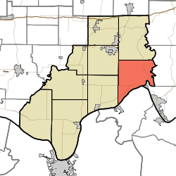
Huff Township, Spencer County, Indiana
Huff Township is one of nine townships in Spencer County, Indiana. As of the 2010 census, its population was 1,156 and it contained 496 housing units.[3]
Huff Township | |
|---|---|
 | |
| Coordinates: 38°01′57″N 86°51′03″W | |
| Country | United States |
| State | Indiana |
| County | Spencer |
| Government | |
| • Type | Indiana township |
| Area | |
| • Total | 43.16 sq mi (111.8 km2) |
| • Land | 42.36 sq mi (109.7 km2) |
| • Water | 0.8 sq mi (2 km2) |
| Elevation | 394 ft (120 m) |
| Population (2010) | |
| • Total | 1,156 |
| • Density | 27.3/sq mi (10.5/km2) |
| FIPS code | 18-35140[2] |
| GNIS feature ID | 453423 |
History
Huff Township was organized in 1837, and named for Aquilla Huff.[4]
Geography
According to the 2010 census, the township has a total area of 43.16 square miles (111.8 km2), of which 42.36 square miles (109.7 km2) (or 98.15%) is land and 0.8 square miles (2.1 km2) (or 1.85%) is water.[3]
Unincorperated towns
gollark: But it says macron.
gollark: https://github.com/macron
gollark: https://github.com/lyricLy/macron/?bees=dispatch
gollark: Why can't it be `gen_add`?
gollark: Intrinsics.
References
- "US Board on Geographic Names". United States Geological Survey. 2007-10-25. Retrieved 2008-01-31.
- "U.S. Census website". United States Census Bureau. Retrieved 2008-01-31.
- "Population, Housing Units, Area, and Density: 2010 - County -- County Subdivision and Place -- 2010 Census Summary File 1". United States Census. Archived from the original on 2020-02-12. Retrieved 2013-05-10.
- History of Warrick, Spencer, and Perry Counties, Indiana: From the Earliest Time to the Present. Goodspeed. 1885. p. 275.
External links
Municipalities and communities of Spencer County, Indiana, United States | ||
|---|---|---|
| City | Map of Indiana highlighting Spencer County | |
| Towns | ||
| Townships | ||
| CDPs | ||
| Other unincorporated communities |
| |
This article is issued from Wikipedia. The text is licensed under Creative Commons - Attribution - Sharealike. Additional terms may apply for the media files.