Trinity Springs, Indiana
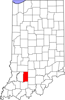
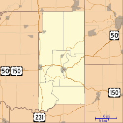
Trinity Springs is an unincorporated community in Mitcheltree Township, Martin County, in the U.S. state of Indiana.[2]
Trinity Springs, Indiana | |
|---|---|
 Martin County's location in Indiana | |
 Trinity Springs Location in Martin County | |
| Coordinates: 38°45′26.2″N 86°45′51.9″W | |
| Country | United States |
| State | Indiana |
| County | Martin |
| Township | Mitcheltree |
| Elevation | 600 ft (183 m) |
| Time zone | UTC-5 (Eastern (EST)) |
| • Summer (DST) | UTC-4 (EDT) |
| ZIP code | 47581 |
| Area code(s) | 812, 930 |
| GNIS feature ID | 444910 |
History
Trinity Springs was originally known as Harrisonville, and under the latter name was platted in 1837.[3] It is the site of three natural springs and was a popular tourist destination in the early 1900s; at one point, seven different hotels operated in the community.[4] The town was briefly the county seat in the 1800s.[5]
A post office was established at Trinity Springs in 1848, and remained in operation until it was discontinued in 1943.[6]
A rock outcrop covered in historic graffiti and the remains of a historic swimming pool situated next to a natural sulphur spring are most of what is left of the resort, commemorated by a historic sign at Mustering Elm Park along State Road 450.
Geography
Trinity Springs is 8 miles (13 km) north of Shoals, at 38°45′26″N 86°45′52″W.
References
- "US Board on Geographic Names". United States Geological Survey. October 25, 2007. Retrieved 2017-05-09.
- "Trinity Springs, Indiana". Geographic Names Information System. United States Geological Survey. Retrieved 2017-06-26.
- Baker, Ronald L. (October 1995). From Needmore to Prosperity: Hoosier Place Names in Folklore and History. Indiana University Press. p. 327. ISBN 978-0-253-32866-3.
This village was platted on August 3, 1837, as Harrisonville.
- Martin County Museum. "Sight Seeing". Archived from the original on September 3, 2007. Retrieved March 9, 2010.
- Indiana Magazine of History. Indiana University, Department of History. 1914. p. 19.
- "Martin County". Jim Forte Postal History. Retrieved June 26, 2017.