Trice Islands
Trice Islands (72°25′S 99°26′W) is a group of small ice-covered islands lying just west of Evans Point, Thurston Island, in Peacock Sound. The group rises above the general level of Abbot Ice Shelf which occupies the sound. First mapped from air photos taken by U.S. Navy Operation Highjump, 1946–47. Named by Advisory Committee on Antarctic Names (US-ACAN) for Jack L. Trice, meteorologist at Byrd Station, 1964–65.
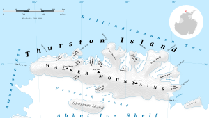
Map of Thurston Island.
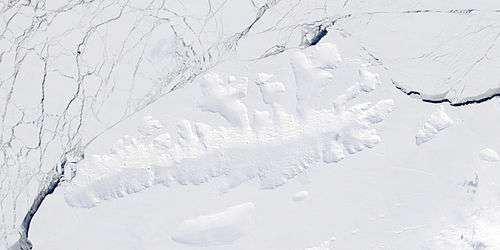
Satellite image of Thurston Island.
Maps
- Thurston Island – Jones Mountains. 1:500000 Antarctica Sketch Map. US Geological Survey, 1967.
- Antarctic Digital Database (ADD). Scale 1:250000 topographic map of Antarctica. Scientific Committee on Antarctic Research (SCAR). Since 1993, regularly upgraded and updated.
gollark: There are also phones with headphone-jackless FM radio.
gollark: The 3a does have one actually.
gollark: Also an OLED display and I don't like those.
gollark: Notably, no micro-SD slot, no removable battery (not that this is available in many recent ones anyway), and no FM radio.
gollark: That is currently my top idea. But it has annoying tradeoffs.
See also
- List of Antarctic and sub-Antarctic islands
![]()
![]()
| General |
| .svg.png) |
|---|---|---|
| Geographic regions | ||
| Waterways | ||
| Famous explorers | ||
This article is issued from Wikipedia. The text is licensed under Creative Commons - Attribution - Sharealike. Additional terms may apply for the media files.