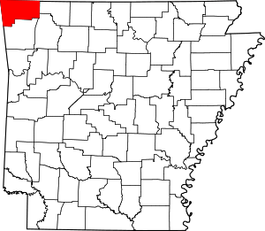
Township 11, Benton County, Arkansas
Township 11 is one of thirteen current townships in Benton County, Arkansas, USA. As of the 2010 census, its total population was 12,273.
Township 11 | |
|---|---|
 Township 11 Location in Arkansas | |
| Coordinates: 36°23′37″N 94°28′6″W | |
| Country | |
| State | |
| County | Benton |
| Area | |
| • Total | 207.804 sq mi (538.21 km2) |
| • Land | 207.558 sq mi (537.57 km2) |
| • Water | 0.246 sq mi (0.64 km2) |
| Population (2010) | |
| • Total | 12,273 |
| • Density | 59.13/sq mi (22.83/km2) |
| Time zone | UTC-6 (CST) |
| • Summer (DST) | UTC-5 (CDT) |
| Area code(s) | 479 |
Geography
According to the United States Census Bureau, Township 11 covers an area of 207.804 square miles (538.21 km2); 207.558 square miles (537.57 km2) of land and 0.246 square miles (0.64 km2) of water.
Cities, towns, and villages
- Centerton (small part)
- Cherokee City
- Decatur
- Gravette
- Highfill (small part)
- Hiwasse (small part)
- Maysville
- Sulphur Springs
gollark: That can be more nicely expressed as 72.1 petadragons.
gollark: 72,057,594,037,927,940 CB dragons would be needed for a checkery one.
gollark: Ah, yes.
gollark: Unless I missed something, you'd need 2^56 CB dragons.
gollark: Wait, is it actually possible to breed anything to 56G without inbreeding (practically)?
References
- United States Census Bureau 2008 TIGER/Line Shapefiles
- United States Board on Geographic Names (GNIS)
- United States National Atlas
External links
This article is issued from Wikipedia. The text is licensed under Creative Commons - Attribution - Sharealike. Additional terms may apply for the media files.
