Torbanlea
Torbanlea is a town and locality in the Fraser Coast Region in Queensland, Australia.[2][3] In the 2016 census, Torbanlea had a population of 791 people.[1]
| Torbanlea Queensland | |||||||||||||||
|---|---|---|---|---|---|---|---|---|---|---|---|---|---|---|---|
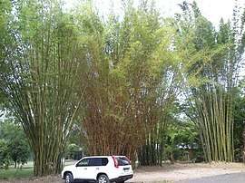
 Giant bamboo, Torbanlea, 2014 | |||||||||||||||
 Torbanlea | |||||||||||||||
| Coordinates | 25.3461°S 152.5958°E | ||||||||||||||
| Population | 791 (2016 census)[1] | ||||||||||||||
| • Density | 25.11/km2 (65.04/sq mi) | ||||||||||||||
| Postcode(s) | 4662 | ||||||||||||||
| Area | 31.5 km2 (12.2 sq mi) | ||||||||||||||
| Location |
| ||||||||||||||
| LGA(s) | Fraser Coast Region | ||||||||||||||
| State electorate(s) | Maryborough | ||||||||||||||
| Federal Division(s) | Hinkler | ||||||||||||||
| |||||||||||||||
Geography
The Burrum River forms the western and northern boundary of the locality. The town is located on the north-western edge of the locality. The North Coast railway line passes through Torbanlea from the south-east to the north with the Torbanlea railway station in the town centre. The Bruce Highway runs through the locality parallel and south of the railway line, bypassing the town centre.[4]
Apart from the town centre, the principal land use is farming mostly along the river and along the highway. The hillier parts of the locality in the south-east are undeveloped bushland.[4]
History
The name Torbanlea is believed to have been suggested by mining manager, James Robertson, after Torbane Hill in Scotland.[2]
St Stephen's Anglican Church opened circa 1896. It closed circa 1988.[5]
An accident at a nearby colliery killed five workers in 1900.
In May 1984, the Bruce Highway bypass was opened. Previously the highway had run through the town on Robertson Street. Neighbouring Howard was also bypassed as part of same project.[6]
In the 2011 census, Torbanlea reported a population of 871 people.[7]
Economy
Torbanlea was a coal mining town.
References
- Australian Bureau of Statistics (27 June 2017). "Torbanlea (SSC)". 2016 Census QuickStats. Retrieved 20 October 2018.

- "Torbanlea - town (entry 35008)". Queensland Place Names. Queensland Government. Retrieved 12 January 2016.
- "Torbanlea - locality (entry 46683)". Queensland Place Names. Queensland Government. Retrieved 12 January 2016.
- "Queensland Globe". State of Queensland. Retrieved 13 November 2018.
- "Closed Anglican Churches". Anglican Church South Queensland. Archived from the original on 3 April 2019. Retrieved 29 June 2020.
- "Burrum and District Museum". Australian Museums and Galleries. Archived from the original on 13 November 2018. Retrieved 13 November 2018.
- Australian Bureau of Statistics (31 October 2012). "Torbanlea (State Suburb)". 2011 Census QuickStats. Retrieved 18 May 2014.

External links
| Wikimedia Commons has media related to Torbanlea, Queensland. |
- "Torbanlea". Queensland Places. Centre for the Government of Queensland, University of Queensland.
- Town map of Torbanlea, 1970