Tongariro Power Scheme
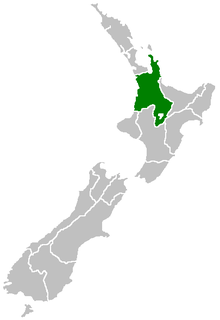
The Tongariro Power Scheme is a 360 MW hydroelectricity scheme in the central North Island of New Zealand. The scheme is currently operated by electricity generation company Genesis Energy.
The scheme takes water from tributaries of the Rangitikei, Whangaehu, Whanganui, and Tongariro rivers, which drain a 2,600-square-kilometre (1,000 sq mi) area covering Ruapehu, Ngauruhoe, Tongariro and the western Kaimanawa Ranges. The water is then sent through a large canal and tunnel system to generate electricity at three hydro power stations, located at Rangipo (120 MW), Tokaanu (240 MW) and Mangaio (2MW). The water is then drained into Lake Taupo where it is stored for further use in the succession of Waikato River power stations.
The scheme generates approximately 1350 GWh of electricity annually, and contributes 4 percent of New Zealand's electricity generation.
Scheme
Eastern Diversion: Whangaehu River to Rangipo Dam
The Eastern Diversion starts at the Waiharakeke Stream, a tributary to the Whangaehu River, where the diversion starts. Water from here and 22 other intakes, including from the Waihianoa and Makahikatoa Streams, passes into the 8.4-kilometre (5.2 mi) long underground Wahianoa Aqueduct. The aqueduct heads eastward, passing under the actual Whangaehu River, but not taking any water from it due to the fact it drains Mount Ruapehu's crater lake and is too acidic. At the end of the aqueduct, near the Desert Road (State Highway 1), water is then diverted through the 1.4-kilometre (0.87 mi) Mangaio Tunnel under the State Highway and either into Mangaio Power Station or a drop structure to enter Lake Moawhango via the Mangaio Stream.
Lake Moawhango is an artificial lake made by the damming of the Moawhango River and Mangaio Stream, two tributaries to the Rangitikei River. Water from Lake Moawhango is then diverted into the 19.2-kilometre (11.9 mi) Moawhango Tunnel to the Rangipo Dam.
The Rangipo Dam is built on the Tongariro River, with water coming from the eastern slopes of Ruapehu and the western slopes of the Kaimanawa Ranges joining the scheme at the dam. Water from the nearby Waihohonu Stream is also taken and diverted via the 960-metre (3,150 ft) Waihohonu Tunnel to Rangipo Dam.
Tongariro Diversion: Rangipo Dam to Lake Rotoaira
The lake behind the Rangipo Dam acts as a head pond to the Rangipo Power Station. Water from the lake is then taken into the 8-kilometre (5.0 mi) Rangipo Headrace Tunnel to Rangipo Power Station, 63 metres (207 ft) below ground level. After passing through Rangipo Power Station, the water passes through the 3-kilometre (1.9 mi) Rangipo Tailrace Tunnel to the Poutu Dam on the Tongariro River.
After taking on more water from the Tongariro River (which now includes water from the eastern slopes of Ngauruhoe and Tongariro), the water is diverted through the Poutu Canal, where the water travels under State Highway 1 and State Highway 46 to the Poutu Stream. Joining with the Poutu Stream, the water enters Lake Rotoaira, where it merges with water from the Western Diversion.
Western Diversion: Whakapapa River to Lake Rotoaira
The Western Diversion starts at the Whakapapa River, taking water from it into a 16.5-kilometre (10.3 mi) long tunnel to Lake Te Whaiau, picking water up from the Okupata, Taurewa, Tawhitikuri, and Mangatepopo streams along the way.
Water from the Whanganui River is diverted via a short tunnel into the Te Whaiau Stream, which joins water from the Whakapapa and other intakes. Water from Lake Te Whaiau is then diverted into the Otamangakau Canal into Lake Otamangakau, where the water is joined by water from the Otamangakau Stream.
From Lake Otamangakau, water from the Western Diversion is diverted into the Wairehu Canal, where it travels under State Highway 47 and into Lake Rotoaira, joining water from the Eastern Diversion.
Rotoaira Diversion: Lake Rotoaira to Lake Taupo
Lake Rotoaira stores water from both the Eastern and Western Diversions, and also stores water coming off Mount Pihanga and Mount Tihia. The lake also acts as the head pond to the Tokaanu Power Station.
Water is taken from the northern end of Lake Rotoaira into the 6.1-kilometre (3.8 mi) Tokaanu Tunnel, which takes the water down under State Highway 47 and through Mount Tihia to the Tokaanu Power Station. After passing through the station, the water is deposited into the 3.8-kilometre (2.4 mi) Tokaanu Tailrace Canal.
The canal passes under the unique Tokaanu Tailrace Bridge, a combined road bridge and aqueduct. State Highway 41 travels over the top of the bridge, with the Tokaanu Stream, an important trout spawning stream, running under the road surface. The canal then drains into Lake Taupo at Waihi Bay.
Power Stations
| Tongariro Hydro Scheme (Tokaanu, Rangipo) | |
|---|---|
| Country |
|
| Location | Central North Island |
| Commission date | 1973 (Tokaanu) 1983 (Rangipo) 2008 (Mangaio) |
| Owner(s) | Genesis Energy |
| Power generation | |
| Units operational | Four (Tokaanu) Two (Rangipo) One (Mangaio) |
| Nameplate capacity | 240 MW (Tokaanu) 120 MW (Rangipo) 2 MW (Mangaio) |
| Annual net output | 1350 GWh (Total) |
Three power stations exist on the scheme, Rangipo, Tokaanu and Mangaio. The power stations are controlled by a control room at Tokaanu.
Rangipo
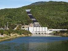
Rangipo Power Station is located on the Eastern Diversion of the scheme. The power station is built 63 metres (207 ft) underground to minimise visual impact, the second hydro station in New Zealand to do so (after Manapouri Power Station). The power station has two turbines, each generating 60 megawatts (80,000 hp), giving the station a total capacity of 120 megawatts (160,000 hp). The station was commissioned in 1983.
Rangipo Power Station connects to the single-circuit 220 kV Bunnythorpe to Wairakei line (BPE-WRK-A) via a short 220 kV twin-circuit deviation line (RPO-DEV-A).[1]
Tokaanu

Tokaanu Power Station is located on the Rotoaira Diversion of the scheme. The power station has four turbines, each generating 60 megawatts (80,000 hp), giving the station a total capacity of 240 megawatts (320,000 hp). The station was commissioned in 1973. Tokaanu also houses the control room for the entire Tongariro Power Scheme.
Tokaanu Power Station connects to the two single-circuit 220 kV Bunnythorpe to Whakamaru lines (BPE-WKM-A and BPE-WKM-B) directly south of the station.[1]
Mangaio
The power station has a total capacity of 2 megawatts (2,700 hp).
References
- "North Island transmission network map - Transpower" (PDF). Archived from the original (PDF) on 2008-10-15. Retrieved 2009-04-22.
Further reading
- Martin, John E, ed. (1991). People, Power and Power Stations: Electric Power Generation in New Zealand 1880 - 1990. Wellington: Bridget Williams Books Ltd and Electricity Corporation of New Zealand. pp. 316 pages. ISBN 0-908912-16-1.
