Thung Yang Daeng District
Thung Yang Daeng (Thai: ทุ่งยางแดง, pronounced [tʰûŋ jāːŋ dɛ̄ːŋ]) is a district (amphoe) of Pattani Province, southern Thailand.
Thung Yang Daeng ทุ่งยางแดง | |
|---|---|
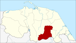 District location in Pattani Province | |
| Coordinates: 6°37′3″N 101°25′33″E | |
| Country | Thailand |
| Province | Pattani |
| Seat | Talo Maena |
| Area | |
| • Total | 114.97 km2 (44.39 sq mi) |
| Population (2005) | |
| • Total | 20,203 |
| • Density | 175.7/km2 (455/sq mi) |
| Time zone | UTC+7 (ICT) |
| Postal code | 94140 |
| Geocode | 9406 |
History
The minor district (king amphoe) Thung Yang Daeng was created on 16 May 1977, when four tambons were split off from Mayo District.[1] On 4 July 1994 it was upgraded to a full district.[2]
Geography
Neighboring districts are (from the south clockwise): Raman of Yala Province; Yarang, Mayo, Sai Buri, and Kapho of Pattani Province.
Administration
The district is divided into four sub-districts (tambons), which are further subdivided into 22 villages (mubans). There are no municipal (thesabans). There are four tambon administrative organizations (TAO).
| No. | Name | Thai name | Villages | Pop. | |
|---|---|---|---|---|---|
| 1. | Talo Mae Na | ตะโละแมะนา | 4 | 2,983 | |
| 2. | Phithen | พิเทน | 7 | 7,481 | |
| 3. | Nam Dam | น้ำดำ | 4 | 3,122 | |
| 4. | Paku | ปากู | 7 | 6,617 |
gollark: Not too hard. That lapis thing someone recommended looked good.
gollark: More like *using* one.
gollark: He is not *making an HTTP client* exactly.
gollark: Websockets only.
gollark: Nope.
References
- ประกาศกระทรวงมหาดไทย เรื่อง แบ่งท้องที่อำเภอมายอ จังหวัดปัตตานี ตั้งเป็นกิ่งอำเภอทุ่งยางแดง (PDF). Royal Gazette (in Thai). 94 (44 ง): 2177. May 24, 1977.
- พระราชกฤษฎีกาตั้งอำเภอเปือยน้อย ... และอำเภอศรีวิไล พ.ศ. ๒๕๓๗ (PDF). Royal Gazette (in Thai). 111 (21 ก): 32–35. June 3, 1994.
This article is issued from Wikipedia. The text is licensed under Creative Commons - Attribution - Sharealike. Additional terms may apply for the media files.