Tettau, Brandenburg
Tettau is a municipality in the Oberspreewald-Lausitz district, in southern Brandenburg, Germany.
Tettau | |
|---|---|
.svg.png) Coat of arms | |
Location of Tettau within Oberspreewald-Lausitz district 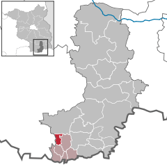  | |
 Tettau  Tettau | |
| Coordinates: 51°25′59″N 13°43′59″E | |
| Country | Germany |
| State | Brandenburg |
| District | Oberspreewald-Lausitz |
| Municipal assoc. | Ortrand |
| Government | |
| • Mayor | Siegmar Petrenz (Wirtschaft-Kultur-Sport) |
| Area | |
| • Total | 8.80 km2 (3.40 sq mi) |
| Elevation | 94 m (308 ft) |
| Population (2018-12-31)[1] | |
| • Total | 775 |
| • Density | 88/km2 (230/sq mi) |
| Time zone | CET/CEST (UTC+1/+2) |
| Postal codes | 01945 |
| Dialling codes | 03574 |
| Vehicle registration | OSL |
| Website | www.gemeinde-tettau.de |
Demography
.pdf.jpg)
Development of Population since 1875 within the Current Boundaries (Blue Line: Population; Dotted Line: Comparison to Population Development of Brandenburg state; Grey Background: Time of Nazi rule; Red Background: Time of Communist rule)
|
|
gollark: That seems implausible.
gollark: I know, but you can only do 4ish.
gollark: I don't do A-level chemistry, so you cannot be saved.
gollark: Chemistry is actually 3 complex.
gollark: See, school tends to simplify or handwave things a lot.
References
- "Bevölkerung im Land Brandenburg nach amtsfreien Gemeinden, Ämtern und Gemeinden 31. Dezember 2018". Amt für Statistik Berlin-Brandenburg (in German). July 2019.
- Detailed data sources are to be found in the Wikimedia Commons.Population Projection Brandenburg at Wikimedia Commons
Towns and municipalities in Oberspreewald-Lausitz | ||
|---|---|---|
Coat of Arms of Oberspreewald-Lausitz district | ||
This article is issued from Wikipedia. The text is licensed under Creative Commons - Attribution - Sharealike. Additional terms may apply for the media files.