Tepi (village)
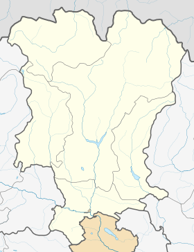
Tepi (Georgian: ტეფი) is a village in the historical region of Khevi, north-eastern Georgia. It is located on the left bank of the Tergi river. Administratively, it is part of the Kazbegi Municipality in Mtskheta-Mtianeti. Distance to the municipality center Stepantsminda is 44.5 km.
Tepi ტეფი | |
|---|---|
 Tepi Location of Tepi in Georgia  Tepi Tepi (Mtskheta-Mtianeti) | |
| Coordinates: 42°39′33″N 44°18′59″E | |
| Country | |
| Mkhare | Mtskheta-Mtianeti |
| Municipality | Kazbegi |
| Elevation | 2,320 m (7,610 ft) |
| Population (2014)[1] | |
| • Total | 0 |
| Time zone | UTC+4 (Georgian Time) |
Sources
- Georgian Soviet Encyclopedia, V. 9, p. 702, Tbilisi, 1985 year.
gollark: Yes. I like how Lua does it, and potentially Zig and Kotlin.
gollark: Hmm. I'm sure *someone* must have thought of this at some point. I need a more principled™ way to share data between these modules than global variables.
gollark: Yes, the async thing seems to be related to the unremovable eldritch horrors, but I don't know how.
gollark: RSAPI uses AIOHTTP, which is nice apart from possibly being the cause of the unremovable eldritch horrors in RSAPI.
gollark: I sometimes use JS, but arguably this is worse.
References
- "Population Census 2014". www.geostat.ge. National Statistics Office of Georgia. November 2014. Retrieved 2 June 2016.
This article is issued from Wikipedia. The text is licensed under Creative Commons - Attribution - Sharealike. Additional terms may apply for the media files.