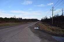
Tennessee State Route 125
State Route 125 (SR 125) is a north–south state route in southern West Tennessee. It begins north of Silerton at SR 100 and ends at the Tennessee–Mississippi state line, where it continues as Mississippi Highway 15.[1][2]
| ||||
|---|---|---|---|---|
| Route information | ||||
| Maintained by TDOT | ||||
| Length | 37.36 mi (60.13 km) | |||
| Major junctions | ||||
| South end | ||||
| North end | ||||
| Location | ||||
| Counties | Hardeman, Chester | |||
| Highway system | ||||
| ||||
Route description
Hardeman County

SR 125 begins as a primary highway in Hardeman County at the Mississippi state line, where the road continues south as Mississippi Highway 15 (MS 15). It goes north as a 2-lane highway past several industrial businesses before entering Middleton and having an intersection with SR 57. SR 125 then goes north past several more businesses before crossing the railroad tracks and passing through downtown. The highway then leaves Middleton and continues north through rural areas for approximately 12 miles (19 km) before entering Bolivar. The highway passes through a couple of neighborhoods before going through a wooded area to enter downtown, where it comes to an intersection with US 64/SR 15 and SR 18, SR 125 then becomes concurrent with SR 18 and they go north through some more neighborhoods before leaving Bolivar and crossing the Hatchie River. The highway then enters rural areas again and come to a Y-Intersection where SR 18 continues north while SR 125 downgrades to a secondary highway and turns east. For the next several miles, SR 125 winds its way through the countryside to Silerton, where it turns north and crosses into Chester County.
Chester County
SR 125 continues to wind its way through countryside, crossing several creeks before passing through a wooded area, where it climbs over a ridge and some steep grades, just shortly before coming to an end at a Y-Intersection with SR 100, directly beside Chickasaw State Park.
Major intersections
| County | Location | mi | km | Destinations | Notes |
|---|---|---|---|---|---|
| Hardeman | | 0.0 | 0.0 | Mississippi state line; southern terminus; SR 125 begins as a primary highway | |
| Middleton | |||||
| Bolivar | Southern end of SR 18 concurrency | ||||
| Bridge over the Hatchie River | |||||
| | Northern end of SR 18 concurrency; SR 125 downgrades to a secondary highway | ||||
| Chester | | 37.36 | 60.13 | Northern terminus; SR 125 ends as a secondary highway | |
1.000 mi = 1.609 km; 1.000 km = 0.621 mi
| |||||
References
- "Driving Directions from Bolivar, TN to Blue Mountain, MS - MapQuest". www.mapquest.com. Retrieved 23 October 2017.
- "Google Maps". Google Maps. Retrieved 23 October 2017.

