Tenbek
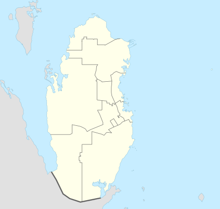
Tenbek (Arabic: تنبك) is a village in Qatar located in the municipality of Al Daayen.[3][4]
Tenbek الرحية | |
|---|---|
Village | |
 Tenbek Location in Qatar | |
| Coordinates: 25.603895°N 51.463817°E | |
| Country | |
| Municipality | Al Daayen |
| Zone | Zone 70 |
| District no. | 287 |
| Area | |
| • Total | 3.7 sq mi (9.6 km2) |
| Elevation | 30 ft (10 m) |
Nearby settlements include Al Rehayya to the north and Simaisma to the south-east.[4]
History
J.G. Lorimer's Gazetteer of the Persian Gulf records Tenbek (as Tinbak) in 1908, giving its location as 4 miles south Khor Shaqiq and close to the coast. He also stated that the area served as a Bedouin camping ground and accommodated a fort. According to Lorimer, inhabitants received their drinking water from a masonry well sunk into stony ground at a depth of 7 fathoms yielding good water.[5]
Gallery
 Road sign indicating Tenbek.
gollark: These exceptions SHOULD come with a line and file.
gollark: Which line does it say?
gollark: Nulls are, you see, evil.
gollark: - they are sufficiently distinct- there is a good reason- there are many ways to generate and use them
gollark: I'm fine with unique power systems if:
References
- "District Area Map". Ministry of Development Planning and Statistics. Retrieved 20 May 2019.
- "Tenbek, Zone 70, Qatar on the Elevation Map". elevationmap.net. Retrieved 19 January 2019.
- "Qatar Development Atlas - Part 1" (PDF). Ministry of Development Planning and Statistics. 2010. p. 10. Retrieved 19 January 2019.
- "District map". The Centre for Geographic Information Systems of Qatar. Retrieved 19 January 2019.
- "'Gazetteer of the Persian Gulf. Vol. II. Geographical and Statistical. J G Lorimer. 1908' [1529] (1644/2084)". Qatar Digital Library. Retrieved 19 January 2019.
This article is issued from Wikipedia. The text is licensed under Creative Commons - Attribution - Sharealike. Additional terms may apply for the media files.