Tayr Falsay
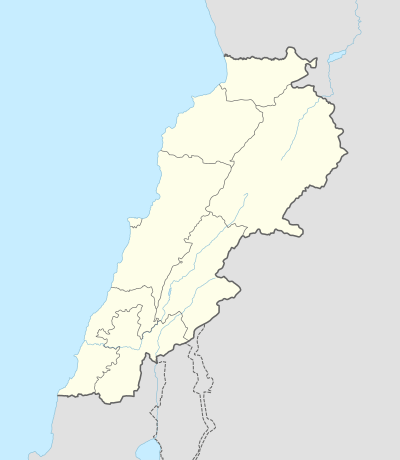
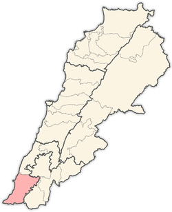
Tayr Falsay (Arabic: طير فلساي) is a village in Tyre District in Southern Lebanon, located just south of the Litani river.
Tayr Falsay طير فلساي | |
|---|---|
Village | |
 Tayr Falsay | |
| Coordinates: 33°18′32″N 35°20′53″E | |
| Grid position | 113/153 L |
| Country | |
| Governorate | South Governorate |
| District | Tyre |
| Elevation | 850 ft (260 m) |
| Time zone | GMT +3 |
Name
According to E. H. Palmer, the name means the fortress of the scales or small coins.[1]
History
In 1881, the PEF's Survey of Western Palestine (SWP) described it: "A village built of stone; about 250 Metawileh; on side of hill near the top, with figs and arable land around. There are two springs, and cisterns."[2]
gollark: Fun thing which I was reminded of by the ongoing free will/volition debate: https://roadtolarissa.com/oracle/
gollark: It's not like they... have size, as we macroscale people think of it, as far as I know.
gollark: Probably depends on how the magical transmutation thing™ interprets a "solid cubic millimetre" of any particles.
gollark: Top quarks maybe.
gollark: For utterly destroying things, I'm sure you could come up with something higher energy than that.
Bibliography
- Conder, C.R.; Kitchener, H. H. (1881). The Survey of Western Palestine: Memoirs of the Topography, Orography, Hydrography, and Archaeology. 1. London: Committee of the Palestine Exploration Fund.
- Palmer, E.H. (1881). The Survey of Western Palestine: Arabic and English Name Lists Collected During the Survey by Lieutenants Conder and Kitchener, R. E. Transliterated and Explained by E.H. Palmer. Committee of the Palestine Exploration Fund.
External links
- Tayr Falsay, Localiban
- Survey of Western Palestine, Map 2: IAA, Wikimedia commons
Capital: Tyre | ||
| Towns and villages |
|  |
| Palestinian refugee camps | ||
| Other | ||
This article is issued from Wikipedia. The text is licensed under Creative Commons - Attribution - Sharealike. Additional terms may apply for the media files.