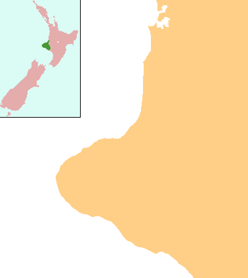
Tariki, New Zealand
Tariki is a small farming community immediately to the east of Mount Taranaki in the west of New Zealand's North Island.[1] It lies on SH 3 halfway between the towns of Inglewood and Stratford. Several small streams, all tributaries of the Manganui River, pass close to Tariki.[2]
Tariki | |
|---|---|
 Tariki | |
| Coordinates: 39°14′10″S 174°14′40″E | |
| Country | New Zealand |
| Region | Taranaki |
| District | New Plymouth District |
| Postcode(s) | 4390 |
The origin of the settlement's name is unknown – it may be named for a person, or be a corruption of the Māori term tarika, meaning to toss and turn.[3]
References
- Wise's New Zealand guide (1969) Dunedin: H. Wise & Co. p. 333.
- Dowling, P. (ed.) (2004). ’’Reed New Zealand atlas’’. Auckland: Reed Publishing. ISBN 0 7900 0952 8 Map 34.
- Reed, A.W. (1975). Place names of New Zealand. Wellington: A.H. & A.W. Reed. p. 404.
This article is issued from Wikipedia. The text is licensed under Creative Commons - Attribution - Sharealike. Additional terms may apply for the media files.