Tacotalpa Municipality
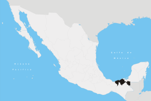
Tacotalpa is a municipality in Tabasco in south-eastern Mexico.[1]
Tacotalpa | |
|---|---|
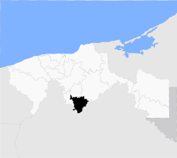 Location of the municipality in Tabasco. | |
| Country | |
| State | Tabasco |
| Capital | Tacotalpa |
| Time zone | UTC-6 (Central Standard Time) |
| • Summer (DST) | UTC-5 (Central Daylight Time) |
Climate
| Climate data for Tacotalpa | |||||||||||||
|---|---|---|---|---|---|---|---|---|---|---|---|---|---|
| Month | Jan | Feb | Mar | Apr | May | Jun | Jul | Aug | Sep | Oct | Nov | Dec | Year |
| Average high °C (°F) | 26.7 (80.1) |
28.1 (82.6) |
30.6 (87.1) |
33.0 (91.4) |
34.3 (93.7) |
33.4 (92.1) |
32.7 (90.9) |
32.7 (90.9) |
31.8 (89.2) |
30.2 (86.4) |
28.6 (83.5) |
27.4 (81.3) |
30.8 (87.4) |
| Average low °C (°F) | 17.4 (63.3) |
17.9 (64.2) |
19.5 (67.1) |
21.4 (70.5) |
22.5 (72.5) |
22.5 (72.5) |
21.9 (71.4) |
21.8 (71.2) |
21.9 (71.4) |
20.9 (69.6) |
19.4 (66.9) |
18.1 (64.6) |
20.4 (68.7) |
| Average precipitation mm (inches) | 200 (7.9) |
140 (5.7) |
100 (4) |
99 (3.9) |
140 (5.7) |
310 (12.4) |
280 (11.2) |
360 (14) |
490 (19.1) |
420 (16.5) |
250 (9.7) |
220 (8.6) |
3,020 (118.8) |
| Source: Weatherbase [2] | |||||||||||||
gollark: Like what? I'm pretty sure there has been thought about this.
gollark: What would you prefer, *no* lockdown (or much less of one) and significantly higher infection (and then death) rates?
gollark: Did you not read anything people said?
gollark: This is obviously not correcting for age and stuff, but still.
gollark: Based on highly advanced simulations*, 5% of people dying would mean that if you know 25 people you stand a 75% chance of one or more dying.* my calculator
References
- "-". Enciclopedia de los Municipios de México. Instituto Nacional para el Federalismo y el Desarrollo Municipal. Retrieved January 4, 2010.
- "Weatherbase: Historical Weather for Tacotalpa, Tabasco". Weatherbase. 2011. Retrieved on November 24, 2011.
Villahermosa (capital) | ||
| Municipalities and (municipal seats) |
|  |
This article is issued from Wikipedia. The text is licensed under Creative Commons - Attribution - Sharealike. Additional terms may apply for the media files.