Tân Phú Đông District
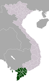
Tân Phú Đông is a new rural district (huyện) of Tiền Giang Province in the Mekong Delta region of Vietnam. This district located in an islet named "Lợi Quan" of the Mekong River. It was established in 2008 and is a poorest district in Tiền Giang Province.[1] Its territory came from split of Gò Công Đông District and Gò Công Tây District.
Tân Phú Đông District Huyện Tân Phú Đông | |
|---|---|
 Tân Phú Đông District | |
| Coordinates: 10°20′N 106°02′E | |
| Country | |
| Region | Mekong Delta |
| Province | Tiền Giang |
| Capital | None |
| Area | |
| • Total | 78.02 sq mi (202.08 km2) |
| Population (2008) | |
| • Total | 42,926 |
| Time zone | UTC+7 (UTC + 7) |
Tân Phú Đông is subdivided into 6 communes:
- Phú Đông
- Phú Tân
- Phú Thạnh
- Tân Thới
- Tân Phú
- Tân Thạnh
References
This article is issued from Wikipedia. The text is licensed under Creative Commons - Attribution - Sharealike. Additional terms may apply for the media files.