Swamp Island
Swamp Island is an island of the Andaman Islands. It belongs to the North and Middle Andaman administrative district, part of the Indian union territory of Andaman and Nicobar Islands.[5] The island lies 140 km (87 mi) north from Port Blair.
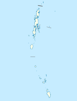 Swamp Island Location of Swamp Island | |
| Geography | |
|---|---|
| Location | Bay of Bengal |
| Coordinates | 12.93°N 92.875°E |
| Archipelago | Andaman Islands |
| Adjacent bodies of water | Indian Ocean |
| Area | 3.44 km2 (1.33 sq mi)[1] |
| Length | 2.9 km (1.8 mi) |
| Width | 1.9 km (1.18 mi) |
| Coastline | 10 km (6 mi) |
| Highest elevation | 0 m (0 ft) |
| Administration | |
| District | North and Middle Andaman |
| Island group | Andaman Islands |
| Island sub-group | Stewart Sound Group |
| Taluk | Diglipur Taluk |
| Demographics | |
| Population | 0 (2016) |
| Additional information | |
| Time zone | |
| PIN | 744202[2] |
| Telephone code | 031927 [3] |
| ISO code | IN-AN-00[4] |
| Official website | www |
| Literacy | 84.4% |
| Avg. summer temperature | 30.2 °C (86.4 °F) |
| Avg. winter temperature | 23.0 °C (73.4 °F) |
| Sex ratio | 1.2♂/♀ |
| Census Code | 35.639.0004 |
| Official Languages | Hindi, English |
Geography
The island belongs to the Stewart Sound Group and lies west of Egg Island.
Administration
Politically, Swamp Island, along neighboring Stewart Sound Group Islands, belongs to Diglipur Taluk.[6]
gollark: I am aware.
gollark: <@151391317740486657> Idea: join SCCraft™ and visit the Apiaristics Division™.
gollark: I suppose they are good if you have a *really big* display to replace several lower-resolution monitors.
gollark: I don't, obviously, but I don't think I could resolve much more detail than my 1080p laptop screen displays at its size.
gollark: Windows upscales stuff a lot on even 1080p screens.
References
- "Islandwise Area and Population - 2011 Census" (PDF). Government of Andaman.
- "A&N Islands - Pincodes". 22 September 2016. Archived from the original on 23 March 2014. Retrieved 22 September 2016.
- "STD Codes of Andaman and Nicobar". allcodesindia.in. Retrieved 23 September 2016.
- Registration Plate Numbers added to ISO Code
- "Village Code Directory: Andaman & Nicobar Islands" (PDF). Census of India. Retrieved 16 January 2011.
- "DEMOGRAPHIC – A&N ISLANDS" (PDF). andssw1.and.nic.in. Retrieved 23 September 2016.
- Geological Survey of India

This article is issued from Wikipedia. The text is licensed under Creative Commons - Attribution - Sharealike. Additional terms may apply for the media files.