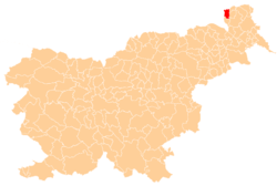
Sveti Jurij, Rogašovci
Sveti Jurij (pronounced [ˈsʋeːti ˈjuːɾii̯]; Hungarian: Vízlendva,[2] German: Sankt Georgen,[3] Prekmurje Slovene: Sveti Güri[4] or Sveti Jürij[5]) is a village in the Municipality of Rogašovci in the Prekmurje region of northeastern Slovenia.[6]
Sveti Jurij Jurij (1955–1990) | |
|---|---|
 Sveti Jurij Location in Slovenia | |
| Coordinates: 46°47′52.83″N 16°2′10.55″E | |
| Country | |
| Traditional region | Prekmurje |
| Statistical region | Mura |
| Municipality | Rogašovci |
| Area | |
| • Total | 3.92 km2 (1.51 sq mi) |
| Elevation | 236 m (774 ft) |
| Population (2016) | |
| • Total | 463 |
| [1] | |
Name
The name of the settlement was changed from Sveti Jurij (literally, 'Saint George') to Jurij (literally, 'George') in 1955. The name was changed on the basis of the 1948 Law on Names of Settlements and Designations of Squares, Streets, and Buildings as part of efforts by Slovenia's postwar communist government to remove religious elements from toponyms. The name Sveti Jurij was restored in 1990.[7][8][9]
Church
The parish church in the village, from which the settlement gets its name, is dedicated to Saint George. It is a large three-aisle Neo-Romanesque building built in 1925. Elements of the original Gothic building from the late 14th century are preserved in the sanctuary. It belongs to the Roman Catholic Diocese of Murska Sobota.[10]
References
- Statistical Office of the Republic of Slovenia
- Vengušt, Jernej. 1919. Seznamek prekmurskih občin (krajev) z označbo pošte in zemljevidom. Radgona, p. 7.
- Rajšp, Vincenc. 2001. Slovenija na vojaškem zemljevidu 1763-1787, vol. 7. Ljubljana: ZRC SAZU, p. 125.
- M. Koletnik: Panonsko lončarsko in kmetijsko izrazje ter druge dialektološke razprave, Bielsko-Biała, Budapest, Kansas, Maribor, Praha 2008. ISBN 978-961-6656-28-3 p. 188.
- "Živinsko i drobno senje (sejmi) v Sl. Krajini." 1929. Nájszvetejsega Szrca Jezusovoga veliki kalendár za lüdsztvo 26: 103. (in Slovene)
- Rogašovci municipal site
- Spremembe naselij 1948–95. 1996. Database. Ljubljana: Geografski inštitut ZRC SAZU, DZS.
- Premk, F. 2004. Slovenska versko-krščanska terminologija v zemljepisnih imenih in spremembe za čas 1921–1967/68. Besedoslovne lastnosti slovenskega jezika: slovenska zemljepisna imena. Ljubljana: Slavistično društvo Slovenije, pp. 113–132.
- Urbanc, Mimi, & Matej Gabrovec. 2005. Krajevna imena: poligon za dokazovanje moči in odraz lokalne identitete. Geografski vestnik 77(2): 25–43.
- Slovenian Ministry of Culture register of national heritage reference number 3046
