Sumner, Georgia
Sumner is a town in Worth County, Georgia, United States. The population was 427 at the 2010 census. It is part of the Albany, Georgia Metropolitan Statistical Area. Sumner High School is listed on the National Register of Historic Places.
Sumner, Georgia | |
|---|---|
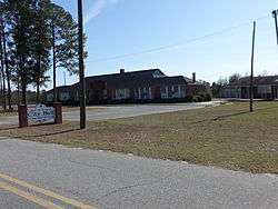 Sumner City Hall | |
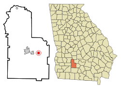 Location in Worth County and the state of Georgia | |
| Coordinates: 31°30′40″N 83°44′18″W | |
| Country | United States |
| State | Georgia |
| County | Worth |
| Area | |
| • Total | 1.77 sq mi (4.59 km2) |
| • Land | 1.77 sq mi (4.59 km2) |
| • Water | 0.00 sq mi (0.00 km2) |
| Elevation | 377 ft (115 m) |
| Population (2010) | |
| • Total | 427 |
| • Estimate (2019)[2] | 424 |
| • Density | 239.28/sq mi (92.41/km2) |
| Time zone | UTC-5 (Eastern (EST)) |
| • Summer (DST) | UTC-4 (EDT) |
| ZIP code | 31789 |
| Area code(s) | 229 |
| FIPS code | 13-74432[3] |
| GNIS feature ID | 0356569[4] |
Geography
Sumner is located at 31°30′40″N 83°44′18″W (31.510979, -83.738315).[5]
According to the United States Census Bureau, the town has a total area of 1.1 square miles (2.8 km2), all land.
History
The community was named after John C. "Jack" Sumner, the original owner of the town site.[6]
The Georgia General Assembly incorporated Sumner as a town in 1883.[7]
Demographics
| Historical population | |||
|---|---|---|---|
| Census | Pop. | %± | |
| 1900 | 333 | — | |
| 1910 | 336 | 0.9% | |
| 1920 | 331 | −1.5% | |
| 1930 | 332 | 0.3% | |
| 1940 | 340 | 2.4% | |
| 1950 | 226 | −33.5% | |
| 1960 | 193 | −14.6% | |
| 1970 | 207 | 7.3% | |
| 1980 | 213 | 2.9% | |
| 1990 | 209 | −1.9% | |
| 2000 | 309 | 47.8% | |
| 2010 | 427 | 38.2% | |
| Est. 2019 | 424 | [2] | −0.7% |
| U.S. Decennial Census[8] | |||
As of the census[3] of 2000, there were 309 people, 110 households, and 87 families residing in the town. The population density was 288.4 people per square mile (111.5/km2). There were 125 housing units at an average density of 116.7 per square mile (45.1/km2). The racial makeup of the town was 83.82% White, 14.89% African American, 0.97% Native American, and 0.32% from two or more races.
There were 110 households out of which 32.7% had children under the age of 18 living with them, 62.7% were married couples living together, 8.2% had a female householder with no husband present, and 20.9% were non-families. 18.2% of all households were made up of individuals and 6.4% had someone living alone who was 65 years of age or older. The average household size was 2.81 and the average family size was 3.14.
In the town, the population was spread out with 24.6% under the age of 18, 12.3% from 18 to 24, 24.6% from 25 to 44, 23.0% from 45 to 64, and 15.5% who were 65 years of age or older. The median age was 35 years. For every 100 females, there were 90.7 males. For every 100 females age 18 and over, there were 91.0 males.
The median income for a household in the town was $30,781, and the median income for a family was $33,750. Males had a median income of $23,000 versus $16,875 for females. The per capita income for the town was $13,532. About 13.4% of families and 16.9% of the population were below the poverty line, including 20.3% of those under the age of eighteen and 22.9% of those sixty five or over.
References
- "2019 U.S. Gazetteer Files". United States Census Bureau. Retrieved July 9, 2020.
- "Population and Housing Unit Estimates". United States Census Bureau. May 24, 2020. Retrieved May 27, 2020.
- "U.S. Census website". United States Census Bureau. Retrieved 2008-01-31.
- "US Board on Geographic Names". United States Geological Survey. 2007-10-25. Retrieved 2008-01-31.
- "US Gazetteer files: 2010, 2000, and 1990". United States Census Bureau. 2011-02-12. Retrieved 2011-04-23.
- Krakow, Kenneth K. (1975). Georgia Place-Names: Their History and Origins (PDF). Macon, GA: Winship Press. p. 215. ISBN 0-915430-00-2.
- Acts and Resolutions of the General Assembly of the State of Georgia. Clark & Hines, State Printers. 1883. p. 291.
- "Census of Population and Housing". Census.gov. Retrieved June 4, 2015.
Municipalities and communities of Worth County, Georgia, United States | ||
|---|---|---|
| Cities | 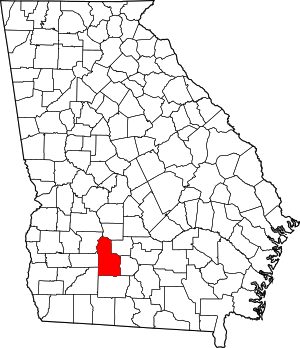 Map of Georgia highlighting Worth County | |
| Town | ||
| Unincorporated communities | ||
| Ghost town | ||
| Authority control |
|
|---|