Sulhamstead Estate, Chiswick
The Sulhamstead Estate is an area in Chiswick where most of the current buildings were built between 1875 and 1905. The housing varies from some that are bigger than those in Bedford Park to some smaller than the houses on the Glebe Estate. The builders also vary from land owners selling off bits of their property, to individuals buying a small plot to build their own house.
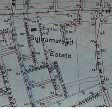
Location
To the north of the estate is Chiswick High Road, which was once a Neolithic road. When the Romans arrived it was part of their London to Windsor Road. When they left the road fell into disrepair and parts of Brentford Road (Chiswick High Road's name at the time,) was known to be a marshy bog that was often impassable during the winter. To the north of Chiswick High Road was another Roman Road that has disappeared completely. Goldhawk Road at one time continued as a straight road that joined up with Chiswick High Road by Chiswick Road. The bend in the High Road is where the two roads met. At some point the left turn in the Goldhawk Road was added when leaving London, which would have meant only one crossing point over the Stamford brook to maintain. The location of rivers in this area is often disputed as the Romans would have diverted all the springs in Acton to protect the road they had built, there are also boundary ditches that have become waterways and also drainage was added to make the marshland of Chiswick usable.
In 704 – 709 the bishop of London was granted 50 hides in Fulham, by the time of the Domesday Book the bishop of London was the largest landowner in the Ossulstone Hundred. The boundary of the Ossulstone Hundred can be seen today in modern roads as Ealing Road, South Ealing Road and Argyle Road. Although by 1066 the manor of Fulham only covered 40 hides it still included Ealing, Gunnersbury and Acton. The cannons of St Pauls held 5 hides which were also one of the manors within Fulham. By 1181 the land held by the cannons had been divided, presumably from the need to maintain the prebendary of Chiswick that was first mentioned in 1103. The larger of the cannons manors was called Sutton, later called Sutton Court.[1] The boundary of the cannons land would have been marked with boundary ditches to prove their ownership. In the same location as the modern day boundary between Chiswick and Hammersmith is Stamford Brook. The name Stamford doesn't refer to a brook by that name, but the crossing point over the brook. The name derives from Stone-ford and the water in the boundary ditch is most probably the Mill Hill Brook and The Wandle that had been diverted.
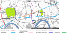
.jpg)
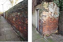
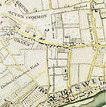
On the other side of the boundary was Paddenswick (also known as Pallenswick or Palingswick) House, which was bombed in the Second World War and no longer exists, although some of the grounds still exist today as Ravenscourt Park. Paddenswick House was once listed for sale including a moat filled by the springs of Acton. In 2014 the Friends of Ravenscourt Park and the Museum of London used a hand-drawn map from 1754 to locate the moat and in 2015 they dug three evaluation trenches and found “Brick structures that appeared to be a culvert and revetment that were probably related to the early 19th century infilling of the moat” [2] The first mention of Paddenswick was in 1373 and was listed as “manors of "Gonyldesbury" and "Palyngeswick," a tenement in "Braynford," and all other lands, tenements”[3]
In 1547 the properties were divided and in 1631 Paddenswick Manor was sold as 83 acres and included, “land in "Cheeswicke feild" 4¾ acres, " land in "Cheeswick feild that lieth by the way to the highway gate" 1 acre, and land in the Westcroft 5 acres”[4] In 1378 Gonyldesbury manor was held by the Bishop of London and included 228 acres of land,[5] the two manors can be seen on modern maps with Gunnersbury Park to the west and Ravenscourt Park (the grounds of Paddenswick House) to the east. As most of the land in between was also owned by the bishop of London, the logical place to fill the Paddenswick moat from would have been to repair the drainage built by the Romans along the old road all the way to the Bollo Brook. A ditch from there to the moat would also have served as a boundary and cut off all of the springs from Acton ensuring Chiswick and Sutton Court didn't become marsh land again.
Before the ditch was dug there would have been several rivers, streams, brooks, running north–south from Acton to the Thames. As most ancient roads exist because of geographical features, it is plausible that Chiswick Lane, the road to the East of Sulhamstead Estate, was originally alongside a brook/stream. As the topography of the land here is flat it would have been a marshy area with flowing water and nothing like the river it connected to, The Thames. Since at least the 16th Century there was a ferry at the end of Chiswick Lane by the Eyot, it was one of the only ways to cross the Thames at the time.[6] With other options to get from the High Road to the river just before and just after, this makes it even more plausible that when leaving London, the High road after Chiswick Lane was not easy to pass because of a brook/stream. The same section became difficult to pass for a very different reason many years later. A Turnpike was installed on the corner of Chiswick High Road and Chiswick Lane and people would use Chiswick Lane and the open roads of Chiswick rather than pay the toll to use the High Road.
To the west of Sulhamstead Estate is Devonshire Road, until 1885 It was called Chiswick Field Lane, it may have a modern name but the road predates Chiswick Lane. It was originally part of a route that connected The Vale in Acton to the Thames and ran alongside a brook / stream / river. A lot of the route can still be seen today in modern roads. The single storey shops on Turnham Green Terrace are on the site of an early drainage/reservoir system. It collected water during the winter to keep the High Road dry and in the summer the water was used to keep the dust on the road down.
Just to the north of that is the junction with Bath Road which is roughly where the Roman road was. When the Roman road fell into disrepair there would have still been a boundary ditch to divide the neighbouring properties. If the ditch was maintained to fill the moat of Paddenswick House, or fell into disrepair and reinstated later is lost in time, but this is the point where the brook/stream was cut off to the south by the Romans. North of that, the river was still shown on Edward Standford's map of 1884. That part of the river still exists today as part of the sewer system running down the middle of Woodstock Road, Woodstock road itself is orientated to follow the river and the path. At the top there is a footpath to cross what was once a railway.
To the south of Sulhamstead Estate is Manor Alley, the Alley can be seen on the Tithe map but it was only given its name in 1911. Some of the walls to the gardens of Wilton Avenue are part of the wall to Manor Farm, the Manor Farm House dates from 1698[7] and was built by Sir Stephen Fox. A large part of the wall was knocked down in 1878 when Dr Tuke expanded the asylum at the Manor Farm House further along Chiswick Lane, behind the houses he was renting.
To begin with Sulhamstead Estate and the land to the south would have been marshland until the brook/stream/river was cut off by the Romans. When the land dried out, its early uses, when it was cut in half by a footpath is unrecorded, but the Rocque map of 1746 shows the land already being divided into the roads that exist today. On the corner of Chiswick Lane was Gordon House. There were also 3 smaller gardens with houses on the High Road roughly where Annandale and Brackley Road are today, and gardens that covered the rest of the site.
Estate name
The name Sulhamstead is taken from one of the houses that was on the site, it had the name from 1858 until it was demolished in 1879 and was located between Devonshire Road and Annandale Road. Most of the first stage of building took place on the grounds of the house, along Devonshire Road and Swanscombe Road. The name is used in the Rate books and is shown on the 1889 and 1899 sewer maps,[8] but the name has disappeared from existence, probably because some of the roads were built on Prebendal land and some were built on private land meaning the roads were not laid out together and unlike neighbouring estates that still have their names, the buildings vary from street to street, and in places from house to house.
Modern roads
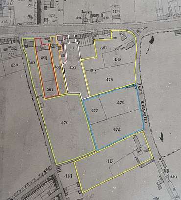
The shape of Annandale and Brackley Roads could be seen on Rocques map, the layout of the other roads can be seen in the 1847 Tithe map.[9] The estate had been split into 15 areas plus the shops on the High Road and was owned by 7 people. Plots number 475, 477 and 478 was part of the Prebendal Lands owned by Charles Welstead Esq and the meadows and garden were occupied by John Gardner. 479, 480 and 481 is where Gordon House and Grovesnor House are, these were owned by Thomas How, who also owned the neighbouring Manor Farm, plot 417. Mr How lived in Gordon House and rented the other two houses out. Five of these plots and the small square behind the shops are where Cranbrook Road and Brackley Terrace are today. Plot 480 and part of 479 became Tower House and created the corner in Cranbrook Road, Manor Farm is now Wilton Avenue. Plot 491 is Park House, it isn't given its own rentcharge in the listings, so must have been owned by one of the big landowners. On an 1814 plan showing designs for Chiswick House Gardens it is coloured green along with plot 476, suggesting they were part of Chiswick House Garden and Park.[10] 498 is the Packhorse and Talbot, at the time it still had gardens behind the pub, it was owned by John Houl and occupied by Philip Honess. 499 is Thorncroft House, it is listed as being owned by Inigo Jones and occupied by Mr Hoole. Annandale House and gardens, plots 500 and 501, were both owned by George Robins but occupied by two different people. A small pathway to plot 501 can be seen that is now Ingress Street. Sulhamstead House was plot 502 and its gardens plot 476 these were both owned by Everett Brand who lived in the house.
The roads were under construction in 1880 and it is mentioned in the CIC minutes that the “developers of the new Sulhamstead Estate were told to form a more costly 40 foot-wide road at its southern end.”[11] In October 1881 it was reported in The Building News[12] that the Chiswick Improvement Commissioners were in a despairing mood about the frequent infringements of the bye Laws by the builders in Chiswick. At a meeting of the board, the surveyor, Mr H. O. Smith said he was seeing the most flagrant cases of infringement. With the delays and difficulty in bringing cases before the magistrate, he had eight cases on hand, none of which had been adjudicated upon, and some of the buildings had been roofed in. Even if they were convicted the magistrates fine was optional and they generally inflicted a fine of half a crown. The builders laughed at the commissioners as they had gained about £100 by scamping on the work. By 1883 there were additional building bye Laws, “yet still ‘jerry-building’ practices continued, with old tins of fish and meat found substituted for hardcore in Sulhamstead Estate streets.”[11] The development of the roads was much slower than the neighbouring estates. In the 1896 Report of the Medical Office of Health for Chiswick, Sulhamstead Estate had an estimated population of 1435. Chiswick New Town had 2223 and the Glebe Estate had an estimated population of 2795.[13]
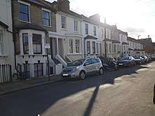


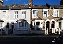
The gardens of Sulhamstead House, plot 476, eventually became Swanscombe Road, Coombe Road, Alkerden Road and some of Devonshire Road. These four roads were marked out and then sold as individual plots. Coombe Road was originally part of Swanscombe Road and the name first appears in the Rate books[14] in 1882 and there were 39 houses owned by 9 people. Swanscombe Road has been renumbered twice since it was built. Number 1 Swanscombe Road was the first to be built in 1881 and it was known as Cleveland house. The following year there were 2 sets of 1 to 7 in the rate book. The houses that are currently numbered 2 to 22 were originally numbered 1 to 11 and the houses that are now 10 to 22 Coombe Road were also 1 to 7 Swanscombe Road, the following year the houses in Coombe road were known as 1 to 7 Clarence Villas and the other houses that had been built on that side of Coombe road numbers 2 to 8, were 53 to 50 Swanscombe Road. The odd numbers in Coombe Road 1 to 21 were originally 54 to 64 Swanscombe Road and when they were built a few years later 23 to 27 Coombe Road were 36 to 38 Swanscombe Road. On the other side, the even numbers 26 to 30 Coombe Road had been given the numbers 41 to 39. 24 Coombe Road changed from year to year, sometimes it is listed as 8 Clarence Villas other years it is listed as 42 Swanscombe Road. The numbering may seem a bit chaotic, but the odd numbers of Swanscombe Road 3 to 15 were 12 to 18 and 17 to 47 were 20 to 35. Numbers 36 to 42 just continue the sequence around the corners. The road was renumbered in 1886, and again in 1912 when they renamed part of the road Coombe Road as the numbering was still confusing on that section. As well as renaming part of the road they adjusted the odd numbers in Swanscombe Road, as there was a gap of four numbers in the sequence that had been left so numbers 34 – 38 Brackley Road could have been built facing Swanscombe Road.
Number 1 Swanscombe road appears in the 1881 rate book and was owned and occupied by Mr Hall. Numbers 2 to 22 Swanscombe Road had been built by the time the rate book was completed in 1882 and Mr Roberts owned 2 to 10 and Mr Green owned 12 to 22. Numbers 3 to 15 were known as Glenfall Terrace and Miss Dollman owned these 7 houses, which were at the bottom of her garden in Thorncroft House. Miss Durran owned 17 to 21 and Mr Aldridge owned 23 to 27. Mr Green had purchased more houses at 29 to 35. Mr Snelling owned 10 to 22 Coombe Road, which were 1 to 7 Clarence Villas, the following year he sold all of them. Numbers 9 to 17 Coombe Road were owned by Mr Sharpe and Mr Wise owned number 19 and the house and shop next door at 21. In 1883 Mr Neighbour was listed as the owner of 2 to 8 Coombe road and Bryant & Stapelton owned 1 to 7 Coombe Road. Mr Whitaker owned 24 and 26, and Mr Wildman 28 and 30 Coombe Road. In 1884 numbers 37 to 47 Swanscombe Road were added to the Rate book and Mr Gregory, Mr Hayes and Mr Rogers owned 2 houses each. In 1885 the last three houses were added, 23 to 27 Coombe Road, these were owned by Pearce Bayliss who had already bought six other houses in the road. In 1887 there were only 3 owner occupiers all the other houses were rented out.
Alkerden Road appears in the Rate book[14] for the first time in 1882, there were 11 houses listed. Numbers 1 to 7 were owned by Miss King. Mr Ball owned numbers 15 to 21, all of these houses had been rented out. Mr Fleming owned numbers 6 to 14 but didn't have any occupiers, the following year he sold them to Mr Pitt. Mrs Brain was the owner of numbers 16- 18 and 9-13, as well as the five houses in Alkerden Road Mrs Brain also bought 6 houses in Annandale Road the following year. Mr Chalker owned 2-4 and the Goldhawk Building Society owned number 22, also known as Beaumont House. Mr Carter at number 20 was the only person to live in the road and own the house. There is a hamlet called Alkerden in the parish of Swanscombe that is now part of the Ebbsfleet Garden City project in Kent.
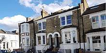
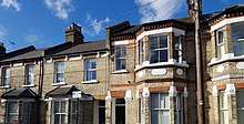
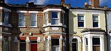
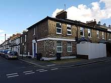
The houses on Devonshire Road are on three different estates, the odd numbered houses are on the Glebe estate and were originally called Chester Terrace. Numbers 130 to 196 were built facing Chiswick New Town and back onto the ABC estate, they were originally known as Mona Terrace. The other even numbered houses are on the Sulhamstead Estate, when they were built the houses were called Sulhamstead Terrace, number 1 was next to Manor alley and 21-26 were between Swanscombe Road and Ingress Street.[14] The road was renamed in 1885 and they were given the even numbers of Devonshire Road. In 1881 Mr Plumridge owned and lived in the house on the corner of Ingress Street, Mr Roberts owned the next three and was renting them all out, Mr Cooper and Mr Lockie both owned and lived in the next two houses. The island between Ingress Street and Swanscombe Road was previously part of a house and garden owned by Mr Thomas that survived until 1880, a year longer than Sulhamstead House. The house can be seen on the Tithe map as a small square in the North West corner of plot 476. Mr Roberts must have bought the house and garden and swopped some of the land, as on the other side of the road he built a shop on the corner, next to the other five houses he owned in Swanscombe Road. A few years later he sold the shop to Mr Mayhew who opened it as a Beer House. The next three houses on Devonshire Road were owned by Mr Cowan and the next four by Miss King who also owned the four houses next to these on Alkerden road, they were all rented out. In 1882 Sulhamstead Terrace was completed and Mr Chalker owned numbers 76 to 82. Mr Hunt owned numbers 84 to 90 and Mr Neighbour owned the shop on the corner, number 92 and as well as the neighbouring four houses in Coombe Road, he also owned the last three houses up to Manor alley. All of the houses in Devonshire Road had been rented out to different people when the Rate book was completed.
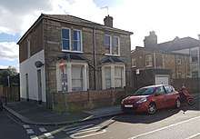
The houses in Annandale Road first appear in the Rate books in 1882 and in a letter to the Council in October 1882, Mr Herrington, one of the occupiers, “requested the Commission to take and make up the road”. The Clark was told to inform the residents that “the road would be made up in due course or that if the owners deposited ¾ of the expenses the Commissioners would take the necessary proceedings at once” [15] The original numbering gives away which order the houses were built and sold. The odd numbers from 1 to 11 were 1 to 6, the even numbers from 2 to 28 were 8 to 21 the odd numbers from 13 to 41 were 28 to 42 and the even numbers from 30 to 46 were 43 to 51. Mr Roberts owned the houses on Devonshire Road next to number 43 and number 43 was originally called Sulhamstead Villa and not listed as part of Annandale Road. In 1882 only six of the houses were occupied. Mr Blackburn owned 1 to 11 but had only rented one of them. Mr Jordan was renting number 32 from Mr Brockwell and a few years later bought the house. Mr Clark was living at number 39 and also owned the house and shop next door at number 41. Jones & Wimpey owned and rented out number 32, a few years later are they also listed as owning number 30. Over the next few years the occupiers changed frequently and so did the owners, by 1887 when the numbering was changed some of the houses had been owned by 3 different people. In 1887 there were only 4 owner occupiers, the other 40 houses were owned by 11 people.
When Thorncroft House was demolished they used the grounds and also knocked down 18 of the houses to build the flats in Annandale Road. The church in Annandale Road was built in 1897 it is on the site of another church that was built there in 1879. Annandale Road gets its name from the house that was there before.
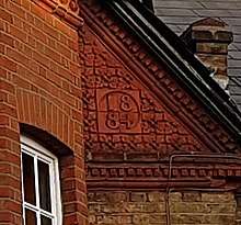
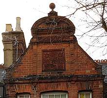

Brackley Road was built by different builders in various stages on the grounds of Park House, plot 491. The first house built in the road no longer exists, it was in the south west corner of Park House gardens roughly where numbers 34 to 38 are today. It was called Little Park House and the architect Mr C.M. Stedman designed it for Mr R Lathbury esq. It was built in 1881 by Messrs Adamson of Turnham Green.[16] As well as owning Park House and Little Park House, Mr Lathbury also owned the shops on the High Road between Park House and the Packhorse and Talbot. He bought these three shops in 1879 and knocked them down in 1883 so the road could be built. The first houses to be built were 33 to 47 in 1884–5, they first appear in the rate book in 1886 and Mr Lathbury still owned all of them. 12 -16 also appear, but 2 of the houses were owned by Mr Cooper. The following year Mr Cooper also owned number 18 and Mr Lathbury had demolished Little Park House and built and rented out all of the houses from 20 to 38. Miss Dollman who owned and lived in the neighbouring Thorncroft House, owned numbers 2 to 10, they were part of the gardens to the Packhorse and Talbot Pub before the houses were built. In 1900 the council began charging Watney's for stables behind the pub, the same year the council had added appurtenances to the description of property for the pub. As well as adding £25 for the stables, the rateable value for the pub went from £119 to £371. The stables were demolished and a warehouse built on the site which is still there today.
In 1904 and 1905 numbers 1-31 were added to the rate books, they had been bought by Mr Ramsden when Park House was demolished by Met Securites Ltd (Wilder & Wilder). In 1904 the council worked out the rateable value of the hoarding was £64 and the workshop and yard they were using was £43. The house they were knocking down only had rateable value of £110 and eight of the sixteen houses had already been built and rented out on the garden with a rateable value of £27 each.
The garden walls of Brackley Terrace and the Charles and Diana wall can be seen on the Tithe map as the boundary of plot 476. The houses were built on part of plots 475 and 477 on land acquired from Mr Hardy and Dr Tuke that was previously part of the Prebendal manor. As plot 476 was private land the line that is now the garden walls has probably been a boundary for over 900 years. The road first appears in the rate books in 1885 and was named and built by Mr Robert Lathbury. He owned all 21 houses and had rented them all out. Mr Lathbury named the roads Brackley after the town in Northamptonshire, where he grew up, his sister was born and his father died.
The houses on Chiswick Lane were original named and each has its own history. No. 2 Grovesnor House is the current home of the Comboni Missionary Sisters. They were also the owners of the house next door, No. 4 Tower House, which was built by John Donaldson in 1875. The Sisters of Pepetual Adoration were tenants of both houses from 1901 until 1951, when the Comboni Missionary Sisters of Verona moved in.[17] The grounds of Tower House were originally much bigger but in 1900 part of it was sold off to build Cranbrook Road. The rest of the grounds and Tower House were sold off in 1996 and Verona Court was built. Verona Court is a small estate of 13 houses and flats developed by Wates Homes Limited in 2001. Tower House was kept and converted into flats and they also kept a building in the gardens that was “mysteriously designed as a boathouse, because of its location it was never used for this purpose but was used as a summerhouse/shed for the convent. By virtue of being within the former curtilage of the listed building at Nos 2-4 Chiswick Lane, it qualifies as a Grade II listed building.”[18] There were 8 other houses along Chiswick lane, the first of them appear in the rate book in 1877. Cleveland House (6), Penwith House (8), Frankley House (10) and The Laurels 1 and 2 (18-20), along with Tower House (4) are grouped with the houses on Chiswick Mall and Old Chiswick. Number 2 Chiswick Lane, Grovesnor House is grouped in a different part of the rate book with the houses and shops on the High Road. The following year the other 3 houses, Rookwood, Glendover and Lynton House (12 to 16) were added to the rate book, they were all owned by Mr Benjamin Hardy. Lynton House was renamed Gordon House in 1893 when Mr Hardy moved in and demolished the other Gordon House on the High Road. The Laurels were 2 semi-detached houses and were rented by Dr Tuke as soon as they were built, he also owned the neighbouring Manor Farm House which was used as an asylum. The year after renting the 2 houses he knocked down part of the garden wall to Manor Farm House and extended the gardens behind The Laurels. In 1893 Dr Tuke began moving to Chiswick House, the first bit of land he moved out of became the ABC Estate. In 1894 he moved out of The Laurels and by 1896 he had sold Manor Farm House. The house was knocked down and the first houses in Wilton Avenue appear in the 1897 rate book in its place. The Laurels 2 became Edithene in 1898 when Miss Edith Mary Mason moved in, the following year the rateable value almost halved when Mr Hardy reduced the gardens along with the next three houses to create space for the last section of Cranbrook Road behind The Laurels. Many years later The Laurels 1 and 2 were demolished and Stephen Fox House was built on the corner of Cranbrook Road. The block of flats is named after Sir Stephen Fox who built the neighbouring Manor Farm House and was also Lord of Chiswick's Prebendal Manor.
Cranbrook Road was never built as one road, but is eight different sections joined together, it could have had a very different layout. The road was started ten years after some of the other roads on the estate had been completed. It filled all the gaps that had been left behind and was a cul-de-sac with only half the houses that it has today for the first ten years. The last few houses in Cranbrook Road were built thirty years after the first few houses were built, which explains some of the odd corners and turns in the road. In 1893 when Gordon House was demolished Mr Charles Gurr acquired the piece of land behind the shops and began building. By 1894 he had completed the first nineteen houses and most of the pairs of houses are slightly different. He also built the corner house number 30 for himself and called it Hawkhurst. It is almost twice the size of other houses in the road, has a garden three times the size and its own garage, the only one in the road until number 1b was built in 1902 by Tyser & Co. Mr Gurr used number 30 as his office and home until 1902 when he moved to the corner at the other end of the road, number 120 and 120a. In 1895 Mr Gurr had an advertising hoarding on the corner of the High Road and Cranbrook Road it had a rateable value of £28. The houses in the road only had a rateable value of £22! The advertising must have worked as the houses up to numbers 62 -27 that were under construction that year had all been sold the following year. Mr Jewitt had bought nine houses, Mr Fluck bought eight, Mr Prior and Mrs Jane Turnham had both bought three each. There were ten owner occupiers in the road and Mr Gurr still owned six other houses in the road and rented five of them. The next stage of building didn't start until 1900, in 1901 the houses up to 74 and 55 had been completed, Mr Gurr was told by the council to stop work on the houses and to continue discussions and resolve all issues with the owners of Brackey Terrace. If it wasn't for the disagreement between Mr Gurr and the owners of Brackley Terrace, it may have connected to Chiswick Lane and the houses in Cranbrook Road turned round to face Brackley Terrace. The discussions about which way the roads should go cannot of lasted long as by 1902 the houses up to numbers 102 – 67 had been completed, apart from four houses sold to Mr Alfred Buxton the rest were owner occupied.
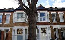
Mr Gurr had also managed to acquire the last bit of land that was the grounds of the Asylum and the gardens of Edithine that had been taken so the road could connect to Chiswick Lane. In 1903 all the houses in the corner and the houses up to 140 – 77 were added to the rate book. In 1904 the last few houses and shop were built along Manor alley, numbers 142 and 144. Mr Gurr remained the owner of 104 to 144 and 71 to 77 and rented them out. On the opposite side it wasn't until 1923 that the last few houses were built, numbers 79 and 81, and the Cranbrook Garage at number 83 was opened in 1928. For many years the Cranbrook Garage has been owned by Fullers Brewery and was used for maintaining their vehicles. When parking controls were introduced to the area, the maintenance was moved and it became a car park for staff. More recently it has become the home of Sipsmith Brewery, distilling Gin almost under the nose of William Hogarth's statue on the High Road next to Annandale Road. When Mr Gurr moved to number 120 he used the large yard next door in the corner of the road for his building company. In 1910 he opened the Cranbrook Motor co. on the site and Chiswick Motor Tyre Accessories on the High Road. The shop on the High Road at number 101 closed after a few years and the site on Cranbrook Road became Arnold Beseke Motor cars for Hire, before Bell Thomas Townshend & Co Motor Coach builders moved into 120a in 1919. Bell Thomas Townshend & Co became S.E. Thomas & Co and they remained there until 19? when it became the Hogarth Garage. The garage was demolished in 2009 and 4 houses were built on the site facing Brackley Terrace that were designed by JPB Architects.[19]
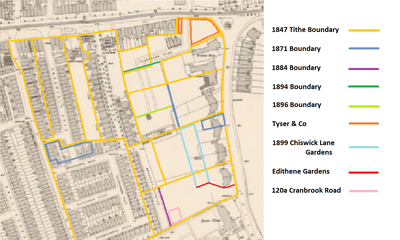
The different sections of Cranbrook Road can be seen on the 1897 Ordnance Survey map. Some of the 1847 boundaries still exist, but with the houses being built on Chiswick Lane a few more boundaries were added. By 1871 only 3 more boundaries had been added to the whole estate. In 1875 the houses on Chiswick Lane were built, Dr Tuke was occupying the land behind the Laurels, north of that were two plots. In 1882 one became part of the gardens to Tower House, the other one became Brackley Terrace in 1884 along with part of Dr Tuke's garden creating another boundary. When Gordon House was demolished the land behind the shops on the High Road was built up by 1894, the other plot where Gordon House was on the High Road, was bought by Tyser & Co. In 1896 the road ended halfway across a plot that had been split in 1871. The rates and the gardens were reduced for the Chiswick Lane houses in 1899, but the land wasn't built on until 1928. Also in 1899 Edithene lost almost all their garden so that Cranbrook road was no longer a cul de sac. 120a was Mr Gurr's yard that became the Hogarth garage and is now four houses in Brackley Terrace.
The local story is that the road was named after the Brook Cran that ran under the road before it was built, but as the evidence suggest if there ever was a brook here, it would have dried out over 1500 years ago, that seems unlikely. In the Census in 1861 Mr Charles Gurr listed aged 16 is listed as an agricultural Labourer living in Cranbrook Kent. He also named the house in the corner number 30, Hawkhurst, which is a neighbouring town to Cranbrook where his first child was born. So the road is named after a town in Kent and has nothing to do with waterways in the area.
Housing and values
The original housing is generally one of seven designs. The houses on Chiswick Lane are large semidetached houses, with large gardens. Most of Alkerden, Swansombe and Cranbrook roads are 2 up 2 down with a rear projection making a third room up and downstairs, the houses in Alkerden and Swancombe have bay windows downstairs, the houses in Cranbrook and a few in Alkerden have bay windows upstairs as well. The even numbered houses on Devonshire Road are the same as those they are next to on the Sulhamstead Estate, but are different architecture to the houses opposite. There are 3 styles of houses on the South of Coombe Road. There are some that are the same as the houses on Devonshire Road, plus others that have subbasement and some of those are double fronted. The houses that have subbasements and those on the South East of Swanscombe Road that also have them were built to make the most of the ditch that was there before the houses were built. The ditch is shown on some maps as a water feature before the houses were built, before that it would have been an open sewer connecting the four large houses on the estate to the sewer on Devonshire Road and out into the Thames. Annandale Road has a large block of flats and houses that are all 3 stories, and the houses in Brackley Terrace are much smaller 2 up 2 downs. In Brackley Road there are 5 different designs of houses, none of which match the surrounding roads. By 1975 houses in Cranbrook Road were worth £28,000. Just before the turn of the century in 1999, houses were selling for £300,000. It was 2011 when the first house was sold for a £1,000,000. Today in 2020 houses prices[20] vary from £4,500,000 for a semidetached house on Chiswick Lane to £1,000,000 for a house in Brackley Terrace. The 2 up 2 down with rear projections sell for between £1.1m and £1.6m depending on how many extensions they have added and houses with the subbasement sell for £? Most of the three storied houses on Annandale Road have been converted into flats, the last house sold on the road was in 2016 and sold for £1.3.
Notable residents
Mr Thomas Bentley lived in a house on the site of Sulhamstead House from 1777 to 1780, his niece Ann Radcliffe would visit and it was here she was introduced to a circle interested in literature and art. Ann Radcliffe became a pioneer of Gothic Fiction and her recollections and memories of her uncle and her visits to the house became part of her book, The Mysteries of Udolpho. Jane Austen parodied the book in Northanger Abbey.[21]
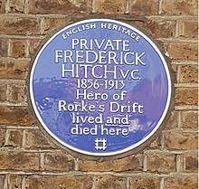
The Estate has a blue plaque in Cranbrook Road to commemorate Private Frederick Hitch V.C. Hero of Rorke's Drift who lived and died there. There is a 1964 film called Zulu and David Kernan plays the part of Pvt. Hitch.[22]
Houses on the High Road
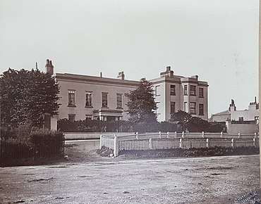
On the corner of Chiswick Lane was Gordon House it was built in ?, in the 1860s Benjamin Hardy purchased the estate. The land he eventually purchased extended all the way along Chiswick Lane to Manor Alley, and along the High Road, the shops from 83 to 109 are where the house and grounds once were. Benjamin Hardy lived in Gordon house and divided the estate and built on it from the early 1870s, before finally moving into the new Gordon House that he had built further down Chiswick Lane and demolishing the house in 1893. Benjamin Hardy had a much bigger impact on Chiswick as he was also a local politician. In 1870 he was elected and became one of the Chiswick Improvement Commissioners and eventually became the Chairman. He also served as chairman for the Chiswick Urban District Council, as well as being a founder member of the Chiswick School Board.[23]
There was a house which is where numbers 111 to 133 are now. The house was demolished in about ?. After the house was demolished there were some smaller houses in this location, Stanley House and Devonshire Cottage both still exist today.
One of the other five large houses on the High Road was Park House, it was owned by Mr Robert Lathbury and the gardens extended to Swanscombe Road. He began building on the gardens in 1881 and by 1885 most of the garden had become Brackley Road. Mr Lathbury was born in 1816 and in 1839 took out insurance with his father to open a pub in Fitzrovia.[24] In 1848 he opened another pub on the Brompton Road, The Crown and Sceptre. In the 1851 Census he is living in the pub with his wife, sister, niece and five servants, his aunt was running the pub in Fitrovia with two live-in Barmen and a domestic servant. In 1860 he employed an architect and builder to rebuild another pub, The Red Lion, the building survives today as number 161 Brompton Road. He also leased the next eight shops along Brompton Road that had just been built in 1861.[25] The following year he and his mother are listed as outgoing licensees for the other two pubs and he moved into the Red Lion. He only ran the pub until 1866 and soon after moved to Park House, Chiswick. He continued to live in Park House until he died in 1901, the following year his son William moved to 30 Brackley Road. The house was sold and it was demolished to build numbers 1 to 31 Brackley Road and the Belgrave Garage was opened on the corner of the High Road and Brackley Road.
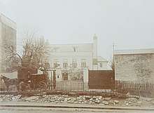
The Dollman family lived in Thorncroft House for many years. Miss Dollman bought some of the houses that had been constructed around the garden, but moved out in 1887 a year after the houses surrounding her garden were completed. Thorncroft House was then owned by Dollman and Others, Mr Ernest Fox occupied the house from 1888 to 1892. Dr Wallis Maurice Edmund Arnold M.R.C.S. occupied it for three years, Dr Arthur Hamilton Walker M.B C.M Physician & Surgeon was there for five years. Then in 1901 Dr Gilbert French M.R.C.S, L.R.C.P. Physician & Surgeon moved in, he occupied Thorncroft House for over 50 years. The house was demolished in 196?
Annandale House was demolished in 1880 it was the home of the Marquees of Annandale. Sulhamstead House was on the corner of Devonshire Road and the High Road, it's the house that gave its name to the estate and was demolished in 1879.
Shops on the High Road
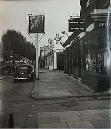
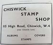
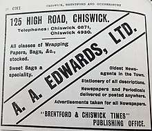
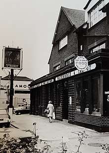
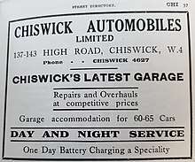
Numbers 83 to 95 were built in 1897 and the shops were originally called Gordon House Parade and numbered 1–9. The buildings were owned by Mr Smallman from Tyser & co, who also owned numbers 1a and 1b in Cranbrook Road just behind the shops. In 1901 they were given the numbers 125 to 141 before the High Road was renumbered again in 1906. Number 97 was built in 1902 and was also owned by Mr Smallman from Tyser & co, the rest of the shops from 99 to 109 were also designed by ?. These were built slightly later in 1903 by Mr M N Rhodes, after he had demolished four cottages and a shed that he had bought in 1898 that were on the site along the High Road. 111 & 113 were built in ? 115 is a small shop squeezed between two buildings, it has its own number as it was a small yard extending behind three of the shops when the High Road was numbered, the building was built in ? 117 and 119 is currently one shop and was originally called Stanley House before it was turned into shops. The building was Miss Bond's Ladies School until 1890. Mr Grey owned Stanley House and the plot next door, numbers 121 and 123. By 1898 it had been split into 4 shops and they were numbered 157, 157, 157a and 157b before the High Road was renumbered in 1906. 131 and 133 is now one shop the building was once called Devonshire Cottage The site of 135 was owned by Mr Lathbury, although when he owned it, it was a cottage and a cottage with a shop. When Park House was demolished the shop and cottage were as well. In 1908 the building that is there today was built. 137 to 143 were built as the Metro Bank in 2012. Before the bank was built it was a petrol station that first opened as a garage in 1906. Although it has four numbers it has always been one site, as it is where Park House stood until 1904. 145 is the Packhorse and Talbot, a pub was first recorded on the site in 1696, the current pub was rebuilt in 1935[26] and kept the façade of the previous building. The façade was extended to the side in 1883 when the neighbouring properties were knocked down so Brackley Road could be built. 147 the site of Thorncroft House until 1962 153 the building on the corner has been a Bank since it was built, London & South Western Bank Limited leased the building from 1881 to 1918 when the company was acquired by Barclays Bank. The branch was originally known as the Turnham Green branch until 1887 when it became the Chiswick branch. In 1901 an agreement was reached with Mrs Soper to purchase her lease for number 151 and in 1903 Messrs Adamson and Sons were awarded the contract at a cost of £2981 to extend into next door. It wasn't until 1955 that they extended into the third shop.[27] 155 to 165 were built in 1880, 161 to 165 were rebuilt in 2001 to match the original buildings. They were renumbered in 1904 and again in 1906, before that they were numbered Bank Buildings 1–6. The Bank on the other side of Annandale Road was number 7 Bank Buildings and wasn't renumbered until 1906.[28]
Table of High Road shops
Some of the shops have been renumbered in 1901, 1904 and all of them in 1906 the original numbers are in brackets.[29]
| 1887 | 1887 | 1906 | 1906 | 1925 | 1925 | 1940 | 1940 | 1975 | 1975 | 2020 | 2020 | |
|---|---|---|---|---|---|---|---|---|---|---|---|---|
| 79 (1) (125) | Benjamin Hardy | Gordon House | Schonewald Carl | Piano-forte tuner | Wade Alfred | Tailor | Wade Alfred | Tailor | Marshall A.S. | Commrcl photographer | Brewers | Decorator Centre |
| 81 (2) (127) | Buyer Jsph / Noakes Miss | Hairdresser | Gordon Geo | Tbocnst | David Caine | Hairdresser | Johnson Egbert | Ladies Hairdresser | BloBar | Ladies Hairdresser | ||
| 83 (3) (129) | Kensington Palace Laundry | London United Laundries Limited | (receiving Office) | London United Laundries Limited | (receiving Office) | Buy Right | Outsider Tart | Café | ||||
| 85 (4) (131) | Rawlings Bros. Ltd | Electrical Engineers | Wheatland H.C. & Co / Surrey Dye Works | Wheatland H.C. & Co | Wheatland H.C. & Co | Outsider Tart | Café | |||||
| 87 (5) (133) | Lashmar Fred | Printer | Vernon Smith & Sons Ltd | China & c | Burley & Burley | Watch Makers | Wheatland H.C. & Co | Parent Hood | Coffee Shop | |||
| 89 (6) (135) | Rollings John | Fruitr. | Vernon Smith & Sons Ltd | furniture, pianos &c | Jones Sewing Machine Co. Ltd | Wheatland H.C. & Co | Parent Hood | Coffee Shop | ||||
| 91 (7) (137) | Clark Joseph William | Confectioner | Clark Percy Jsph | Conf | Mrs Maud Youngs | Confctnr | Studio Carpet Services | Thai Retreat | Hair & Massage | |||
| 93 (8) (139) | Gramophonia | (R.R. Cole) | Chiswick Electricity Supply Corporation | Fleming & Smith Ltd | Dog Town | Dog Care | ||||||
| 95 (9) (141) | Bellomo J | Restaurant | Perillo Jn | Restaurant | P Fornara | Restaurant | Chiswick Grill | Domino's Pizza | ||||
| 97 (143) | Albert Doddington | Coffee House | Mayhew G & Son | Dining Rooms | Spring Grove Laundry Ltd | Direct Services | Secondhand furniture Dealers | Parle Pantry | Café | |||
| 99 (145) | Issac Chandler | Coffee House | Singer's Sewing Machine Co. | Jn. Jacobs | Fish Restaurant | Waltons Fish Bar | Fish Bar | Fried Fish Shop | Tor Thai Bistro | Restaurant | ||
| 101 (147) | Mrs Loise | French shirt & collar Dresser | Chapman H & co | Furniture Dealer | West London Sale & Exchange | Thos White | Boot Repairer | Annapurna | Restaurant | Annapurna | Restaurant | |
| 103 (149) | John Arthur Mettam | Artificial Teeth Manfr. | Vernon Smith & Sons Ltd | Machinery & C | Cocoon | Hairdressers | ||||||
| 105 (151) | Wladislaw & Rowinski Stanislaw | Music warehouse | Kentucky Tobacco Co. | Wash Inn | Launderette | Dejoli | Clothing | |||||
| 107 | J&E Skinner | Dressmaker | Mrs Buchanan / Madame Delysian | Dress Maker / Costumier | Delta Cleaners | 4 Star Dry Cleaners | ||||||
| 109 | M.N. Rhodes | Builder | Homolka Jn / Ideal Studios | Upholstr / Photographers | Daniel Toper | Upholtstr | Curry & Paxton Ltd | Opticians | Chinese Medicine Clinic | |||
| 111 (153) | Fredk Bridges | Greengrocer | Lewis & Co | Tailors | Redfearn William | House & Estate Agent | Redfearn & Gimson | House & Estate Agent | Polakoff | Dental Surgeon | Smilecare | Dental Clinic |
| 113 | Savile Frdk. Leonard | Furniture Dealer | Arundel Signs | Signwritters | Berger M.R.C.V.S | Veterinary Surgn | Village Vet | Veterinary Surgn | ||||
| 115 (155) | H.J. Owers | Bicycle Manufacturer | Savile Frdk. Leonard | Furniture Dealer | Chiswick Stamp Shop | Goodview Restaurant | ||||||
| 117 (157) | Miss Bond Ladies School | Stanley House | W. Lovett | Builder | Smith Vernon & Sons | Transport Agency | Misses I&A Gilbert | Confctr | Massey | radio & TV dealers | Watches.co.uk | |
| 119 (157) | Alfd A Edwards | Confr | Connor Jn | Bootmaker | Massey | radio & TV dealers | Watches.co.uk | |||||
| 121 (157a) | Mrs Mary Jane Gilbert | Tobacconist | Richd. Dew | Auctioneer, estate agent | Smith Vernon & Sons | Musical Instruments | Crompton S&J Ltd | General Dealers | Massey | radio & TV dealers | Southbeach | Spa and Beauty Salon |
| 123 (157b) | Jas Crawley | Gasfitter | Clarke Thomas | Dining Rooms | Smith Vernon & Sons | Motor Cycles | Massey | radio & TV dealers | Southbeach | Spa and Beauty Salon | ||
| 125 (159) | Mrs Brain | Umbrella Manufactory | Richards & Co | Dressmaker | Alfd A Edwards, Stationer | Chiswick Chamber Of Commerce, E.R Robbinson | Alfd A Edwards, Stationer | Brentford Chiswick Times | Edwards | Stationer | To Let | |
| 127 161) | Mrs Hartley | Joseph Eden | Grocer | Bond Wm. Stephen | Undertaker | Bond Wm. Stephen | Undertaker | Bond Wm. Stephen | Undertaker | Bond Wm. Stephen | Undertaker | |
| 129 (163) | F.D. Smither | Music Seller | Hy Fowler | Decorator | Crompton Bros | Sewing Machine Repairs | Shepherds's Bush Radio Stores Ltd | Fays Metals Ltd | Aluminium Stockists | Iris | Clothing | |
| 131 (165) | Henry K Cox | Devonshire Cottage | William Frdk Blades | Tailors | Rogers Alfd | Estate Agent | Horseshoe Restaurant | Gourmet Burger Kitchen | ||||
| 133 (167) | Harry Taylor | Bootmaker | Sparks R.H | Bootmaker | Adams | Delicatessen | Gourmet Burger Kitchen | |||||
| 135 (169) | Mrs Westwood | Dress & Mantle maker | Leslie Stepen | Teacher of Music | Alfred C Bolton | Antique & Furniture Dealer | Christian Science Reading Room | Insider Dealings | Interior Decorator | |||
| 137 (171) | Rt Lathbury | Park House | Davey Herbert | Belgrave Garage | Elsee Herbert | Motor Garage | Shrimptons Garage | Motor Car agts & dlrs | Metro Bank | |||
| 139 - 143 (173) | Alfrd. Bradbury | House Decorator | Davey Herbert | Belgrave Garage | Elsee Herbert | Motor Garage | Shrimptons Garage | Motor Car agts & dlrs | Metro Bank | |||
| 145 | George David Jones | Pack Horse & Talbot | James Harry Squires, Jun | Pack Horse & Talbot | R Harrison | Pack Horse & Talbot | C J Brooke | Pack Horse & Talbot | Pack Horse & Talbot | Pack Horse & Talbot | ||
| 147 | Miss Dollman | Thorncroft | Dr Gilbert French M.R.C.S, L.R.C.P. | Physician & Surgeon (Thorncroft) | French Gilbert. M.R.C.S, L,R,C,P. | Physician & Surgeon (Thorncroft) | French Gilbert. M.R.C.S, L,R,C,P. | Physician & Surgeon (Thorncroft) | Sound of Music | Organ Dealers | Sofa Workshop | |
| 149 (9) | Humphrys Charles / Hewett Edward | Picture Frame Maker | Phillips Solomon | Furniture Dealer | H Salem | Furniture Dealer | Barclays Bank Ltd | Barclays Bank Ltd | ||||
| 151 (8) | Soper Wm | Furniture dealer | London & South Western Bank Limited | Barclays Bank Ltd | Barclays Bank Ltd | Barclays Bank Ltd | Barclays Bank Ltd | |||||
| 153 (7) | London & South Western Bank Limited | London & South Western Bank Limited | Barclays Bank Ltd | Barclays Bank Ltd | Barclays Bank Ltd | Barclays Bank Ltd | ||||||
| 155 (6) (183) | Bourke Edmond McW | Daniel a.E | Baby carriage maker | Pallant J&J. F | Chiswick Furniture Galleries Ltd | Sturgis & Sons | Estate agents | Chestertons | Estate agents | |||
| 157 (5) (185) | Richmond & co | Tailors | Collett Charles | Coffee & Dining rooms | Wilkerson Mrs Lillian | Dining Rooms | E Simmons | Dining Rooms | Sunray Dining Room | Stone & Wood Gallery | ||
| 159 (4) (187) | Victoria Wine Co | Victoria Wine Co | Victoria Wine Co | Victoria Wine Co | Autocoin self service laundry | Oddono's | Fresh Gelato | |||||
| 161 (3) (189) | The City Furnishing Co | Soper Wm | Furn. Dealr | Hansing & Williams | Greengrocers | Bowles Jas & Sons | Greengrocers | Turner & Siddall Ltd | Dry Cleaners | Craig & Rose | ||
| 163 (2) (191) | Wittenberg Edward | Bootmaker | Wittenberg Edward | Bootmaker | Carter Arthur Albert | Furniture Dealer | Herbt Binyon | Buctchers | Dervigh Steak & Kebab House | Kinleigh Folkard & Hayward | Estate agents | |
| 165 (1) (193) | Ayres W | Pawnbroker | Thomson William | Pawnbroker | Hassell Robert | Pawnbrokers | Hassell Robert | Pawnbrokers | Carpet Fair | Carpet Dealers | Kinleigh Folkard & Hayward | Estate agents |
Devonshire Road shops
The even numbered shops were built in 1881 and were known as Market Place, the first listed owner of the shops was Mr Stapleton. The following year all 23 had been built and there were only 5 vacant shops. Having completed the parade of shops and leased most of them out, Mr Stapleton sold all of them to Mr Lofts. By 1888 Mr Lofts began selling them to the occupiers, the first to buy them were Mr James Baker and Mr Joseph Skelton at numbers 28 and 30. They ran a bakers and a grocers. Henry Baker continued running the bakers until the 1930s. Although part of Chiswick Field Lane the parade of shops was listed as 1 to 23 Market Place until the road was renamed in 1885, when they were given the even numbers they have today. no.2a and 2b were rebuilt in 2001.[14] Two of the longest trading shops still run by the same family are on Devonshire Road. Top Hat Cleaners first opened in 1968 on the High Road, before moving to Devonshire Road. Teleonics Radio & TV Dealers opened at 30 Devonshire Road in 1965, the shop is still run by the same family but is now the Chiswick Lighting Company.
Table of Devonshire Road shops
Source: Kelly Directories (1887 - 1975 ed.)[29]
| 1887 | 1887 | 1925 | 1925 | 1940 | 1940 | 1975 | 1975 | 2020 | 2020 | |
|---|---|---|---|---|---|---|---|---|---|---|
| 2b | To Let | |||||||||
| 2a | Tribe Contemporary Rugs | |||||||||
| 2 | Eded Gisby | Ironmgr | Percy Bowcott | Confr | Mrs S Wand | Confr | W4 Bathrooms | |||
| 4 | Ebenezer Bates | Butcher | Robert Halston | Marine Store Dealer | Stoute A Da Costa | Surgery | Uttam Gill M.R.C.S L.R.C.P | Physcn & Surgn | Rokkon Japanese Restaurant | |
| 6 | Mrs Emma Piggott | Fancy Draper | Mrs Emma Piggott | Fancy Draper | Comprehensive Household Services Ltd | Big Jims Trimms | ||||
| 8 | James David Burn | Hairdresser | Wm V Burn | Hairdresser | Johns | Hairdressers | Duci | Gelato & More | ||
| 10 | Wm Peters | Butcher | Ernest Halse | Bootmaker | Ernest Halse | Bootmaker | Auto Tools | Motor car accessories | Stitching Room | Alterations & Tailorings |
| 12 | Walt Clark | Greengrocer | John Gray | Fruiterer | Frank Edward Holloway | Fruiterer | ||||
| 14 | Dedman & Co | Grocers | Mrs Nellie Summers | Dairy | Hy L Gibson | Confr | Wild Swans | Clothing | ||
| 16 | Mrs R Ginger | Corn merchant | Percy Wm Ginger | Corn merchant | MEM | Hair & Beauty | ||||
| 18 | William Goddard | Fried Fish Shop | William Goddard | Fried Fish Shop | Gordons | Fried Fish Shop | Vinoteca | Wine & Food | ||
| 20 | Dadds William Henry & Sons Limited | Bootmaker | Dadds William Henry & Sons Limited | Bootmaker | Beacon Cleaners | Top Hat | Dry Cleaners | |||
| 22 | Dadds William Henry & Sons Limited | Bootmaker | Dadds William Henry & Sons Limited | Bootmaker | Burlington Car Hire | Taxi Office | ||||
| 24 | Wm Gossage | Butcher | Geo Byford | Butchers | L A Hacon | Butchers | Hollyoak | Butcher | ||
| 26 | Mrs E.L. Bailey | Wardrobe Dealer | Mrs J Beenham | Tobacconist | Beenham J & Sons Ltd | Tobacconist | Beenham J & Sons Ltd | Tobccnsts | Chiswick Acupunture Clinic | |
| 28 | James Baker | Baker | Henry Herbet Baker | Baker | Fredk Landgrebe | Baker | Kaggees | Miscellaneous Dlrs | Beehive | Restaurant |
| 30 | Joseph Skelton | Grocer | Jules P Sadler | Grocer | Keens Stores | Grocer | Ledbury K.P. & Co Ltd | Radio & TV Dealers | Chiswick Lighting Company | |
| 32 | Wm Jas Cato | Oilman | Robertson & Sons | Oilman | Fredk Parsons | Oilman | Chiswick Pets | |||
| 34 | James Robertson | Wine, ale and bottled beer stores | Robertson & Sons | Wine & Beer Stores | Robertson & Sons | Wine & Beer Stores | Fuller Smith & Turner | Wine & Spirit retailer | Chiswick Pets | |
| 36 | Robertson & Sons | China Dealers | Aida | Ladies Hairdresser | Yvonne | Ladies Hairdresser | London Laser Clinic | |||
| 38 | William Sculthorpe | Cycle dealer | William Sculthorpe | Cycle dealer | Mrs Rose Huxley | Greengrocers | Casa Dino | Restaurant | ||
| 40 | Mrs E A Hayward | Confectioner | Mrs E A Hayward | Confectioner | T Turner | Draper | ||||
| 42 | Mrs Bone | Bootmaker | Mrs Bone | To Let | ||||||
| 44 | Jubb's | Pharmacy | Mayfive | Hair Salon | ||||||
| 46 | Edwin Stone | Grocer | Christphr Hy Strong | Grocer | A& B Hill | Grocers | Strand Antiques | |||
| 60 | G. J. Mayhew | Beer Retailer | Arth Whyman | Beer Retailer | Wm Auld | Beer Retailer | ||||
| 92 | Walter Rodway | Dairyman | Mrs Florence Egginton | Confectioner | Wm Marshall | Confectioner |
References
- Diane K Bolton, Patricia E C Croot and M A Hicks. "A History of the County of Middlesex: Volume 7, Acton, Chiswick, Ealing and Brentford, West Twyford, Willesden, ed". British History Online. Retrieved 6 March 2020.
- "Paddenswick Moat". Friends of Ravenscourt park.
- James Bird and Philip Norman. "Ravenscourt Park (Palingswick)', in Survey of London: Volume 6, Hammersmith, ed". British History Online. Retrieved 6 March 2020.
- James Bird and Philip Norman. "Ravenscourt Park (Palingswick)', in Survey of London: Volume 6, Hammersmith, ed". British History Online. Retrieved 6 March 2020.
- Diane K Bolton, Patricia E C Croot and M A Hicks. "Ealing and Brentford: Manors', in A History of the County of Middlesex: Volume 7, Acton, Chiswick, Ealing and Brentford, West Twyford, Willesden, ed". British History Online. Retrieved 6 March 2020.
- "Chiswick ferry". Chiswick timeline. 13 April 2017.
- "Manor House". Brentford and Chiswick Local History Society.
- Sewer Maps. copy held at Chiswick Library.
- "Tithe Map". Chiswick Library.
- "Copy Of Plan Showing Designs For Garden And Park By Lewis Kennedy 1814". historicengland.
- Logan, Tracey. "Improving Chiswick 1858-1883" (PDF).
- "Building News". Building News.
- "1896 Medical officer report". Wellcome library.
- Chiswick Rate Books (1874 - 1905 ed.). Chiswick Library."Chiswick Rate Books 1874-05".
- "Chiswick Commission minutes". Chiswick Library.
- "Little Park House, Picture page 500, info page 494". Building news.
- "Sisters of Verona". Brentford and Chiswick Local History Society.
- "Boat House". Hounslow Planning.
- "120a" (PDF). Hounslow Planning.
- "2020 House prices". Right Move. Retrieved 7 March 2020.
- Norton, Rictor (8 March 1999). Mistress of Udolpho: The Life of Ann Radcliffe. Bloomsbury Publishing. ISBN 9780718502027.
- "Film - Zulu". IMD.
- "Benjamin Hardy". Middlesex County Times: 1. 27 May 1914.
- "Pubs". Pub Wiki.
- F H W Sheppard. "Brompton Road: South side', in Survey of London: Volume 41, Brompton, ed". British History Online.
- "Packhorse and Talbot". Pubology.
- With the kind help of Rosie Chew, Archivist. "Barclays Group Archives". Barclays Group Archive.
- Kelly Directories (1887 - 1975 ed.). Chiswick Reference Library.
- Kelly Directories (1887 - 1975 ed.). Chiswick Reference Library.
Further reading
| Wikimedia Commons has media related to Chiswick, London. |
- Draper, Warwick (1990). Chiswick. Anne Bingley in association with Hounslow Leisure Services. ISBN 1899144102.
- Roe, William (1990). Glimpses of Chiswick’s place in History. Alwyn Press. ISBN 0 9516512 0 X.
- Clegg, Gillian (1995). Chiswick Past. Historical Publications. ISBN 0-94866-733-8.CS1 maint: ref=harv (link)
- Roe, William (1999). Glimpses of Chiswick’s Development. William P Roe. ISBN 0 9516512 2 6.