Stronach, Michigan
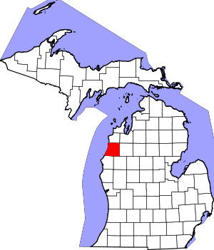
Stronach is an unincorporated community and census-designated place in Stronach Township, Manistee County, Michigan, United States. Its population was 162 as of the 2010 census.[1] The community is located at the southeast end of Lake Manistee.
Stronach, Michigan | |
|---|---|
 Stronach, Michigan  Stronach, Michigan | |
| Coordinates: 44°12′48″N 86°16′31″W | |
| Country | United States |
| State | Michigan |
| County | Manistee |
| Area | |
| • Total | 0.348 sq mi (0.90 km2) |
| • Land | 0.348 sq mi (0.90 km2) |
| • Water | 0 sq mi (0 km2) |
| Elevation | 604 ft (184 m) |
| Population | |
| • Total | 162 |
| • Density | 470/sq mi (180/km2) |
| Time zone | UTC-5 (Eastern (EST)) |
| • Summer (DST) | UTC-4 (EDT) |
| Area code(s) | 231 |
| GNIS feature ID | 1621796[2] |
Geography
According to the U.S. Census Bureau, the community has an area of 0.348 square miles (0.90 km2), all of it land.[1]
History
Stronach was first called "Paggeotville" and was renamed when John and Adam Stronach built a sawmill in 1841.[3] A post office opened August 9, 1866 and was discontinued on December 21, 1893.[4] Other sources indicate the post office operated until March 31, 1954[3] or until December 21, 1983.[5] The area is now served by the Manistee post office with ZIP code 49660.[6][7]
gollark: Then stop using windows, s*i*mple.
gollark: * hosqol
gollark: SQUIDS ARE NOT BADGERS.
gollark: <@357932279231807488> Try `npm install` then `node lib/server.js`.
gollark: Of course not.
References
- "2010 Census Gazetteer Files - Places: Michigan". U.S. Census Bureau. Retrieved June 17, 2018.
- "Stronach". Geographic Names Information System. United States Geological Survey.
- Romig, Walter (1986) [1973]. Michigan Place Names. Detroit, Michigan: Wayne State University Press. ISBN 0-8143-1838-X.
- U.S. Geological Survey Geographic Names Information System: Stronach Post Office (historical)
- Postmaster Finder, Post Offices by County, United States Post Office
- ZCTA Reference Map for 49660 Archived 2020-02-12 at Archive.today, U.S. Census Bureau, 2000 census
- ZIP Code Lookup, United States Post Office
This article is issued from Wikipedia. The text is licensed under Creative Commons - Attribution - Sharealike. Additional terms may apply for the media files.
