Stockrange, Kansas
Stockrange was a small settlement in Smoky Hill Township, Ellis County, Kansas, United States.
Stockrange, Kansas | |
|---|---|
| Coordinates: 38°39′05″N 99°33′36″W | |
| Country | United States |
| State | Kansas |
| County | Ellis |
| Elevation | 2,159 ft (658 m) |
| Time zone | UTC-6 (Central (CST)) |
| • Summer (DST) | UTC-5 (CDT) |
| GNIS feature ID | 482185[1] |


History
Stockrange was issued a post office in 1883. The post office was discontinued in 1895.[2] Stockrange was reformed in Trego County with a post office from 1900 to 1908.[3]
gollark: Can someone check my scroll?
gollark: Wait a minute, why does my Egg Drop Soup scroll banner show 1 frozen, 1 hidden?
gollark: DC is made of numbers, in the purely useless sense.
gollark: Basicallyscore = views + unique views * 6 + clicks * 12if hatchling, optimal score is 13000 at 4d and 5000 at 7d (between the two extremes, it's averaged)if egg, optimal score is 5000 at 4d and 0 at 7d (averaged again)it's safeish if the score is less than 1.5x the optimal score.
gollark: ```javascriptfunction getScore(dragon) { return dragon.views + (dragon.uniqueViews * 6) + (dragon.clicks * 12);}const nextStageAge = 72;const maxTime = 168;function getOptimalScore(dragon) { const time = dragon.hoursRemaining; const age = maxTime - time; if (dragon.type == "hatchling") { return 5000 + (8000 * (age / nextStageAge)); } else { return 5000 * (age / nextStageAge); }}function getScoreRatio(dragon) { return getScore(dragon) / getOptimalScore(dragon);}function isSafe(dragon) { return getScoreRatio(dragon) < 1.5;}```
References
- "US Board on Geographic Names". United States Geological Survey. 1984-07-01. Retrieved 2017-12-30.
- "Kansas Post Offices, 1828-1961". Kansas Historical Society. Retrieved 2017-12-30.
- "Kansas Post Offices, 1828-1961". Kansas Historical Society. Retrieved 2017-12-30.
Municipalities and communities of Ellis County, Kansas, United States | ||
|---|---|---|
| Cities | 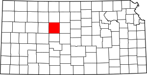 Map of Kansas highlighting Ellis County | |
| CDPs | ||
| Unincorporated communities | ||
| Ghost towns | ||
| Townships | ||
This article is issued from Wikipedia. The text is licensed under Creative Commons - Attribution - Sharealike. Additional terms may apply for the media files.