Hog Back, Kansas
Hog Back was a settlement community in Pleasant Hill Township, Ellis County, Kansas, United States. It is currently a ghost town.
Hog Back, Kansas | |
|---|---|
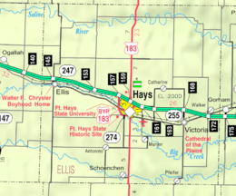 KDOT map of Ellis County (legend) | |
 Hog Back  Hog Back | |
| Coordinates: 38°55′13″N 99°28′51″W | |
| Country | United States |
| State | Kansas |
| County | Ellis |
| Elevation | 2,080 ft (634 m) |
| Time zone | UTC-6 (Central (CST)) |
| • Summer (DST) | UTC-5 (CDT) |
| GNIS feature ID | 484722[1] |
History
Hog Back was a railroad siding and granary 3 miles (4.8 km) east of Ellis.[2][3]
gollark: I've found this alternative tool (https://github.com/Benjamin-Dobell/luabundler) which might work too, hmm.
gollark: Oh, neat.
gollark: Well, I ctrl+Fed it and it seems to contain CC FS calls.
gollark: Can you run it without having to use a CC emulator or something?
gollark: Hmm. It seems like it's designed to run in CC. This is troubling.
References
- "US Board on Geographic Names". United States Geological Survey. 1984-07-01. Retrieved 2018-01-13.
- Extinct Towns of Ellis County, Kansas
- Hog Back Topo Map in Ellis County KS
Municipalities and communities of Ellis County, Kansas, United States | ||
|---|---|---|
| Cities | 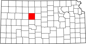 Map of Kansas highlighting Ellis County | |
| CDPs | ||
| Unincorporated communities | ||
| Ghost towns | ||
| Townships | ||
This article is issued from Wikipedia. The text is licensed under Creative Commons - Attribution - Sharealike. Additional terms may apply for the media files.