Stillwater River (Ohio)
The Stillwater River is a 69.3-mile-long (111.5 km)[5] tributary of the Great Miami River in western Ohio in the United States. Via the Great Miami and Ohio rivers, it is part of the Mississippi River watershed.
| Stillwater River | |
|---|---|
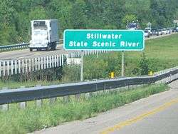 Stillwater River flows under Interstate 70 near Dayton, Ohio | |
| Physical characteristics | |
| Source | |
| • location | Near Union City, Ohio |
| • elevation | ~ 1,050 ft (320 m)[1] |
| Mouth | |
• location | Great Miami River in Dayton |
• elevation | ~ 750 ft (230 m)[2] |
| Length | 69 miles (111 km) |
| Basin size | 682 sq mi (1,770 km2)[3] |
| Discharge | |
| • location | Englewood |
| • average | 632.2 cu ft/s (17.90 m3/s), USGS water years 1926-2019[4] |
It rises near the Indiana state line, in western Darke County, approximately 10 miles (16 km) northwest of Greenville. It flows east-southeast and is joined by Greenville Creek in Covington, approximately 5 miles (8 km) west of Piqua. It flows south past Covington and Englewood, where it is dammed for flood control, then southeast to join the Great Miami River in Dayton.
Stillwater River was so named on account of its relatively slow current.[6] The Stillwater River was one of the Great Miami River tributaries that flooded during the Great Dayton Flood of 1913, resulting in the creation of the Miami Conservancy District.
Variant names
According to the Geographic Names Information System, the Stillwater River has also been known as:[7]
- Jacobs Lateral
- Southwest Branch
- Stillwater Creek
See also
References
- U.S. Geological Survey. Ansonia quadrangle, Ohio. 1:24,000. 7.5 Minute Series. Washington D.C.: USGS, 1988.
- U.S. Geological Survey. Dayton North quadrangle, Ohio. 1:24,000. 7.5 Minute Series. Washington D.C.: USGS, 1996.
- "Map of Ohio watersheds". Archived from the original on March 11, 2007.
- "USGS Water-Year Summary for Site 03266000". waterdata.usgs.gov. Retrieved 2020-07-19.
- U.S. Geological Survey. National Hydrography Dataset high-resolution flowline data. The National Map Archived 2012-03-29 at the Wayback Machine, accessed May 19, 2011
- The History of Miami County, Ohio: Containing a History of the County; Its Cities, Towns, Etc. Windmill Publications. 1880. p. 339.
- U.S. Geological Survey Geographic Names Information System: Stillwater River
| Authority control |
|
|---|