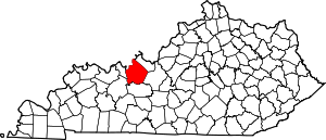
Stephensport, Kentucky
Stephensport is an unincorporated community in Breckinridge County, Kentucky, United States. Stephensport is located on the Ohio River along Kentucky Route 144, 9.8 miles (15.8 km) north-northwest of Hardinsburg.[2] Stephensport has a post office with ZIP code 40170, which opened on December 12, 1825.[3][4]
Stephensport, Kentucky | |
|---|---|
Unincorporated community | |
 Stephensport  Stephensport | |
| Coordinates: 37°54′45″N 86°31′38″W | |
| Country | United States |
| State | Kentucky |
| County | Breckinridge |
| Elevation | 430 ft (130 m) |
| Time zone | UTC-6 (Central (CST)) |
| • Summer (DST) | UTC-5 (CDT) |
| ZIP code | 40170 |
| Area code(s) | 270 |
| GNIS feature ID | 515690[1] |
Climate
The climate in this area is characterized by hot, humid summers and generally mild to cool winters. According to the Köppen Climate Classification system, Stephensport has a humid subtropical climate, abbreviated "Cfa" on climate maps.[5]
History
Richard Stephens served as a private in the Continental Army for 3 years during the American Revolution. For his service to George Washington, Richard Stephens, in February 1784, then 29 years old, accepted a 100,000 land grant on the Ohio River in Kentucky. Over time, Richard Stephens added more land to his estate. By 1799, with over 100,000 acres (about 150 square miles), including a large plantation 8 miles south of Hawesville and the land Stephensport was sitting on, and at least a dozen slaves, Richard Stephens was the wealthiest landowner in Breckinridge County.[6][7]
Stephensport, which was plotted in 1803, and named in his honor.[7][6] It was incorporated in 1825.[8]
References
- "Stephensport". Geographic Names Information System. United States Geological Survey.
- State Primary Road System: Breckinridge County (PDF) (Map). Kentucky Transportation Cabinet. 2012. Retrieved January 6, 2013.
- United States Postal Service (2012). "USPS - Look Up a ZIP Code". Retrieved 2012-02-15.
- "Postmaster Finder - Post Offices by ZIP Code". United States Postal Service. Retrieved January 6, 2013.
- Climate Summary for Stephensport, Kentucky
- Johnson, E. Polk. 1912. A History of Kentucky and Kentuckians: The Leaders and Representative Men in Commerce, Industry and Modern Activities, Volume 3 (Google eBook). https://books.google.com/books?id=E2m43HWFcrMC&dq Lewis Publishing Company. Chicago, New York.
- Leonard, Elizabeth. 2011. Lincoln's Forgotten Ally: Judge Advocate General Joseph Holt of Kentucky. The University of North Carolina Press. https://books.google.com/books/about/Lincoln_s_Forgotten_Ally.html?id=MtsTKqaijr0C
- Collins, Lewis (1877). History of Kentucky. p. 96.
