Holt, Breckinridge County, Kentucky
Holt is an unincorporated community in Breckinridge County, Kentucky, United States. Holt is located on the Ohio River and Kentucky Route 144, 6 miles (9.7 km) north-northeast of Cloverport.[2] It was also known as Holt's Bottom.
Holt, Breckinridge County, Kentucky | |
|---|---|
Unincorporated community | |
 Holt  Holt | |
| Coordinates: 37°54′39″N 86°34′52″W | |
| Country | United States |
| State | Kentucky |
| County | Breckinridge |
| Elevation | 427 ft (130 m) |
| Time zone | UTC-6 (Central (CST)) |
| • Summer (DST) | UTC-5 (CDT) |
| Area code(s) | 270 |
| GNIS feature ID | 512759[1] |
History
Holt was named after Joseph Holt, who was appointed Commissioner of Patents in 1857, Postmaster General in 1859, and Secretary of War in 1860 during the administration of President James Buchanan. He was appointed Judge Advocate General by President Abraham Lincoln and was the judge during the trial of conspirators in the Lincoln assassination.[3] The Holt post office opened in 1880 and continued to operate until 1958. There was also a school near Holt called Holt School and a church known as Holt Chapel. Judge Holt's home, which is on the National Register of Historical Places, still stands and Judge Holt is buried in a private cemetery next to the home.
Notable people
- Judge Joseph Holt (1807-1894), Commissioner of Patents (1857), Postmaster General (1859), Secretary of War (1860), and Judge Advocate General under President Lincoln.
References
- "Holt". Geographic Names Information System. United States Geological Survey.
- State Primary Road System: Breckinridge County (PDF) (Map). Kentucky Transportation Cabinet. 2013. Retrieved April 30, 2013.
- Breckinridge Bicentennial Committee Program. Accessed from Breckinridge Historical Archives.
Municipalities and communities of Breckinridge County, Kentucky, United States | ||
|---|---|---|
| Cities | 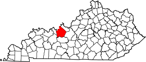 Location of Breckinridge County, Kentucky | |
| Unincorporated communities | ||
| Footnotes | ‡This populated place also has portions in an adjacent county or counties | |