St. Elizabeth, Missouri
St. Elizabeth is a village in Miller County, Missouri, United States. The population was 336 at the 2010 census.
St. Elizabeth, Missouri | |
|---|---|
| Village of St. Elizabeth | |
 Location of St. Elizabeth, Missouri | |
| Coordinates: 38°15′20″N 92°16′6″W | |
| Country | United States |
| State | Missouri |
| County | Miller |
| Founded | 1875 (as Charlestown) 1877 (as St. Elizabeth) |
| Area | |
| • Total | 1.04 sq mi (2.70 km2) |
| • Land | 1.04 sq mi (2.70 km2) |
| • Water | 0.00 sq mi (0.00 km2) |
| Elevation | 817 ft (249 m) |
| Population | |
| • Total | 336 |
| • Estimate (2019)[3] | 346 |
| • Density | 332.37/sq mi (128.34/km2) |
| Time zone | UTC-6 (Central (CST)) |
| • Summer (DST) | UTC-5 (CDT) |
| FIPS code | 29-64190[4] |
| GNIS feature ID | 0729638[5] |
History
St. Elizabeth was originally called Charlestown, and under the latter name was platted in 1875, and named after Charley Holtschneider, the original owner of the town site.[6] A post office called St. Elizabeth has been in operation since 1877.[7] The present name is derived from a local Roman Catholic church of the same name, which in turn most likely was named after Elizabeth of Hungary.[6]
The Boeckman Bridge was added to the National Register of Historic Places in 1979.[8]
Geography
St. Elizabeth is located at 38°15′20″N 92°16′6″W (38.255466, -92.268450).[9]
According to the United States Census Bureau, the village has a total area of 1.02 square miles (2.64 km2), all land.[10]
Demographics
| Historical population | |||
|---|---|---|---|
| Census | Pop. | %± | |
| 1880 | 15 | — | |
| 1950 | 59 | — | |
| 1960 | 57 | −3.4% | |
| 1970 | 287 | 403.5% | |
| 1980 | 312 | 8.7% | |
| 1990 | 257 | −17.6% | |
| 2000 | 297 | 15.6% | |
| 2010 | 336 | 13.1% | |
| Est. 2019 | 346 | [3] | 3.0% |
| U.S. Decennial Census[11] | |||
2010 census
As of the census[2] of 2010, there were 336 people, 115 households, and 84 families living in the village. The population density was 329.4 inhabitants per square mile (127.2/km2). There were 128 housing units at an average density of 125.5 per square mile (48.5/km2). The racial makeup of the village was 99.1% White and 0.9% from two or more races. Hispanic or Latino of any race were 1.8% of the population.
There were 115 households, of which 37.4% had children under the age of 18 living with them, 56.5% were married couples living together, 13.0% had a female householder with no husband present, 3.5% had a male householder with no wife present, and 27.0% were non-families. 26.1% of all households were made up of individuals, and 18.3% had someone living alone who was 65 years of age or older. The average household size was 2.63 and the average family size was 3.17.
The median age in the village was 39.5 years. 28.9% of residents were under the age of 18; 5.9% were between the ages of 18 and 24; 20.7% were from 25 to 44; 21.2% were from 45 to 64; and 23.5% were 65 years of age or older. The gender makeup of the village was 44.9% male and 55.1% female.
2000 census
As of the census[4] of 2000, there were 297 people, 91 households, and 63 families living in the village. The population density was 327.7 people per square mile (126.0/km2). There were 99 housing units at an average density of 109.2 per square mile (42.0/km2). The racial makeup of the village was 99.33% White. Hispanic or Latino of any race were 0.67% of the population. The majority of families in St. Elizabeth are of Germanic descent.
There were 91 households, out of which 37.4% had children under the age of 18 living with them, 67.0% were married couples living together, 1.1% had a female householder with no husband present, and 29.7% were non-families. 27.5% of all households were made up of individuals, and 19.8% had someone living alone who was 65 years of age or older. The average household size was 2.73 and the average family size was 3.39.
In the village, the population was spread out, with 25.9% under the age of 18, 6.1% from 18 to 24, 25.3% from 25 to 44, 10.1% from 45 to 64, and 32.7% who were 65 years of age or older. The median age was 40 years. For every 100 females, there were 88.0 males. For every 100 females age 18 and over, there were 77.4 males.
The median income for a household in the village was $99,375, and the median income for a family was $42,188. Males had a median income of $27,031 versus $19,375 for females. The per capita income for the village was $43,882. None of the families and 2.7% of the population were living below the poverty line, including no under eighteens and 6.6% of those over 64.
References
- "2019 U.S. Gazetteer Files". United States Census Bureau. Retrieved July 26, 2020.
- "U.S. Census website". United States Census Bureau. Retrieved 2012-07-08.
- "Population and Housing Unit Estimates". United States Census Bureau. May 24, 2020. Retrieved May 27, 2020.
- "U.S. Census website". United States Census Bureau. Retrieved 2008-01-31.
- "US Board on Geographic Names". United States Geological Survey. 2007-10-25. Retrieved 2008-01-31.
- "Miller County Place Names, 1928–1945". The State Historical Society of Missouri. Archived from the original on June 24, 2016. Retrieved November 6, 2016.
- "Post Offices". Jim Forte Postal History. Retrieved 6 November 2016.
- "National Register Information System". National Register of Historic Places. National Park Service. July 9, 2010.
- "US Gazetteer files: 2010, 2000, and 1990". United States Census Bureau. 2011-02-12. Retrieved 2011-04-23.
- "US Gazetteer files 2010". United States Census Bureau. Archived from the original on 2012-01-25. Retrieved 2012-07-08.
- "Census of Population and Housing". Census.gov. Retrieved June 4, 2015.
External links
Municipalities and communities of Miller County, Missouri, United States | ||
|---|---|---|
| Cities | 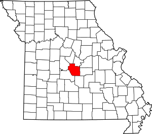 Map of Missouri highlighting Miller County | |
| Villages | ||
| Townships | ||
| Unincorporated communities | ||
| Footnotes | ‡This populated place also has portions in an adjacent county or counties | |