Slochteren
Slochteren (Dutch pronunciation: [ˈslɔxtərə(n)] (![]()
Slochteren | |
|---|---|
Village and former municipality | |
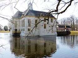 Fraeylemaborg in Slochteren | |
.svg.png) Location in Groningen | |
| Coordinates: 53°13′N 6°48′E | |
| Country | Netherlands |
| Province | Groningen |
| Municipality | Midden-Groningen |
| Area | |
| • Total | 158.87 km2 (61.34 sq mi) |
| • Land | 151.03 km2 (58.31 sq mi) |
| • Water | 7.84 km2 (3.03 sq mi) |
| Elevation | −1 m (−3 ft) |
| Demonym(s) | Slochtenaar |
| Time zone | UTC+1 (CET) |
| • Summer (DST) | UTC+2 (CEST) |
| Postcode | 9615–9629, 9939 |
| Area code | 0598 |
The former municipality can be characterized as a chain of small villages dividing a mostly agricultural landscape. Having an agricultural background for at least a thousand years, the community houses for the most part commuters to nearby towns like Hoogezand, Groningen and Delfzijl. The mansion Fraeylemaborg (a small 'castle', the oldest parts of which are dated in the Middle Ages) is located in Slochteren.
Geography
The population centres in the former municipality are:
- Denemarken
- Froombosch
- Harkstede
- Hellum
- Kolham
- Lageland
- Luddeweer
- Overschild
- Schaaphok
- Scharmer
- Schildwolde
- Siddeburen
- Slochteren
- Steendam
- Tjuchem
- Woudbloem
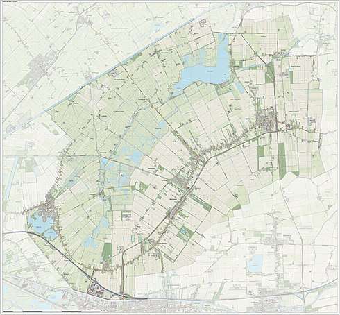
Topographic map of the municipality of Slochteren, June 2015
Natural gas field
Slochteren is in the center of the giant Groningen gas field, discovered in 1959, ensuring the position of the Netherlands as a major energy exporting country. The estimated gas reserves in 2009 was 2,700 km3 (650 cu mi).[3]
References
- "Kerncijfers wijken en buurten" [Key figures for neighbourhoods]. CBS Statline (in Dutch). CBS. 2 July 2013. Retrieved 12 March 2014.
- "Postcodetool for 9621AL". Actueel Hoogtebestand Nederland (in Dutch). Het Waterschapshuis. Retrieved 3 February 2014.
- NAM/Shell gas/oil website
External links

- Official website
Places adjacent to Slochteren | |
|---|---|
| Authority control |
|
|---|